
Forts · East Midlands
Battle of Stoke Field 1487
In or near Thoroton.
Battle of Stoke Field 1487 is a fort in the United Kingdom.

Trevor Rickard — CC BY-SA 2.0 via Wikimedia Commons licence

Plan your visit
- Typical visit
- 45 min–1.5 h
- Nearest railway station
- Fiskerton · 3.3 km
About
Battle of Stoke Field 1487 is a historic fort or fortified site in the United Kingdom. Coordinates: 53.0343°, -0.8881°. This entry is part of The Great Britain Guide, a free, ad-free, open-data tourist directory.
Photo gallery
Place summary
The Battle of Stoke Field 1487 is a historical site located in Elston, Nottinghamshire, in the East Midlands. This site marks the last significant battle of the Wars of the Roses, reflecting the tumultuous political landscape of late 15th-century England.
AI-generated from the structured facts on this page (operator, designation, listing, era). Not a substitute for visiting.
- Coordinates
- 53.0343, -0.8881
- County
- Nottinghamshire
- District
- Newark and Sherwood
- Parish
- Elston
- Postcode
- NG23 5PG
- Parliamentary constituency
- Newark
- Nearest railway station
- Fiskerton — 3.3 km
Sources
- osm: n324358065 (ODbL)
Other places nearby

East Stoke
Villages · 0.3 km
.jpg?width=1200)
Battle of Stoke Field
Forts · 0.4 km

Digger
Public art & sculpture · 0.5 km

Medieval settlement and remains of open fields immediately west of East Stoke village
Vineyards · 0.8 km
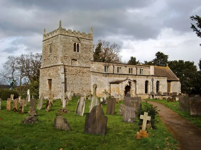
St Oswald's Church, East Stoke
Historic churches · 0.9 km

Stoke Hall
Historic houses · 1.0 km

Elston
Villages · 1.7 km
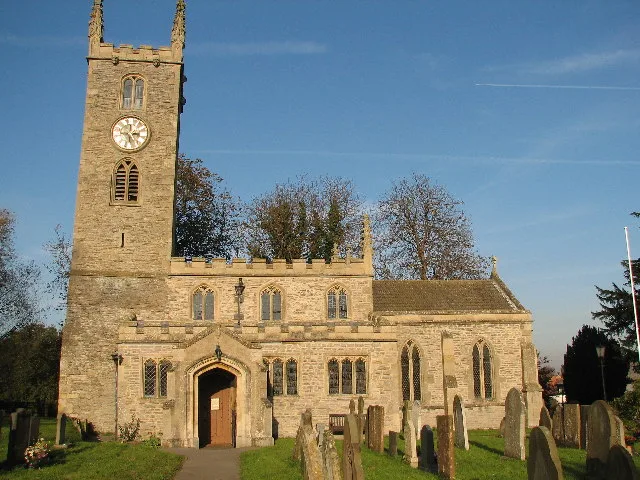
All Saints' Church, Elston
Historic churches · 1.7 km

Ad Pontem
Archaeological sites · 1.7 km

Ad Pontem
Archaeological sites · 1.7 km
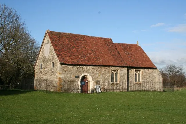
Elston Chapel
Historic churches · 1.8 km

Fiskerton
Villages · 2.2 km
Nearby
📷 5📷 3📷 3Public art & sculpture · East Midlands
Digger
Digger — a public art in england-east-midlands, United Kingdom.
📷 5Vineyards · East Midlands
Medieval settlement and remains of open fields immediately west of East Stoke village
human settlement in East Stoke, Newark and Sherwood, Nottinghamshire, England, UK
📷 3Historic churches · East Midlands
St Oswald's Church, East Stoke
St Oswald's Church, East Stoke — church in Newark and Sherwood, Nottinghamshire, England, UK.
📷 4Historic houses · East Midlands
Stoke Hall
Stoke Hall — a Grade II*-listed historic house in england-east-midlands, United Kingdom.
Where to eat & stay near Battle of Stoke Field 1487
Places to stay
 📷 5
📷 5Hotels · East Midlands
Saracen's Head
Saracen's Head — a hotel in england east midlands.
 📷 5
📷 5 📷 5
📷 5Campsites · East Midlands
Maythorne caravan site & fishing lakes
Maythorne caravan site & fishing lakes — a campsite in england east midlands.
 📷 5
📷 5Campsites · East Midlands
Gunthorpe Camping
Gunthorpe Camping — a campsite in england east midlands.
 📷 5
📷 5B&Bs · East Midlands
East Bridgford Hill
East Bridgford Hill — a bed-and-breakfast in england east midlands.
 📷 5
📷 5Caravan parks · East Midlands
Riverdale Caravan Park
Riverdale Caravan Park — a caravan park in england east midlands.
Places to eat & drink
 📷 5
📷 5Cafés · East Midlands
The Clock House Cafe
The Clock House Cafe — a café in england east midlands.
 📷 7
📷 7Historic pubs · East Midlands
The Spring House Public House
The Spring House Public House in England East Midlands, United Kingdom.
 📷 5
📷 5Restaurants · East Midlands
Victoria Fish Bar
Victoria Fish Bar — a restaurant in england east midlands. Cuisine: fish and chips.
 📷 5
📷 5Historic pubs · East Midlands
The Watermill Public House
The Watermill Public House in England East Midlands, United Kingdom.
 📷 7
📷 7Historic pubs · East Midlands
The Horse And Gears Public House
The Horse And Gears Public House in England East Midlands, United Kingdom.
 📷 7
📷 7Historic pubs · East Midlands
Castle And Falcon Public House And Attached Outbuildings
Castle And Falcon Public House And Attached Outbuildings in England East Midlands, United Kingdom.
More forts in this region
 📷 5
📷 5Forts · East Midlands
Obelisk To Captain Shultz In The Churchyard To South West Of St Peter And St Paul
Obelisk To Captain Shultz In The Churchyard To South West Of St Peter And St Paul — a martello broad in england-london, United Kingdom.
 📷 3
📷 3Forts · East Midlands
Bailey's Tump
Bailey's Tump is a fort in the United Kingdom.
📷 3 📷 3
📷 3Frequently asked questions
- Where is Battle of Stoke Field 1487?
- Battle of Stoke Field 1487 is in Nottinghamshire, the East Midlands, United Kingdom (postcode NG23 5PG), in the parish of Elston.
- What is Battle of Stoke Field 1487?
- Battle of Stoke Field 1487 is a fort in the United Kingdom.
- How do I get to Battle of Stoke Field 1487?
- The nearest railway station is Fiskerton, about 3.3 km away. Drivers can use postcode NG23 5PG.
- How do I get to Battle of Stoke Field 1487?
- The nearest railway station is Fiskerton, about 3.3 km away. Drivers can navigate to postcode NG23 5PG.