
Chapels · Yorkshire & the Humber
How Hill Tower
In or near Ripon.
How Hill Tower — building in Markington with Wallerthwaite, North Yorkshire, England, UK.

Wikimedia Commons contributors — see linked file page for photographer and licence licence

Plan your visit
- Typical visit
- 20 min–45 min
- Free entry
Getting there & planning your visit
How Hill Tower is located in North Yorkshire, with the postcode HG4 3AN. Admission is free. Accessibility information is not provided.
About
How Hill Tower is a chapel in the United Kingdom. Heritage designation: Grade II* listed building. Wikidata describes it as: "building in Markington with Wallerthwaite, North Yorkshire, England, UK". Coordinates: 54.0986°, -1.5795°.
Photo gallery
Heritage listing
How Hill Tower is a historic 18th century building at Studley Royal Park, a World Heritage Site in North Yorkshire, in England, close to the site of, and/or incorporating the remains of, an earlier medieval chapel. An earlier structure on the site, the Chapel of Saint Michael de Monte, was built for Fountains Abbey in the 13th century. This became a minor medieval pilgrimage site. Visitors to the site could see both York Minster and Ripon Cathedral from its summit. The flooring was made of mosaic tiles, similar to those attributed to a painted pavement dating to between 1236 and 1247. Marmaduke Huby either repaired or rebuilt it between 1494 and 1526. After the Dissolution of the Monasteries it initially served local women, but was abandoned by 1600 and fell into ruin.
From the Historic England List Entry under OGL v3.
Protected designations
- Area of Outstanding Natural Beauty: Nidderdale
Designations sourced from Natural England open data under OGL v3.
From the Wikipedia article
How Hill Tower is a historic 18th century building at Studley Royal Park, a World Heritage Site in North Yorkshire, in England, close to the site of, and/or incorporating the remains of, an earlier medieval chapel. An earlier structure on the site, the Chapel of Saint Michael de Monte, was built for Fountains Abbey in the 13th century. This became a minor medieval pilgrimage site. Visitors to the site could see both York Minster and Ripon Cathedral from its summit. The flooring was made of mosaic tiles, similar to those attributed to a painted pavement dating to between 1236 and 1247. Marmaduke Huby either repaired or rebuilt it between 1494 and 1526. After the Dissolution of the Monasteries it initially served local women, but was abandoned by 1600 and fell into ruin. In 1719, John Aislabie commissioned a folly tower, as part of his initial design of Studley Royal Park, adjacent to (and possibly re-using stones from) the ruins of the old chapel. Likely designed by Sir John Vanbrugh, the view from the tower extended across the Studley estates, and York could even be seen 26 miles (42 km) away. In 1737, gaming tables were installed, while later in the century, the tower and further chapel ruins adjacent to it were converted into farm outbuildings. In 1810, an estate survey recorded a farmhouse on the site, but by 1822 the description had changed to "How Hill House & Tower". Presumably, the site had lost its significance as a garden building in a designed landscape and was commissioned to a more functional use. Wilfred Owen considered living in the building while it was being let out as two cottages. During the Second World War the Home Guard used it as an observation post. As at 1975 and 1984 its condition was somewhat ruinous, but it appears that restoration of both the tower and attached buildings was carried out between 1984 and 2006 (refer "Gallery"). The tower was Grade II* listed in 1986. The tower and outbuildings are built of limestone and gritstone with…
Excerpt from Wikipedia under CC BY-SA 4.0. See the source article linked in Sources below.
- Coordinates
- 54.0986, -1.5795
- District
- North Yorkshire
- Parish
- Markington with Wallerthwaite
- Postcode
- HG4 3AN
- Parliamentary constituency
- Skipton and Ripon
- Established
- 1719
Sources
- wikidata: Q17536565 (CC0)
- wikipedia: How Hill Tower (CC BY-SA 4.0)
- commons: Chapel on How Hill - geograph.org.uk - 118576.jpg (CC BY-SA 4.0)
Featured in this guide
Other places nearby

How Hill
Mountains & hills · 0.0 km
How Hill
Mountains & hills · 0.0 km

Site of medieval chapel and section of Fountains Park park pale, 170m south west of How Hill Farm
Archaeological sites · 0.1 km

Old Mill House
Watermills · 1.2 km
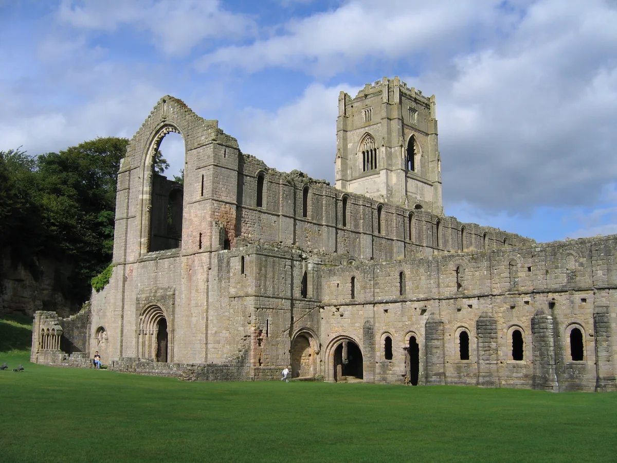
Fountains Abbey
UNESCO World Heritage · 1.2 km

Fountains Abbey
Cathedrals · 1.2 km

Galand Bridge
Historic bridges · 1.3 km

Fountains Hall
Manor houses · 1.3 km

Swanley Grange
Natural landmarks · 1.4 km

Bridge Approximately 200 Metres North Of Rough House
Historic bridges · 1.5 km

Tent Hill
Viewpoints · 1.5 km

Rustic Bridge At South End Of The Canal, With Culvert And Arch To Reservoir
Historic bridges · 1.6 km
Nearby
📷 5Mountains & hills · Yorkshire & the Humber
How Hill
How Hill — a hill or mountain in england yorkshire.
📷 5Mountains & hills · Yorkshire & the Humber
How Hill
How Hill — mountain in england yorkshire. Elevation: 175 m.
📷 3Archaeological sites · Yorkshire & the Humber
Site of medieval chapel and section of Fountains Park park pale, 170m south west of How Hill Farm
Site of medieval chapel and section of Fountains Park park pale, 170m south west of How Hill Farm — archaeological site in Markington with Wallerthwaite, Harrogate, England, UK.
★ Iconic📷 3Watermills · Yorkshire & the Humber
Old Mill House
Old Mill House is a watermill in the United Kingdom.
📷 4UNESCO World Heritage · Yorkshire & the Humber
Fountains Abbey
Fountains Abbey — ruined Cistercian abbey in Yorkshire, England, UK.
📷 4Cathedrals · Yorkshire & the Humber
Fountains Abbey
Fountains Abbey is a cathedral in the United Kingdom.
Where to eat & stay near How Hill Tower
Places to stay
 📷 5
📷 5Campsites · Yorkshire & the Humber
Copper Beech Glade
Copper Beech Glade — a campsite in england yorkshire.
 📷 5
📷 5Caravan parks · Yorkshire & the Humber
Chequers Lodge Caravan Park
Chequers Lodge Caravan Park — a caravan park in england yorkshire.
 📷 5
📷 5Caravan parks · Yorkshire & the Humber
River Laver Holiday Park Ltd.
River Laver Holiday Park Ltd. — a caravan park in england yorkshire.
 📷 5
📷 5 📷 5
📷 5Campsites · Yorkshire & the Humber
Clotherholme Farm Campsite
Clotherholme Farm Campsite — a campsite in england yorkshire.
 📷 5
📷 5Campsites · Yorkshire & the Humber
Church Farm Caravan Park
Church Farm Caravan Park — a campsite in england yorkshire.
Places to eat & drink
 📷 5
📷 5Historic pubs · Yorkshire & the Humber
The Nelson Arms Public House And Attached Outbuilding
The Nelson Arms Public House And Attached Outbuilding in England Yorkshire, United Kingdom.
 📷 7
📷 7Historic pubs · Yorkshire & the Humber
Lamb And Flag Public House
Lamb And Flag Public House in England Yorkshire, United Kingdom.
 📷 5
📷 5Cafés · Yorkshire & the Humber
Lula's Café
Lula's Café — a café in england yorkshire.
 📷 5
📷 5Historic pubs · Yorkshire & the Humber
The Unicorn Hotel
The Unicorn Hotel in England Yorkshire, United Kingdom.
 📷 7
📷 7 📷 7
📷 7Historic pubs · Yorkshire & the Humber
Ye Hornblower Tavern
Ye Hornblower Tavern in England Yorkshire, United Kingdom.
More places in this region
 📷 3
📷 3Chapels · Yorkshire & the Humber
Dukinfield Old Chapel
Dukinfield Old Chapel — chapel in Dukinfield, Greater Manchester, England, UK.
 📷 3
📷 3Chapels · Yorkshire & the Humber
Old Hall Chapel
Old Hall Chapel — chapel in Dukinfield, Greater Manchester, England, UK.
 📷 3
📷 3Chapels · Yorkshire & the Humber
1A, Moor Road
1A, Moor Road — chapel in Leeds, West Yorkshire, England, UK.
 📷 4
📷 4Chapels · Yorkshire & the Humber
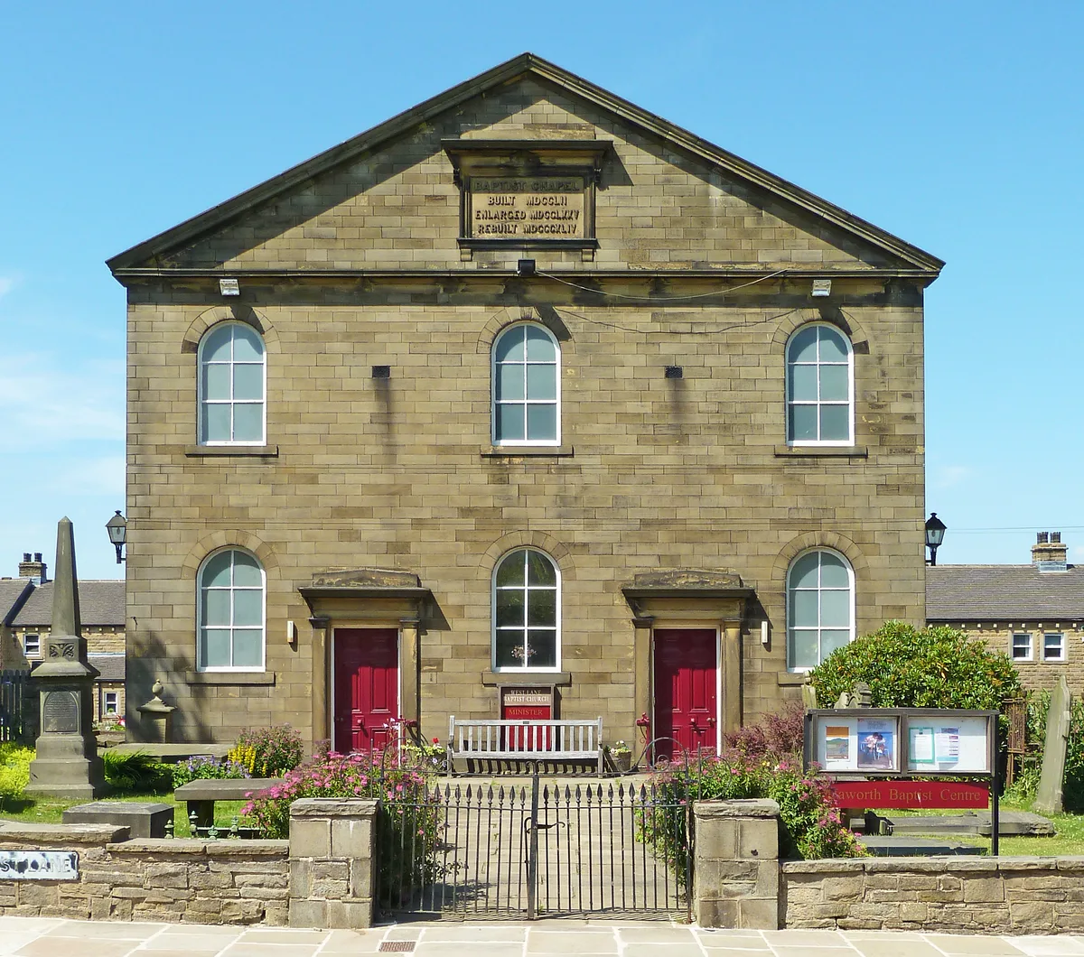
Baptist Chapel
Baptist Chapel — chapel in Haworth, Cross Roads and Stanbury, Bradford, West Yorkshire, England, UK.
Frequently asked questions
- Where is How Hill Tower?
- How Hill Tower is in Yorkshire, United Kingdom (postcode HG4 3AN), in the parish of Markington with Wallerthwaite.
- What is How Hill Tower?
- How Hill Tower — building in Markington with Wallerthwaite, North Yorkshire, England, UK.
- How do I get to How Hill Tower?
- The nearest town is Ripon. Drivers can use postcode HG4 3AN.
- When was How Hill Tower built?
- Built or established in 1719.
- Is How Hill Tower a listed building?
- How Hill Tower is officially recognised as Grade II* listed building listed.
- Is How Hill Tower a protected site?
- Yes — How Hill Tower is part of the Nidderdale National Landscape (AONB).
- Is How Hill Tower free to visit?
- Yes, How Hill Tower is free to enter.
- How do I get to How Hill Tower?
- Drivers can navigate to postcode HG4 3AN. It sits within the Skipton and Ripon parliamentary constituency.