
Chapels · Yorkshire & the Humber
Dukinfield Old Chapel
In or near Manchester.
Dukinfield Old Chapel — chapel in Dukinfield, Greater Manchester, England, UK.

Wikimedia Commons contributors — see linked file page for photographer and licence licence

Plan your visit
- Typical visit
- 20 min–45 min
- Nearest railway station
- Ashton-under-Lyne · 1.5 km
- Free entry
Getting there & planning your visit
Dukinfield Old Chapel is located in Tameside, with the nearest railway station being Ashton-under-Lyne, which is 1.5 km away. The postcode for the chapel is SK16 4ES, and entry is free.
About
Dukinfield Old Chapel is a chapel in the United Kingdom. Heritage designation: Grade II* listed building. Wikidata describes it as: "chapel in Dukinfield, Greater Manchester, England, UK". Coordinates: 53.4784°, -2.0865°.
Photo gallery
See it from the streetimagery from 2026
Imagery © Mapillary contributors, CC BY-SA 4.0
Official information
Dukinfield Old Chapel is a historic Unitarian chapel established in 1708, offering a space for individuals to explore their faith in an atmosphere of acceptance. It serves as a community hub where people can worship, share, and engage with spiritual questions in a liberal and open-minded environment.
From the Wikipedia article
Dukinfield Old Chapel is a Unitarian chapel on Old Road in Dukinfield, a town in Tameside, Greater Manchester, England. The present building was constructed between 1838 and 1841 to the designs of Robert Tattersall, with the west front refaced by Worthington & Elgood in the early 1890s. It stands within a historic graveyard containing several listed 18th‑century monuments and continues a tradition of Nonconformist worship in the area dating back to the 17th century. The chapel is recorded in the National Heritage List for England as a Grade II* listed building. As of 2025, it remains on Historic England's Heritage at Risk Register, rated in very bad condition with no agreed solution.
Excerpt from Wikipedia under CC BY-SA 4.0. See the source article linked in Sources below.
Background
History
The origins of organised Nonconformist worship in Dukinfield date to the late 17th century, when a congregation formed around the ministry of the Revd Samuel Angier. In 1707 a purpose‑built meeting house was erected on land leased from the Duckenfield family, the local lords of the manor, who were long associated with Puritanism and dissenting religious traditions. The site, later known as Chapel Hill, remained the centre of Unitarian worship in the town for more than a century. By the early 19th century the original meeting house had become inadequate, and in 1838–41 a new chapel was constructed on the same site to the designs of the Manchester architect Robert Tattersall. The west front…
Architecture
The chapel is constructed in ashlar with a roof of slate. The plan is cruciform, incorporating aisles, a three‑sided gallery, and an east organ. The design follows an early 14th-century style. The west front has a doorway set below a five‑light window with tracery. Large octagonal pinnacles, buttressed at the lower stages, flank the gable, with small stair wings to each side. The transepts contain three lancet windows and have raked, coped gables with clasping buttresses and kneelers. Both sides of the transepts contain three bays with flat buttresses, lancet aisle windows fitted with hood moulds and carved stops, and lancet clerestory windows flanked by smaller blind lancets.
Sourced from Wikipedia under CC BY-SA 4.0.
- Coordinates
- 53.4784, -2.0865
- District
- Tameside
- Parish
- Tameside, unparished area
- Postcode
- SK16 4ES
- Parliamentary constituency
- Ashton-under-Lyne
- Phone
- 0161 338 3800
- Established
- 1838
- Nearest railway station
- Ashton-under-Lyne — 1.5 km
- Official site
- dukinfieldoldchapelunitarians.org.uk
Sources
- wikidata: Q17549165 (CC0)
- wikipedia: Dukinfield Old Chapel (CC BY-SA 4.0)
- commons: Dukinfield Old Chapel - geograph.org.uk - 1721451.jpg (CC BY-SA 4.0)
Other places nearby

Dukinfield War Memorial
Memorials & monuments · 0.1 km

Oxford Super Cinema
Theatres · 0.3 km

Tame Valley War Memorial
Memorials & monuments · 0.4 km
Dukinfield
Castles · 0.6 km

Dukinfield Swimming Pool
Natural landmarks · 0.7 km

Lord Wright
Memorials & monuments · 0.8 km

St John's Church, Dukinfield
Historic churches · 0.9 km

Peak Forest Canal Bridge Number 30
Historic bridges · 1.0 km

Tudor Mill, Ashton-under-Lyne
Gardens · 1.0 km

Dukinfield Junction
Museums · 1.0 km

Ashton Canal
Canals · 1.0 km

Portland Basin Museum
Museums · 1.0 km
Nearby
📷 3Memorials & monuments · Yorkshire & the Humber
Dukinfield War Memorial
Dukinfield War Memorial — Grade II listed building-listed memorial in england-west-midlands, United Kingdom.
📷 3Theatres · North West England
Oxford Super Cinema
Oxford Super Cinema in England North West, United Kingdom.
📷 3Memorials & monuments · Yorkshire & the Humber
Tame Valley War Memorial
Tame Valley War Memorial — Grade II listed building-listed memorial in england-west-midlands, United Kingdom.
📷 5Castles · Yorkshire & the Humber
Dukinfield
Dukinfield ( DUK-in-feeld; locally DUUK-in-fi-yuhld) is a town in Tameside, Greater Manchester, England, on the south bank of the River Tame opposite Ashton-under-Lyne, 6.3 miles (10.1 km) east of Ma
📷 3Natural landmarks · Yorkshire & the Humber
Dukinfield Swimming Pool
Dukinfield Swimming Pool — a place in Yorkshire & the Humber, United Kingdom.
📷 3Memorials & monuments · Yorkshire & the Humber
Lord Wright
Lord Wright — a memorial in Yorkshire & the Humber, United Kingdom.
Where to eat & stay near Dukinfield Old Chapel
Places to stay
 📷 5
📷 5 📷 5
📷 5Caravan parks · Yorkshire & the Humber
Far Benfield Farm Caravan Storage
Far Benfield Farm Caravan Storage — a caravan park in england west midlands.
 📷 5
📷 5Campsites · Yorkshire & the Humber
Boarfold Scout Camp
Boarfold Scout Camp — a campsite in england west midlands.
 📷 5
📷 5Campsites · North West England
Well-i-Hole Farm Caravan and Camping
Well-i-Hole Farm Caravan and Camping — a campsite in england north west.
 📷 5
📷 5Campsites · East Midlands
Crossgate Farm Campsite
Crossgate Farm Campsite — a campsite in england east midlands.
 📷 5
📷 5Caravan parks · East Midlands
Windy Harbour Hotel Caravan and Camping Site
Windy Harbour Hotel Caravan and Camping Site — a caravan park in england east midlands.
Places to eat & drink
 📷 7
📷 7 📷 5
📷 5Historic pubs · North West England
Colliers Arms Public House
Colliers Arms Public House in England North West, United Kingdom.
 📷 7
📷 7Historic pubs · North West England
The Plough, Gorton
The Plough, Gorton in England North West, United Kingdom.
 📷 7
📷 7 📷 7
📷 7Historic pubs · East Midlands
The Spinners Arms Public House
The Spinners Arms Public House in England Yorkshire, United Kingdom.
 📷 7
📷 7Cafés · Yorkshire & the Humber
Station South
Station South — a café in england west midlands.
More places in this region
 📷 3
📷 3Chapels · Yorkshire & the Humber
Old Hall Chapel
Old Hall Chapel — chapel in Dukinfield, Greater Manchester, England, UK.
 📷 3
📷 3Chapels · Yorkshire & the Humber
1A, Moor Road
1A, Moor Road — chapel in Leeds, West Yorkshire, England, UK.
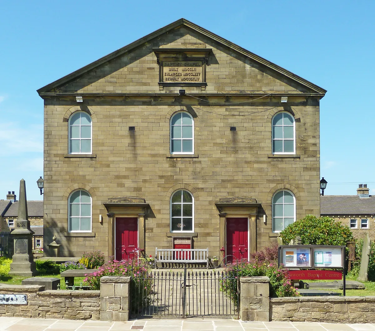 📷 4
📷 4Chapels · Yorkshire & the Humber
Baptist Chapel
Baptist Chapel — chapel in Haworth, Cross Roads and Stanbury, Bradford, West Yorkshire, England, UK.
 📷 3
📷 3Chapels · Yorkshire & the Humber
Bedern Chapel
Bedern Chapel — Grade II* listed building in York, North Yorkshire, England, UK.
Frequently asked questions
- Where is Dukinfield Old Chapel?
- Dukinfield Old Chapel is in Yorkshire, United Kingdom (postcode SK16 4ES), in the parish of Tameside, unparished area.
- What is Dukinfield Old Chapel?
- Dukinfield Old Chapel — chapel in Dukinfield, Greater Manchester, England, UK.
- How do I get to Dukinfield Old Chapel?
- The nearest railway station is Ashton-under-Lyne, about 1.5 km away. The nearest town is Manchester. Drivers can use postcode SK16 4ES.
- When was Dukinfield Old Chapel built?
- Built or established in 1838.
- Is Dukinfield Old Chapel a listed building?
- Dukinfield Old Chapel is officially recognised as Grade II* listed building listed.
- Is Dukinfield Old Chapel free to visit?
- Yes, Dukinfield Old Chapel is free to enter.
- How do I get to Dukinfield Old Chapel?
- The nearest railway station is Ashton-under-Lyne, about 1.5 km away. Drivers can navigate to postcode SK16 4ES.