
Archaeological sites · Yorkshire & the Humber
Site of medieval chapel and section of Fountains Park park pale, 170m south west of How Hill Farm
In or near Ripon.
Site of medieval chapel and section of Fountains Park park pale, 170m south west of How Hill Farm — archaeological site in Markington with Wallerthwaite, Harrogate, England, UK.

Wikimedia Commons contributors — see linked file page for photographer and licence licence

Plan your visit
- Typical visit
- 45 min–1.5 h
- Free entry
- Dog-friendly
About
Site of medieval chapel and section of Fountains Park park pale, 170m south west of How Hill Farm is an archaeological site in the United Kingdom. Heritage designation: scheduled monument. Wikidata describes it as: "archaeological site in Markington with Wallerthwaite, Harrogate, England, UK". Coordinates: 54.0986°, -1.5805°.
Photo gallery
Protected designations
- Area of Outstanding Natural Beauty: Nidderdale
Designations sourced from Natural England open data under OGL v3.
Place summary
The Site of a medieval chapel and a section of Fountains Park park pale is located 170 metres south-west of How Hill Farm in Yorkshire. This archaeological site is designated as a scheduled monument and lies within the Nidderdale Area of Outstanding Natural Beauty (AONB).
AI-generated from the structured facts on this page (operator, designation, listing, era). Not a substitute for visiting.
- Coordinates
- 54.0986, -1.5805
- District
- North Yorkshire
- Parish
- Markington with Wallerthwaite
- Postcode
- HG4 3AN
- Parliamentary constituency
- Skipton and Ripon
Sources
- wikidata: Q17673704 (CC0)
- commons: How Hill Tower - geograph.org.uk - 750144.jpg (CC BY-SA 4.0)
Other places nearby

How Hill
Mountains & hills · 0.1 km
How Hill
Mountains & hills · 0.1 km

How Hill Tower
Chapels · 0.1 km

Old Mill House
Watermills · 1.2 km
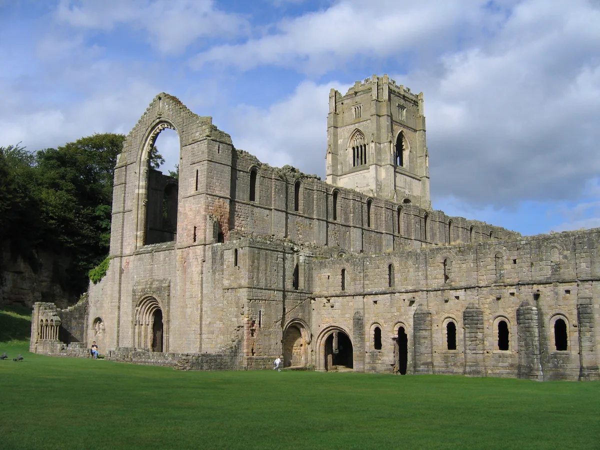
Fountains Abbey
UNESCO World Heritage · 1.2 km

Fountains Abbey
Cathedrals · 1.2 km

Fountains Hall
Manor houses · 1.3 km

Galand Bridge
Historic bridges · 1.3 km

Swanley Grange
Natural landmarks · 1.4 km

Bridge Approximately 200 Metres North Of Rough House
Historic bridges · 1.4 km

Tent Hill
Viewpoints · 1.5 km

Rustic Bridge At South End Of The Canal, With Culvert And Arch To Reservoir
Historic bridges · 1.6 km
Nearby
📷 5Mountains & hills · Yorkshire & the Humber
How Hill
How Hill — a hill or mountain in england yorkshire.
📷 5Mountains & hills · Yorkshire & the Humber
How Hill
How Hill — mountain in england yorkshire. Elevation: 175 m.
★ Iconic📷 5Chapels · Yorkshire & the Humber
How Hill Tower
How Hill Tower — building in Markington with Wallerthwaite, North Yorkshire, England, UK.
★ Iconic📷 3Watermills · Yorkshire & the Humber
Old Mill House
Old Mill House is a watermill in the United Kingdom.
📷 4UNESCO World Heritage · Yorkshire & the Humber
Fountains Abbey
Fountains Abbey — ruined Cistercian abbey in Yorkshire, England, UK.
📷 4Cathedrals · Yorkshire & the Humber
Fountains Abbey
Fountains Abbey is a cathedral in the United Kingdom.
Where to eat & stay near Site of medieval chapel and section of Fountains Park park pale, 170m south west of How Hill Farm
Places to stay
 📷 5
📷 5Campsites · Yorkshire & the Humber
Copper Beech Glade
Copper Beech Glade — a campsite in england yorkshire.
 📷 5
📷 5Caravan parks · Yorkshire & the Humber
Chequers Lodge Caravan Park
Chequers Lodge Caravan Park — a caravan park in england yorkshire.
 📷 5
📷 5Caravan parks · Yorkshire & the Humber
River Laver Holiday Park Ltd.
River Laver Holiday Park Ltd. — a caravan park in england yorkshire.
 📷 5
📷 5 📷 5
📷 5Campsites · Yorkshire & the Humber
Clotherholme Farm Campsite
Clotherholme Farm Campsite — a campsite in england yorkshire.
 📷 5
📷 5Campsites · Yorkshire & the Humber
Church Farm Caravan Park
Church Farm Caravan Park — a campsite in england yorkshire.
Places to eat & drink
 📷 5
📷 5Historic pubs · Yorkshire & the Humber
The Nelson Arms Public House And Attached Outbuilding
The Nelson Arms Public House And Attached Outbuilding in England Yorkshire, United Kingdom.
 📷 7
📷 7Historic pubs · Yorkshire & the Humber
Lamb And Flag Public House
Lamb And Flag Public House in England Yorkshire, United Kingdom.
 📷 5
📷 5Cafés · Yorkshire & the Humber
Lula's Café
Lula's Café — a café in england yorkshire.
 📷 5
📷 5Historic pubs · Yorkshire & the Humber
The Unicorn Hotel
The Unicorn Hotel in England Yorkshire, United Kingdom.
 📷 7
📷 7 📷 7
📷 7Historic pubs · Yorkshire & the Humber
Ye Hornblower Tavern
Ye Hornblower Tavern in England Yorkshire, United Kingdom.
More archaeological sites in this region
 📷 3
📷 3Archaeological sites · Yorkshire & the Humber
Mellor Mill dig site
Mellor Mill dig site — an archaeological site in Yorkshire & the Humber, United Kingdom.
 📷 3
📷 3Archaeological sites · Yorkshire & the Humber
Industrial Chimney
Industrial Chimney — an archaeological site in Yorkshire & the Humber, United Kingdom.
 📷 3
📷 3Archaeological sites · Yorkshire & the Humber
The Dipping Stone
The Dipping Stone — an archaeological site in Yorkshire & the Humber, United Kingdom.
 📷 3
📷 3Archaeological sites · Yorkshire & the Humber
Murder Stone
Murder Stone — an archaeological site in Yorkshire & the Humber, United Kingdom.
Frequently asked questions
- Where is Site of medieval chapel and section of Fountains Park park pale, 170m south west of How Hill Farm?
- Site of medieval chapel and section of Fountains Park park pale, 170m south west of How Hill Farm is in Yorkshire, United Kingdom (postcode HG4 3AN), in the parish of Markington with Wallerthwaite.
- What is Site of medieval chapel and section of Fountains Park park pale, 170m south west of How Hill Farm?
- Site of medieval chapel and section of Fountains Park park pale, 170m south west of How Hill Farm — archaeological site in Markington with Wallerthwaite, Harrogate, England, UK.
- How do I get to Site of medieval chapel and section of Fountains Park park pale, 170m south west of How Hill Farm?
- The nearest town is Ripon. Drivers can use postcode HG4 3AN.
- Is Site of medieval chapel and section of Fountains Park park pale, 170m south west of How Hill Farm a listed building?
- Site of medieval chapel and section of Fountains Park park pale, 170m south west of How Hill Farm is officially recognised as scheduled monument listed.
- Is Site of medieval chapel and section of Fountains Park park pale, 170m south west of How Hill Farm a protected site?
- Yes — Site of medieval chapel and section of Fountains Park park pale, 170m south west of How Hill Farm is part of the Nidderdale National Landscape (AONB).
- Is Site of medieval chapel and section of Fountains Park park pale, 170m south west of How Hill Farm free to visit?
- Yes, Site of medieval chapel and section of Fountains Park park pale, 170m south west of How Hill Farm is free to enter.
- How do I get to Site of medieval chapel and section of Fountains Park park pale, 170m south west of How Hill Farm?
- Drivers can navigate to postcode HG4 3AN. It sits within the Skipton and Ripon parliamentary constituency.