
Beaches · East of England
Horsey Beach
In or near Sea Palling.
Horsey Beach — Coastal area in Great Britain.

Wikimedia Commons contributors — see linked file page for photographer and licence licence
.jpg)
Plan your visit
- Typical visit
- 1 h–3 h
- Best time of year
- Summer (Jun–Aug)
- Free entry
- Family-friendly
- Dog-friendly
Getting there & planning your visit
Horsey Beach is located in North Norfolk, with the postcode NR29 4EQ. Entry to the beach is free. There is no railway station nearby, so please plan your visit accordingly.
About
Horsey Beach is a named beach on the United Kingdom coastline. Part of Norfolk Coast Path. Wikidata describes it as: "Coastal area in Great Britain". Coordinates: 52.7561°, 1.6531°.
Photo gallery
Official information
Horsey Beach is a scenic coastal destination in Norfolk, known for its large grey seal colony and beautiful sandy beach. Visitors can enjoy coastal walks, wildlife photography, and the peaceful natural environment year-round.
Protected designations
- Site of Special Scientific Interest: Winterton-Horsey Dunes SSSI
- Area of Outstanding Natural Beauty: Norfolk Coast
Designations sourced from Natural England open data under OGL v3.
From the Wikipedia article
Horsey Beach, also known as Horsey Gap or Horsey Dunes, is a beach on the east coast of Norfolk, England. It is owned by the National Trust and is within the Norfolk Coast AONB. It contains Horsey Dunes, one of the largest dune systems in Norfolk. To the south is the adjacent SSSI Winterton Dunes - it is possible to walk from one to the other. The site is notable for a large colony of grey seals which breed there each winter. The site, together with the adjoining Winterton Dunes, hosts the largest colonies of dark green fritillary and grayling butterflies in Norfolk. Other butterflies recorded from here in numbers include small copper and common blue. The site has been subject to illegal raves in the past, which have significantly harmed the butterfly population.
Excerpt from Wikipedia under CC BY-SA 4.0. See the source article linked in Sources below.
- Coordinates
- 52.7561, 1.6531
- County
- Norfolk
- District
- North Norfolk
- Parish
- Horsey
- Postcode
- NR29 4EQ
- Parliamentary constituency
- North Norfolk
- Opening
- Daily 8am–8pm; 8am–6pm October to March
- Official site
- www.horseygap.co.uk
Sources
- wikidata: Q5906144 (CC0)
- wikipedia: Horsey Beach (CC BY-SA 4.0)
- commons: Horsey Gap (17566865835).jpg (CC BY-SA 4.0)
Other places nearby

Horsey - Seal viewing
Natural landmarks · 0.9 km

Waxham Sands Holiday Park
Campsites · 1.0 km

Horsey, Norfolk
Museums · 1.2 km

Walnut Farm
Campsites · 1.6 km

Brograve Mill
Gardens · 1.8 km

Horsey Windpump
Natural landmarks · 1.9 km

Horsey Mere viewing area
Natural landmarks · 2.0 km

Horsey Mere
Viewpoints · 2.0 km
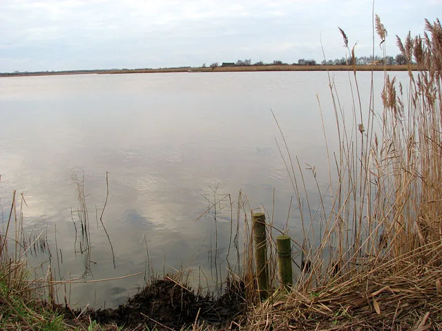
Horsey Mere
Natural landmarks · 2.4 km

Horsey
Villages · 2.7 km

Stubb Mill Raptor Watchpoint
Viewpoints · 3.4 km

Stubb Mill
Windmills · 3.4 km
Nearby
📷 3Natural landmarks · East of England
Horsey - Seal viewing
Horsey - Seal viewing — a other in england-east-midlands, United Kingdom.
📷 5Campsites · East of England
Waxham Sands Holiday Park
Waxham Sands Holiday Park — a campsite in england east midlands.
📷 5Museums · East of England
Horsey, Norfolk
Horsey is a village and civil parish in the English county of Norfolk, within The Broads National Park. Horsey is located 9.9 miles (15.9 km) north of Great Yarmouth and 17 miles (27 km) north-east of
📷 5📷 5Gardens · East of England
Brograve Mill
Brograve Mill — a garden in england-east-midlands, United Kingdom.
📷 3Natural landmarks · East of England
Horsey Windpump
Horsey Windpump — a other in england-east-midlands, United Kingdom.
Where to eat & stay near Horsey Beach
Places to stay
📷 5Campsites · East of England
Waxham Sands Holiday Park
Waxham Sands Holiday Park — a campsite in england east midlands.
📷 5 📷 5
📷 5Caravan parks · East of England
Dune Lodge Caravan Park
Dune Lodge Caravan Park — a caravan park in england east midlands.
 📷 5
📷 5Caravan parks · East of England
Sandy Hills Holiday Park
Sandy Hills Holiday Park — a caravan park in england east midlands.
 📷 5
📷 5Caravan parks · East of England
Golden Sands Holiday Centre
Golden Sands Holiday Centre — a caravan park in england east midlands.
 📷 5
📷 5Places to eat & drink
 📷 5
📷 5 📷 5
📷 5 📷 5
📷 5Historic pubs · East of England
Two Necked Swan Public House
Two Necked Swan Public House in England East, United Kingdom.
 📷 5
📷 5Historic pubs · East of England
St Johns Head Public House
St Johns Head Public House in England East, United Kingdom.
 📷 5
📷 5Historic pubs · East of England
Dukes Head Public House
Dukes Head Public House in England East, United Kingdom.
 📷 5
📷 5Historic pubs · East of England
Peggottys Public House
Peggottys Public House in England East, United Kingdom.
More beaches in this region
 📷 5
📷 5 📷 5
📷 5Beaches · East of England
St Mary's Bay Beach
St Mary's Bay Beach is a beach in the United Kingdom.
 📷 5
📷 5Beaches · East of England
Stort Beach
Stort Beach is a beach in the United Kingdom.
 📷 5
📷 5Beaches · East of England
Thorney Bay Beach
Thorney Bay Beach is a beach in the United Kingdom.
Frequently asked questions
- Where is Horsey Beach?
- Horsey Beach is in Norfolk, the East Midlands, United Kingdom (postcode NR29 4EQ), in the parish of Horsey.
- What is Horsey Beach?
- Horsey Beach — Coastal area in Great Britain.
- How do I get to Horsey Beach?
- Drivers can use postcode NR29 4EQ.
- Is Horsey Beach a protected site?
- Yes — Horsey Beach is part of the Winterton-Horsey Dunes SSSI Site of Special Scientific Interest and the Norfolk Coast National Landscape (AONB).
- Is Horsey Beach free to visit?
- Yes, Horsey Beach is free to enter.
- How do I get to Horsey Beach?
- Drivers can navigate to postcode NR29 4EQ. It sits within the North Norfolk parliamentary constituency.