
Burial mounds & barrows · North East England
HMS G11
In or near Craster.
HMS G11 in England North East, United Kingdom.

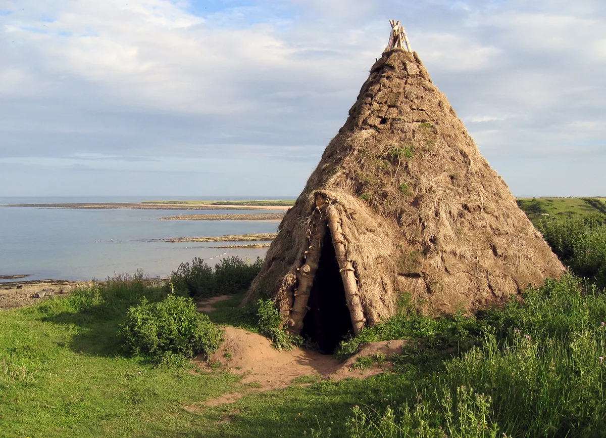
Mat Fascione — CC BY-SA 2.0 via Wikimedia Commons licence

Plan your visit
- Typical visit
- 30 min–1 h
- Nearest railway station
- Alnmouth · 7.2 km
- Free entry
- Dog-friendly
About
HMS G11 is a place of interest in England North East, United Kingdom — drawn from open-data sources for visitor reference. See the linked Wikipedia article for the full description.
Photo gallery
360° viewimagery from 2024
Imagery © Mapillary contributors, CC BY-SA 4.0
Protected designations
- Site of Special Scientific Interest: Northumberland Shore SSSI
- Area of Outstanding Natural Beauty: Northumberland Coast
- Ramsar wetland: Northumbria Coast
Designations sourced from Natural England open data under OGL v3.
From the Wikipedia article
HMS G11 was a G-class submarine of the Royal Navy in service during the First World War. One of six of her class built by Vickers at Barrow in Furness, she was launched on 22 February 1916, and commissioned on 13 May 1916.
Excerpt from Wikipedia under CC BY-SA 4.0. See the source article linked in Sources below.
Background
Description
The G-class submarines were designed by the Admiralty in response to a rumour that the Germans were building double-hulled submarines for overseas duties. The G-class had a length of 187 ft overall, a beam of 22 ft and a mean draft of 13 ft. They displaced 703 LT on the surface and 837 LT submerged. The G-class submarines had a crew of 30 officers and ratings. They had a partial double hull. For surface running, the boats were powered by two 800 bhp Vickers two-stroke diesel engines, each driving one propeller shaft. When submerged each propeller was driven by a 420 hp electric motor. They could reach 14.25 kn on the surface and 9 kn underwater. On the surface, the G class had a range of…
Sourced from Wikipedia under CC BY-SA 4.0.
- Coordinates
- 55.4520, -1.5890
- District
- Northumberland
- Parish
- Longhoughton
- Postcode
- NE66 3LF
- Parliamentary constituency
- North Northumberland
- Nearest railway station
- Alnmouth — 7.2 km
Sources
Featured in this guide
Other places nearby
Howick house
Hill forts · 0.3 km

Howick
Historic houses · 0.6 km

Road Bridge And Footbridge 320 Metres South East Of Howick Hall
Historic bridges · 1.1 km

Howick Arboretum
Botanic gardens · 1.3 km

Howick Hall
Historic houses · 1.3 km

Howick Hillfort
Archaeological sites · 1.4 km

Suger Sands
Beaches · 1.7 km

Craster defended settlement
Vineyards · 2.0 km

Howdlemont Sands
Beaches · 2.0 km

Howick
Villages · 2.1 km

Craster Tower
Castles · 2.2 km

Craster
Towns & cities · 2.2 km
Nearby
📷 3📷 5📷 3Historic bridges · North East England
Road Bridge And Footbridge 320 Metres South East Of Howick Hall
Road Bridge And Footbridge 320 Metres South East Of Howick Hall — Grade II listed building-listed bridge in scotland-lowlands, United Kingdom.
📷 5Botanic gardens · North East England
Howick Arboretum
Howick Arboretum — a botanic garden in scotland lowlands.
📷 5Historic houses · North East England
Howick Hall
Howick Hall in England North East, United Kingdom.
📷 5Archaeological sites · North East England
Howick Hillfort
Howick Hillfort — archaeological in scotland lowlands. Operated by Historic England.
Where to eat & stay near HMS G11
Places to stay
 📷 5
📷 5Hotels · North East England
The Cottage Inn
The Cottage Inn — a hotel in scotland lowlands.
 📷 5
📷 5Caravan parks · North East England
Proctors Stead
Proctors Stead — a caravan park in scotland lowlands.
 📷 5
📷 5Campsites · North East England
Coast & Castles Camp Site
Coast & Castles Camp Site — a campsite in scotland lowlands.
 📷 5
📷 5Campsites · North East England
Dunstan Hill Camping and Caravanning Club Site
Dunstan Hill Camping and Caravanning Club Site — a campsite in scotland lowlands.
 📷 5
📷 5Caravan parks · North East England
Seaton Park Caravans
Seaton Park Caravans — a caravan park in scotland lowlands.
 📷 5
📷 5B&Bs · North East England
Blue Bell Inn
Blue Bell Inn — a bed-and-breakfast in scotland lowlands.
Places to eat & drink
 📷 7
📷 7 📷 7
📷 7Historic pubs · North East England
The Tanners Arms
The Tanners Arms in Scotland Lowlands, United Kingdom.
 📷 5
📷 5Cafés · North East England
Mean Bean Coffee
Mean Bean Coffee — a café in scotland lowlands.
📷 7 📷 7
📷 7 📷 7
📷 7Historic pubs · North East England
Black Swan Public House
Black Swan Public House in Scotland Lowlands, United Kingdom.
More places in this region
 📷 3
📷 3Burial mounds & barrows · North East England
Howgill Fells
Howgill Fells in England North East, United Kingdom.
 📷 3
📷 3Burial mounds & barrows · North East England
Long Cairn
Long Cairn — a burial mound in scotland-lowlands, United Kingdom.
 📷 3
📷 3Burial mounds & barrows · North East England
Seven Sisters round barrow
Seven Sisters round barrow — a burial mound in scotland-lowlands, United Kingdom.
 📷 3
📷 3Burial mounds & barrows · North East England
Round barrow on Hasting Hill
Round barrow on Hasting Hill — a burial mound in scotland-lowlands, United Kingdom.
Frequently asked questions
- Where is HMS G11?
- HMS G11 is in North-East England, United Kingdom (postcode NE66 3LF), in the parish of Longhoughton.
- What is HMS G11?
- HMS G11 in England North East, United Kingdom.
- How do I get to HMS G11?
- The nearest railway station is Alnmouth, about 7.2 km away. Drivers can use postcode NE66 3LF.
- Is HMS G11 a protected site?
- Yes — HMS G11 is part of the Northumberland Shore SSSI Site of Special Scientific Interest and the Northumberland Coast National Landscape (AONB).
- Is HMS G11 free to visit?
- Yes, HMS G11 is free to enter.
- How do I get to HMS G11?
- The nearest railway station is Alnmouth, about 7.2 km away. Drivers can navigate to postcode NE66 3LF.