Castles · North West England
Geltsdale
In or near Ainstable.
Geltsdale in England North East, United Kingdom.

Jonathan Adams — CC BY-SA 2.0 via Wikimedia Commons licence
Plan your visit
- Typical visit
- 1.5 h–3 h
- Nearest railway station
- Brampton · 6.6 km
- Family-friendly
- Limited wheelchair access
Getting there & planning your visit
To visit Geltsdale, the nearest railway station is Brampton, located 6.6 km away. The postcode for sat-nav is CA8 9NG. Accessibility is limited for wheelchair users.
About
Geltsdale is a place of interest in England North East, United Kingdom — drawn from open-data sources for visitor reference. See the linked Wikipedia article for the full description.
Photo gallery
Protected designations
- Site of Special Scientific Interest: Geltsdale & Glendue Fells SSSI
- Site of Special Scientific Interest: River Eden and Tributaries SSSI
- Area of Outstanding Natural Beauty: North Pennines
Designations sourced from Natural England open data under OGL v3.
From the Wikipedia article
Geltsdale is a hamlet and former civil parish, now in the parish of Castle Carrock, in the Cumberland district, in the ceremonial county of Cumbria, England, to the southeast of Castle Carrock village. In 2001 the parish had a population of 6. From 1858 Geltsdale was a civil parish in its own right. On 1 April 2003 the parish was abolished and merged with Castle Carrock. The Geltsdale Reservoir railway ran in the vicinity. The local landscapes are under several levels of protection. Two of the protected areas cover a large area: the North Pennines Area of Outstanding Natural Beauty the North Pennines Moors Special Protection Area (147,276 ha) Geltsdale & Glendue Fells Site of Special Scientific Interest has an area of 8,059 ha, and is one of the SSSIs which underlie the SPA. Geltsdale RSPB reserve is a 5,000 ha nature reserve within the SSSI. It mainly moorland and is managed by the Royal Society for Protection of Birds for upland birds such as black grouse and hen harrier.
Excerpt from Wikipedia under CC BY-SA 4.0. See the source article linked in Sources below.
- Coordinates
- 54.8762, -2.6717
- District
- Cumberland
- Parish
- Castle Carrock
- Postcode
- CA8 9NG
- Parliamentary constituency
- Carlisle
- Nearest railway station
- Brampton — 6.6 km
Sources
Other places nearby

Castle Carrock
Castles · 0.8 km

Hespeck Raise
Mountains & hills · 1.1 km

Cumrew Fell
Mountains & hills · 1.7 km

Tarnmonath Fell
Mountains & hills · 1.9 km

Simmerson Hill
Mountains & hills · 2.4 km
Simmerson Hill
Mountains & hills · 2.4 km

Middle Top
Mountains & hills · 2.6 km

Talkin Fell
Mountains & hills · 2.7 km

Castle Carrock Castle
Literary houses · 3.1 km

Castle Carrock War Memorial
Memorials & monuments · 3.2 km

Castle Carrock
Villages · 3.3 km

Woodcock Hill
Mountains & hills · 3.5 km
Nearby
📷 4Castles · North West England
Castle Carrock
Castle Carrock in England North East, United Kingdom.
📷 5Mountains & hills · North West England
Hespeck Raise
Hespeck Raise — mountain in scotland lowlands. Elevation: 427 m.
📷 5Mountains & hills · North West England
Cumrew Fell
Cumrew Fell — a hill or mountain in scotland lowlands.
📷 5Mountains & hills · North West England
Tarnmonath Fell
Tarnmonath Fell — mountain in scotland lowlands. Elevation: 512 m.
📷 5Mountains & hills · North West England
Simmerson Hill
Simmerson Hill — a hill or mountain in scotland lowlands.
📷 5Mountains & hills · North West England
Simmerson Hill
Simmerson Hill — mountain in scotland lowlands. Elevation: 400 m.
Where to eat & stay near Geltsdale
Places to stay
 📷 5
📷 5Caravan parks · North West England
Chapel House Caravan Park
Chapel House Caravan Park — a caravan park in scotland lowlands.
 📷 5
📷 5Campsites · North West England
Talkin Tarn Campsite
Talkin Tarn Campsite — a campsite in scotland lowlands.
 📷 5
📷 5 📷 7
📷 7 📷 7
📷 7B&Bs · North West England
Scotch Arms Mews
Scotch Arms Mews — a bed-and-breakfast in scotland lowlands.
 📷 5
📷 5Caravan parks · North West England
Cleugh Head Caravan Club
Cleugh Head Caravan Club — a caravan park in scotland lowlands.
Places to eat & drink
 📷 5
📷 5Historic pubs · North West England
Graham Arms (West Of Gelt Bridge)
Graham Arms (West Of Gelt Bridge) in Scotland Lowlands, United Kingdom.
 📷 4
📷 4Historic pubs · North West England
Hallbankgate
Hallbankgate in England North East, United Kingdom.
 📷 4
📷 4 📷 5
📷 5Historic pubs · North West England
St Nicholas Arms Public House
St Nicholas Arms Public House in Scotland Lowlands, United Kingdom.
 📷 7
📷 7Historic pubs · North West England
The Andalusian
The Andalusian in Scotland Lowlands, United Kingdom.
 📷 4
📷 4Historic pubs · North West England
The Griffin
The Griffin — Historic pub — listed building or notable heritage status.
More castles in this region
 📷 3
📷 3Castles · North West England
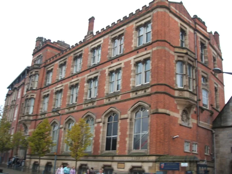
Manchester Castle
Manchester Castle — medieval fortified manor house in England.
 📷 5
📷 5Castles · North West England
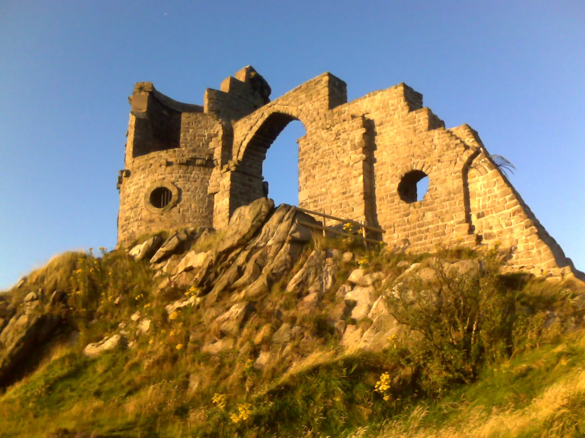
Mow Cop Castle
Mow Cop Castle — folly on the Cheshire and Staffordshire border, England, UK.
 📷 3
📷 3 📷 3
📷 3Castles · North West England
Ullerwood Castle
Ullerwood Castle — castle in Greater Manchester, England.
Frequently asked questions
- Where is Geltsdale?
- Geltsdale is in North-East England, United Kingdom (postcode CA8 9NG), in the parish of Castle Carrock.
- What is Geltsdale?
- Geltsdale in England North East, United Kingdom.
- How do I get to Geltsdale?
- The nearest railway station is Brampton, about 6.6 km away. Drivers can use postcode CA8 9NG.
- Is Geltsdale a protected site?
- Yes — Geltsdale is part of the Geltsdale & Glendue Fells SSSI Site of Special Scientific Interest and the River Eden and Tributaries SSSI Site of Special Scientific Interest.
- Does Geltsdale charge admission?
- Geltsdale typically charges admission. Check the official site for current ticket prices and opening hours.
- How do I get to Geltsdale?
- The nearest railway station is Brampton, about 6.6 km away. Drivers can navigate to postcode CA8 9NG.