
Towns & cities · North West England
Ainstable
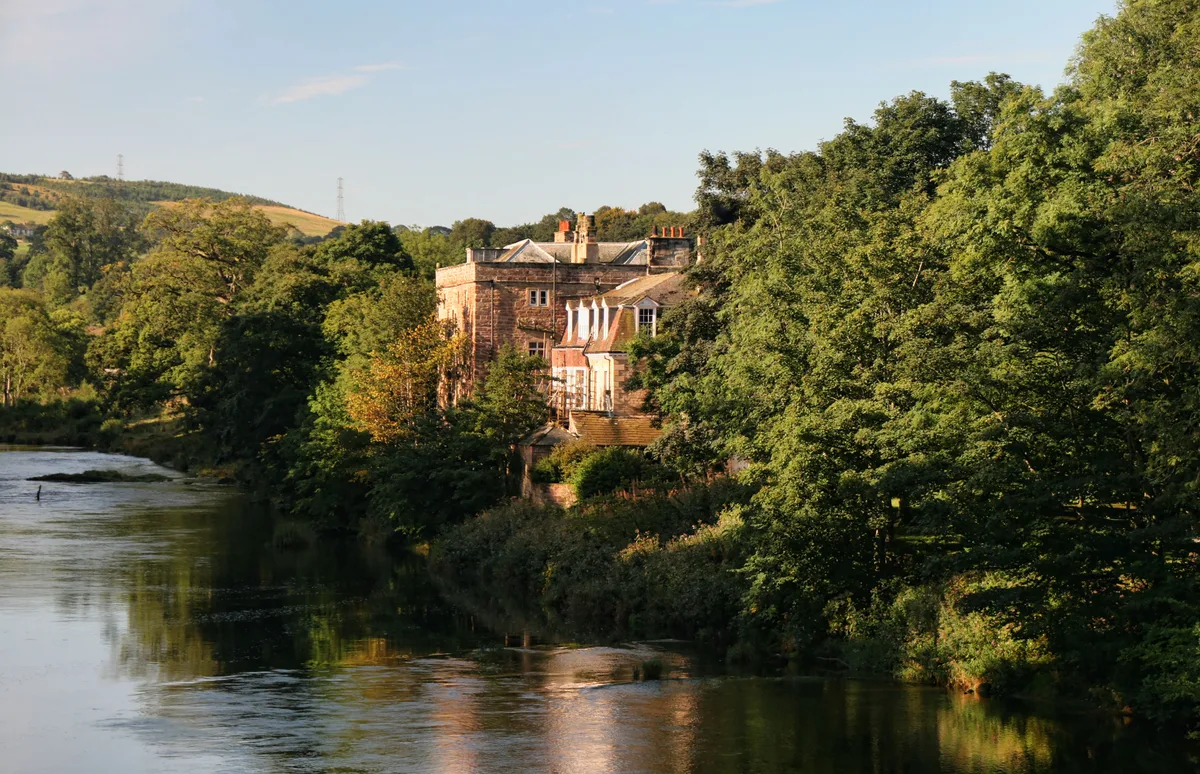
Ainstable — village and civil parish in Cumbria, UK.

Wikimedia Commons contributors — see linked file page for photographer and licence licence

Plan your visit
- Typical visit
- 3 h–6 h
- Nearest railway station
- Armathwaite · 2.7 km
- Free entry
- Family-friendly
- Dog-friendly
Getting there & planning your visit
Ainstable is located in the Scottish Lowlands, with the nearest railway station being Armathwaite, which is 2.7 km away. Entry to the town is free. The postcode for Ainstable is CA4.
About
Ainstable is a town, city, village or settlement in the United Kingdom. Recent population estimates put it at around 532 people. Address: CA4. Wikidata describes it as: "village and civil parish in Cumbria, UK". Coordinates: 54.8000°, -2.7330°.
Photo gallery
Protected designations
- Site of Special Scientific Interest: River Eden and Tributaries SSSI
Designations sourced from Natural England open data under OGL v3.
From the Wikipedia article
Ainstable is a village and civil parish in the English county of Cumbria. Historically part of the traditional county of Cumberland, it is now in the unitary authority area of Westmorland and Furness. The parish stretches from the banks of the River Eden to the summits of the North Pennines where it borders Northumberland and includes the villages of Croglin and Newbiggin as well as the hamlets of Dale, Walmersyke, Ruckcroft and Longdales and part of the village of Armathwaite. Ainstable was the site of a Benedictine convent (the manor of "Nunnery"). This is said to date from the reign of William Rufus. However, Pevsner says that "the earliest reference is 1200. The nuns were so harassed by the Scots that in 1480 they had to reinvent their own charter, spuriously dating their foundation to 1089 and William Rufus." After the closure of the monasteries, the convent building became a private home, held for many years by the Aglionby family, and is now a guesthouse. Eden Valley Woollen Mill is located in Ainstable itself. The former village pub, the New Crown Inn, has closed and been sold for redevelopment. In 2014 Eden District Council rejected a fiercely opposed plan to erect a wind turbine near to the village and the neighbouring village of Armathwaite.
Excerpt from Wikipedia under CC BY-SA 4.0. See the source article linked in Sources below.
- Coordinates
- 54.8000, -2.7330
- District
- Westmorland and Furness
- Parish
- Ainstable
- Postcode
- CA4
- Parliamentary constituency
- Penrith and Solway
- Population
- 532
- Nearest railway station
- Armathwaite — 2.7 km
Sources
- wikidata: Q1869807 (CC0)
- wikipedia: Ainstable (CC BY-SA 4.0)
- commons: Ainstable - geograph.org.uk - 212975.jpg (CC BY-SA 4.0)
Other places nearby

Ruckcroft Hill
Mountains & hills · 0.7 km

Ainstable War Memorial Lych-Gate
Memorials & monuments · 1.4 km

Broomrigg D stone circle
Stone circles · 2.2 km

Broomrigg D stone circle
Archaeological sites · 2.2 km
Broomrigg I: standing stone in Broomrigg Plantation, 920m south east of Street House
Windmills · 2.2 km

Armathwaite Bridge
Historic bridges · 2.4 km
Broomrigg G: standing stone in Broomrigg Plantation, 730m south east of Street House
Windmills · 2.4 km
Armathwaite Castle
Castles · 2.5 km

The Chapel Of Christ And St Mary
Chapels · 2.5 km

Lawson Hill
Mountains & hills · 3.5 km

Newbiggin
Villages · 3.7 km

Grey Yauds
Archaeological sites · 3.7 km
Ainstable is a village located in the Scottish Lowlands with a population of 532. Our guide lists N nearby attractions within reach.
At a glance
- Population
- 532
- Constituency
- Penrith and Solway
- Top categories near here
Things to see in Ainstable
47 attractions within 12 km — showing the 24 most editorially-significant. Full guide: things to do in Ainstable →
 📷 4
📷 4Castles · North West England
Castle Carrock
Castle Carrock in England North East, United Kingdom.
 📷 4
📷 4 📷 4📷 3📷 3
Chapels · North West England
The Chapel Of Christ And St Mary
The Chapel Of Christ And St Mary — chapel in Armathwaite, Cumbria, England, UK.
📷 3Archaeological sites · North West England
Grey Yauds
Grey Yauds — a archaeological in scotland-lowlands, United Kingdom.

Castles · North West England
Dunwalloght Castle
Dunwalloght Castle — a castle in scotland-lowlands, United Kingdom.
Stone circles · North West England
Broomrigg D stone circle
Broomrigg D stone circle — a stone circle in scotland-lowlands, United Kingdom.
 📷 3
📷 3Historic houses · North West England
Croglin Lime Works
Croglin Lime Works — a historic house in scotland-lowlands, United Kingdom.
📷 3Historic bridges · North West England
Armathwaite Bridge
Armathwaite Bridge — Grade II listed building-listed bridge in scotland-lowlands, United Kingdom.
📷 3Memorials & monuments · North West England
Croglin War Memorial
Croglin War Memorial — Grade II listed building-listed memorial in scotland-lowlands, United Kingdom.
 📷 3
📷 3Memorials & monuments · North West England
Cotehill War Memorial
Cotehill War Memorial — Grade II listed building-listed memorial in scotland-lowlands, United Kingdom.
📷 3Memorials & monuments · North West England
Ainstable War Memorial Lych-Gate
Ainstable War Memorial Lych-Gate — Grade II listed building-listed memorial in scotland-lowlands, United Kingdom.
 📷 3
📷 3Memorials & monuments · North West England
High Hesket War Memorial
High Hesket War Memorial — Grade II listed building-listed memorial in scotland-lowlands, United Kingdom.
 📷 3
📷 3Memorials & monuments · North West England
Castle Carrock War Memorial
Castle Carrock War Memorial — Grade II listed building-listed memorial in scotland-lowlands, United Kingdom.
Windmills · North West England
Broomrigg G: standing stone in Broomrigg Plantation, 730m south east of Street House
Broomrigg G: standing stone in Broomrigg Plantation, 730m south east of Street House — a post mill in scotland-lowlands, United Kingdom.
Windmills · North West England
Broomrigg I: standing stone in Broomrigg Plantation, 920m south east of Street House
Broomrigg I: standing stone in Broomrigg Plantation, 920m south east of Street House — a post mill in scotland-lowlands, United Kingdom.
 📷 5
📷 5Caravan parks · North West England
Englethwaite Hall
Englethwaite Hall — a caravan park in scotland lowlands.
 📷 5
📷 5Caravan parks · North West England
Chapel House Caravan Park
Chapel House Caravan Park — a caravan park in scotland lowlands.
 📷 5
📷 5 📷 4
📷 4Vineyards · North West England
Slight univallate hillfort on Barrock Fell
Slight univallate hillfort on Barrock Fell — a UK vineyard in scotland lowlands, producing English or Welsh wine from cool-climate grape varieties.
 📷 5
📷 5Vineyards · North West England
Castlerigg
Castlerigg — a UK vineyard in scotland lowlands, producing English or Welsh wine from cool-climate grape varieties.
 📷 5
📷 5Literary houses · North West England
Castle Carrock Castle
Castle Carrock Castle — a literary house museum in scotland lowlands.

Literary houses · North West England
Dunwalloght Castle
Dunwalloght Castle — a literary house museum in scotland lowlands.
Nearby
📷 5Mountains & hills · North West England
Ruckcroft Hill
Ruckcroft Hill — a hill or mountain in scotland lowlands.
📷 3Memorials & monuments · North West England
Ainstable War Memorial Lych-Gate
Ainstable War Memorial Lych-Gate — Grade II listed building-listed memorial in scotland-lowlands, United Kingdom.
Stone circles · North West England
Broomrigg D stone circle
Broomrigg D stone circle — a stone circle in scotland-lowlands, United Kingdom.
📷 5Archaeological sites · North West England
Broomrigg D stone circle
Broomrigg D stone circle — archaeological in scotland lowlands.
Windmills · North West England
Broomrigg I: standing stone in Broomrigg Plantation, 920m south east of Street House
Broomrigg I: standing stone in Broomrigg Plantation, 920m south east of Street House — a post mill in scotland-lowlands, United Kingdom.
📷 3Historic bridges · North West England
Armathwaite Bridge
Armathwaite Bridge — Grade II listed building-listed bridge in scotland-lowlands, United Kingdom.
Where to eat & stay near Ainstable
Places to stay
📷 5 📷 5
📷 5Campsites · North West England
Lazonby Pool Campsite
Lazonby Pool Campsite — a campsite in scotland lowlands.
 📷 5
📷 5Campsites · North West England
Mains Farm
Mains Farm — a campsite in scotland lowlands.
📷 5Caravan parks · North West England
Englethwaite Hall
Englethwaite Hall — a caravan park in scotland lowlands.
 📷 5
📷 5 📷 5
📷 5Caravan parks · North West England
Melmerby Mill Holiday Caravan Park
Melmerby Mill Holiday Caravan Park — a caravan park in scotland lowlands.
Places to eat & drink
 📷 5
📷 5Historic pubs · North West England
Graham Arms (West Of Gelt Bridge)
Graham Arms (West Of Gelt Bridge) in Scotland Lowlands, United Kingdom.
 📷 3
📷 3 📷 7
📷 7Cafés · North West England
Narrowbar Cafe
Narrowbar Cafe — a café in scotland lowlands.
 📷 4
📷 4Historic pubs · North West England
Hallbankgate
Hallbankgate in England North East, United Kingdom.
 📷 6
📷 6Historic pubs · North West England
Gloucester Arms
Gloucester Arms in Scotland Lowlands, United Kingdom.
 📷 7
📷 7Historic pubs · North West England
Two Lions public house and integral stables
Two Lions public house and integral stables in Scotland Lowlands, United Kingdom.
More towns in this region
 Flagship📷 3
Towns & cities · North West England
Manchester
Manchester — city in Greater Manchester, England.
 📷 3
📷 3Towns & cities · North West England
Alderley Edge
Alderley Edge — village and civil parish in Cheshire East, UK.
_-_geograph.org.uk_-_60497.jpg?width=1200) 📷 5
📷 5Towns & cities · North West England
Appleton Thorn
Appleton Thorn — village in Warrington, Cheshire, UK.
 📷 5
📷 5Towns & cities · North West England
Aston juxta Mondrum
Aston juxta Mondrum — village and civil parish in Cheshire East, England, UK.
Frequently asked questions
- Where is Ainstable?
- Ainstable is in the Scottish Lowlands, United Kingdom (postcode CA4), in the parish of Ainstable.
- What is Ainstable?
- Ainstable — village and civil parish in Cumbria, UK.
- How do I get to Ainstable?
- The nearest railway station is Armathwaite, about 2.7 km away. Drivers can use postcode CA4.
- Is Ainstable a protected site?
- Yes — Ainstable is part of the River Eden and Tributaries SSSI Site of Special Scientific Interest.
- Is Ainstable free to visit?
- Yes, Ainstable is free to enter.
- How do I get to Ainstable?
- The nearest railway station is Armathwaite, about 2.7 km away. Drivers can navigate to postcode CA4.