
Historic bridges · Northern Ireland
Foyle Bridge
In or near Maydown.
Foyle Bridge is a historic bridge in the United Kingdom.

Wikimedia Commons contributors — see linked file page for photographer and licence licence

Plan your visit
- Typical visit
- 15 min–30 min
- Nearest railway station
- Derry~Londonderry · 3.0 km
- Free entry
- Dog-friendly
Getting there & planning your visit
To visit Foyle Bridge, the nearest railway station is Derry~Londonderry, located 3 km away. The postcode for navigation is BT48 7BF, and entry to the bridge is free. Accessibility information is not provided.
About
Foyle Bridge is a named historic bridge in the United Kingdom. Coordinates: 55.0179°, -7.2924°. This entry is part of The Great Britain Guide, a free, ad-free, open-data tourist directory.
Photo gallery
From the Wikipedia article
The Foyle Bridge is a bridge in Derry, Northern Ireland. The central span of the bridge is the longest on the island of Ireland, at 234 metres (767 ft), and the whole suspended bridge structure including the approach spans is 866 metres long (2839 ft). It crosses the River Foyle to the north of the city, and forms only the second of three bridges linking the city centre to the Waterside, the others being the Craigavon Bridge and the Peace Bridge walkway. Work on the bridge began in 1980 and it opened in October 1984. The seven approach spans on the east bank are of pre-stressed concrete box construction. The three main river spans are of steel box construction and were built by Harland and Wolff shipyard in Belfast in 6 segments, weighed up to 900 tonnes each, and then transported by barge and oceangoing tug to site where they were lifted into position. Between 2003 and 2005 the bridge underwent strengthening, resurfacing and other improvements, leading to widespread traffic disruption in the city. Total cost of the refurbishment work was £10.6 million. The road was built to four-lane dual carriageway standard, and carries the A515. By 2004 more than 30,000 vehicles used the bridge every day. The bridge was built for the Roads Service of Northern Ireland by RDL- John Graham (Dromore) Joint Venture, with the consulting engineers being Ove Arup and Partners including D. C. Black Ltd. The value of the four-year construction contract was £15,765,000. It was the first bridge in Ireland to be built according to a "Design and Construct" system, whereby the same firm designed and constructed the bridge.
Excerpt from Wikipedia under CC BY-SA 4.0. See the source article linked in Sources below.
Background
History
The bridge crosses the Foyle at Madam's Bank, which is the same site as King James II's army chose to place their boom barrier during the Siege of Derry in 1688–1689. It is the third bridge across the River Foyle to be officially named "Foyle Bridge". The oldest Foyle Bridge still in existence, an iron railway bridge that crossed the Foyle near Porthall, a village just north of Lifford, carried the Great Northern Railway (Ireland) (the G.N.R.) line from Strabane and through The Laggan district in East Donegal. This railway line, which ran via St Johnston, had its terminus at Foyle Road in Derry. Parts of this bridge still stand. The other bridge with this name is better known as Lifford…
Sourced from Wikipedia under CC BY-SA 4.0.
- Coordinates
- 55.0179, -7.2924
- District
- Derry City and Strabane
- Postcode
- BT48 7BF
- Parliamentary constituency
- Foyle
- Nearest railway station
- Derry~Londonderry — 3 km
Sources
- osm: w1137238600 (ODbL)
- wikipedia: Foyle Bridge (CC BY-SA 4.0)
- commons: Foyle bridge, railside.jpg (CC BY-SA 4.0)
Other places nearby

A515 road
Natural landmarks · 0.4 km

Boom Hall
Historic houses · 0.5 km
Ballynashallog Picnic Area
Natural landmarks · 0.6 km

Gransha Hospital
Natural landmarks · 0.9 km

Oakgrove Integrated College
Natural landmarks · 1.3 km

Da Vinci's
Hotels · 1.3 km
Ruins of Old Enagh Church
Historic houses · 1.6 km
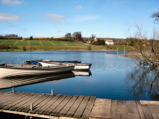
Enagh Lough
Natural landmarks · 1.7 km

Londonderry County Asylum
Natural landmarks · 1.7 km
Londonderry Graving Dock railway station
Natural landmarks · 2.0 km

Beechgrove
Natural landmarks · 2.0 km

Thornhill College
Natural landmarks · 2.0 km
Nearby
📷 4📷 3📷 3Natural landmarks · Northern Ireland
Ballynashallog Picnic Area
Ballynashallog Picnic Area — a other in northern-ireland, United Kingdom.
📷 4Natural landmarks · Northern Ireland
Gransha Hospital
Gransha Hospital in Northern Ireland, United Kingdom.
📷 3Natural landmarks · Northern Ireland
Oakgrove Integrated College
Oakgrove Integrated College in Northern Ireland, United Kingdom.
📷 7Where to eat & stay near Foyle Bridge
Places to stay
📷 7 📷 5
📷 5 📷 5
📷 5 📷 5
📷 5 📷 5
📷 5Hostels · Northern Ireland
Derry City Independent Hostel (Annexe)
Derry City Independent Hostel (Annexe) — a hostel in northern ireland.
 📷 5
📷 5Hostels · Northern Ireland
Derry City Independent Hostel
Derry City Independent Hostel — a hostel in northern ireland.
More bridges in this region
 📷 3
📷 3Historic bridges · Northern Ireland
Albert Bridge
Albert Bridge is a historic bridge in the United Kingdom.
 📷 3
📷 3Historic bridges · Northern Ireland
Antrim Road
Antrim Road is a historic bridge in the United Kingdom.
 📷 3
📷 3Historic bridges · Northern Ireland
Arthur Road
Arthur Road is a historic bridge in the United Kingdom.
 📷 3
📷 3Historic bridges · Northern Ireland
Ballinlea Road
Ballinlea Road is a historic bridge in the United Kingdom.
Frequently asked questions
- Where is Foyle Bridge?
- Foyle Bridge is in Northern Ireland, United Kingdom (postcode BT48 7BF).
- What is Foyle Bridge?
- Foyle Bridge is a historic bridge in the United Kingdom.
- How do I get to Foyle Bridge?
- The nearest railway station is Derry~Londonderry, about 3.0 km away. Drivers can use postcode BT48 7BF.
- Is Foyle Bridge free to visit?
- Yes, Foyle Bridge is free to enter.
- How do I get to Foyle Bridge?
- The nearest railway station is Derry~Londonderry, about 3.0 km away. Drivers can navigate to postcode BT48 7BF.