
Natural landmarks · Northern Ireland
A515 road
In or near Maydown.
A515 road in Northern Ireland, United Kingdom.

Matthew Chadwick — CC BY-SA 2.0 via Wikimedia Commons licence

Plan your visit
- Typical visit
- 1 h–2 h
- Nearest railway station
- Derry~Londonderry · 3.0 km
- Free entry
- Dog-friendly
- Limited wheelchair access
About
A515 road is a place of interest in Northern Ireland, United Kingdom — drawn from open-data sources for visitor reference. See the linked Wikipedia article for the full description.
Photo gallery
See it from the streetimagery from 2025
Imagery © Mapillary contributors, CC BY-SA 4.0
From the Wikipedia article
The A515 Skeoge Link is a road in Northern Ireland which was designed to complete the route between Foyle Bridge in County Londonderry and County Donegal. It is part of a larger project to link County Donegal with Belfast. The total construction cost was £5 million.
Excerpt from Wikipedia under CC BY-SA 4.0. See the source article linked in Sources below.
Background
Architecture
Skeoge Link Road is a road scheme that was constructed along the northwestern periphery of Derry. This road had been called for going back as far as the 1980s to relieve traffic from the already congested Buncrana Road which is the A2 and other roads within the Galliagh and Steelstown Area. It was reported in February 2008 in the Derry Journal that the scheme is set to open in March of the same year. The road opened to traffic on 20 March 2020.
Sourced from Wikipedia under CC BY-SA 4.0.
- Coordinates
- 55.0158, -7.2871
- District
- Derry City and Strabane
- Postcode
- BT47 6TF
- Parliamentary constituency
- Foyle
- Established
- 2008
- Nearest railway station
- Derry~Londonderry — 3 km
Sources
- wikidata: Q4649439 (CC0)
- wikipedia: A515 road (Northern Ireland) (CC BY-SA 4.0)
Other places nearby

Foyle Bridge
Historic bridges · 0.4 km

Gransha Hospital
Natural landmarks · 0.5 km

Boom Hall
Historic houses · 0.9 km

Oakgrove Integrated College
Natural landmarks · 1.0 km
Ballynashallog Picnic Area
Natural landmarks · 1.0 km
Ruins of Old Enagh Church
Historic houses · 1.4 km
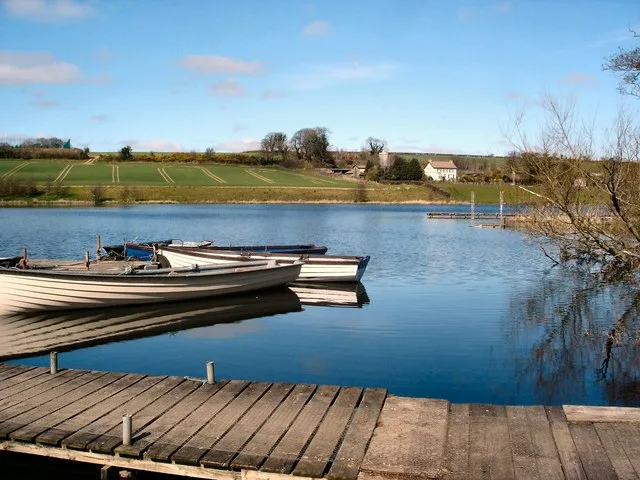
Enagh Lough
Natural landmarks · 1.4 km

Da Vinci's
Hotels · 1.6 km

Ballyoan Cemetery
Cemeteries · 1.7 km

Beechgrove
Natural landmarks · 1.9 km

Londonderry County Asylum
Natural landmarks · 2.0 km

Thornhill College
Natural landmarks · 2.1 km
Nearby
📷 4Historic bridges · Northern Ireland
Foyle Bridge
Foyle Bridge is a historic bridge in the United Kingdom.
📷 4Natural landmarks · Northern Ireland
Gransha Hospital
Gransha Hospital in Northern Ireland, United Kingdom.
📷 3📷 3Natural landmarks · Northern Ireland
Oakgrove Integrated College
Oakgrove Integrated College in Northern Ireland, United Kingdom.
📷 3Natural landmarks · Northern Ireland
Ballynashallog Picnic Area
Ballynashallog Picnic Area — a other in northern-ireland, United Kingdom.
📷 3Historic houses · Northern Ireland
Ruins of Old Enagh Church
Ruins of Old Enagh Church — a historic house in northern-ireland, United Kingdom.
Where to eat & stay near A515 road
Places to stay
📷 7 📷 5
📷 5 📷 5
📷 5 📷 5
📷 5 📷 5
📷 5Hostels · Northern Ireland
Derry City Independent Hostel (Annexe)
Derry City Independent Hostel (Annexe) — a hostel in northern ireland.
 📷 5
📷 5Hostels · Northern Ireland
Derry City Independent Hostel
Derry City Independent Hostel — a hostel in northern ireland.
More natural landmarks in this region
 Flagship📷 4
Natural landmarks · Northern Ireland
Lough Erne
Lough Erne — lake in County Fermanagh, Northern Ireland, UK.
 Flagship📷 4
Natural landmarks · Northern Ireland
Lough Neagh
Lough Neagh — large lake in Northern Ireland.
 📷 3
📷 3Natural landmarks · Northern Ireland
Ballysaggart Lough
Ballysaggart Lough — lake in the United Kingdom.
 📷 5
📷 5Natural landmarks · Northern Ireland
Belmore Mountain
Belmore Mountain — mountain in the United Kingdom.
Frequently asked questions
- Where is A515 road?
- A515 road is in Northern Ireland, United Kingdom (postcode BT47 6TF).
- What is A515 road?
- A515 road in Northern Ireland, United Kingdom.
- How do I get to A515 road?
- The nearest railway station is Derry~Londonderry, about 3.0 km away. Drivers can use postcode BT47 6TF.
- When was A515 road built?
- Built or established in 2008.
- Is A515 road free to visit?
- Yes, A515 road is free to enter.
- How do I get to A515 road?
- The nearest railway station is Derry~Londonderry, about 3.0 km away. Drivers can navigate to postcode BT47 6TF.