
Historic houses · Northern Ireland
Boom Hall
In or near Maydown.
Boom Hall in Northern Ireland, United Kingdom.

N Chadwick — CC BY-SA 2.0 via Wikimedia Commons licence

Plan your visit
- Typical visit
- 1 h–2 h
- Nearest railway station
- Derry~Londonderry · 3.3 km
- Family-friendly
- Limited wheelchair access
Getting there & planning your visit
To visit Boom Hall, the nearest railway station is Derry~Londonderry, located 3.3 km away. The postcode for sat-nav is BT48 7BF. Accessibility is limited for wheelchair users.
About
Boom Hall is a place of interest in Northern Ireland, United Kingdom — drawn from open-data sources for visitor reference. See the linked Wikipedia article for the full description.
Photo gallery
From the Wikipedia article
Boom Hall is a house and demesne in Derry, Northern Ireland. Lying close to the west bank of the River Foyle, a fort was constructed on the site during the English Civil War. During the Williamite War in Ireland a boom was constructed across the river to try to prevent Williamite forces relieving the Siege of Derry. A two-storey country house was subsequently built on the site by the Alexander family and named after this boom. The estate was later leased to a number of people until a leasehold was sold to Daniel Baird in 1849 by The 3rd Earl of Caledon. This was inherited by Daniel Baird Maturin-Baird who also purchased the freehold from the Alexanders. Boom Hall was again let to a number of different people, with Michael Henry McDevitt living there from 1924. During the Second World War, the demesne was used by the Admiralty and a number of temporary huts were built there. McDevitt purchased the freehold in 1949 and the house was renovated. It fell into disuse in the 1960s and was almost destroyed by fire in the 1970s. Part of the estate was used for the construction of the Foyle Bridge. The property was purchased by Derry City Council in 1997 though it remains a fenced-off shell. There are two current proposals to renovate the house; one as part of a recreational park described as being in the style of the Eden Project, and one as a community hub for outdoor activities. The council is developing a redevelopment brief that will seek to partner with one or more parties to redevelop the site.
Excerpt from Wikipedia under CC BY-SA 4.0. See the source article linked in Sources below.
Background
History
The Boom Hall Demesne borders the River Foyle in western County Londonderry. It extends from the river north west to the Culmore Road. The land, which is underlain with schistose grits and pelitic schists of the Upper Dalradian Londonderry Formation, slopes gradually towards the river. The ground falls away steeply, over a 35 m width, at the river's edge. The site came into the ownership of the Catholic Abbey of Derry but as part of the Plantation of Ulster was granted to The Honourable The Irish Society. In 1688, during the Williamite War in Ireland, Charles Fort was occupied by Jacobite forces as part of the Siege of Derry. To try to prevent Williamite forces from relieving the siege a…
Sourced from Wikipedia under CC BY-SA 4.0.
- Coordinates
- 55.0212, -7.2973
- District
- Derry City and Strabane
- Postcode
- BT48 7BF
- Parliamentary constituency
- Foyle
- Established
- 1779
- Nearest railway station
- Derry~Londonderry — 3.3 km
Sources
- wikidata: Q104215785 (CC0)
- wikipedia: Boom Hall (CC BY-SA 4.0)
Other places nearby
Ballynashallog Picnic Area
Natural landmarks · 0.2 km

Foyle Bridge
Historic bridges · 0.5 km

A515 road
Natural landmarks · 0.9 km

Da Vinci's
Hotels · 1.2 km

Gransha Hospital
Natural landmarks · 1.3 km

Steelstown GAC
Natural landmarks · 1.6 km

Oakgrove Integrated College
Natural landmarks · 1.6 km

Londonderry County Asylum
Natural landmarks · 1.7 km

Thornhill College
Natural landmarks · 1.8 km
Ruins of Old Enagh Church
Historic houses · 1.9 km
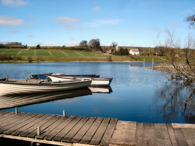
Enagh Lough
Natural landmarks · 1.9 km
Londonderry Graving Dock railway station
Natural landmarks · 1.9 km
Nearby
📷 3Natural landmarks · Northern Ireland
Ballynashallog Picnic Area
Ballynashallog Picnic Area — a other in northern-ireland, United Kingdom.
📷 4Historic bridges · Northern Ireland
Foyle Bridge
Foyle Bridge is a historic bridge in the United Kingdom.
📷 4📷 7📷 4Natural landmarks · Northern Ireland
Gransha Hospital
Gransha Hospital in Northern Ireland, United Kingdom.
📷 4Natural landmarks · Northern Ireland
Steelstown GAC
Steelstown GAC in Northern Ireland, United Kingdom.
Where to eat & stay near Boom Hall
Places to stay
📷 7 📷 5
📷 5 📷 5
📷 5 📷 5
📷 5 📷 5
📷 5Hostels · Northern Ireland
Derry City Independent Hostel (Annexe)
Derry City Independent Hostel (Annexe) — a hostel in northern ireland.
 📷 5
📷 5Hostels · Northern Ireland
Derry City Independent Hostel
Derry City Independent Hostel — a hostel in northern ireland.
More historic houses in this region
.jpg?width=1200) 📷 3
📷 3Historic houses · Northern Ireland
1 Charlemont Place
1 Charlemont Place — house in Armagh, County Armagh, Northern Ireland.
 📷 3
📷 3Historic houses · Northern Ireland
2-4 Mount Charles
2-4 Mount Charles — house in Belfast, County Antrim, Northern Ireland.
 📷 3
📷 3Historic houses · Northern Ireland
23 Adelaide Park
23 Adelaide Park — house in Belfast, County Antrim, Northern Ireland.
 📷 3
📷 3Historic houses · Northern Ireland
25 English St.
25 English St. — house in Downpatrick, County Down, Northern Ireland.
Frequently asked questions
- Where is Boom Hall?
- Boom Hall is in Northern Ireland, United Kingdom (postcode BT48 7BF).
- What is Boom Hall?
- Boom Hall in Northern Ireland, United Kingdom.
- How do I get to Boom Hall?
- The nearest railway station is Derry~Londonderry, about 3.3 km away. Drivers can use postcode BT48 7BF.
- When was Boom Hall built?
- Built or established in 1779.
- Who owns Boom Hall?
- Boom Hall is owned by Derry City and Strabane District Council.
- How do I get to Boom Hall?
- The nearest railway station is Derry~Londonderry, about 3.3 km away. Drivers can navigate to postcode BT48 7BF.