
Towns & cities · South East England
Falmer
Falmer — village in Lewes District, East Sussex, England, UK.

Wikimedia Commons contributors — see linked file page for photographer and licence licence

Plan your visit
- Typical visit
- 3 h–6 h
- Nearest railway station
- Falmer · 2.0 km
- Free entry
- Family-friendly
- Dog-friendly
Getting there & planning your visit
To visit Falmer, the nearest railway station is Falmer, located 2 km away. Entry to the area is free.
About
Falmer is a town, city, village or settlement in the United Kingdom. It covers approximately 17 km². Recent population estimates put it at around 153 people. Address: BN1. Wikidata describes it as: "village in Lewes District, East Sussex, England, UK". Coordinates: 50.8800°, -0.0900°.
Photo gallery
Protected designations
- Site of Special Scientific Interest: Clayton to Offham Escarpment SSSI
- Area of Outstanding Natural Beauty: High Weald
Designations sourced from Natural England open data under OGL v3.
From the Wikipedia article
Falmer is a small village and civil parish in the Lewes District of East Sussex, England, lying between Brighton and Lewes, approximately five miles (8 km) north-east of the former. It is also the site of Brighton & Hove Albion's Falmer Stadium. Falmer village is divided by the A27 road. North of the dual carriageway are a few houses and a pub, with a footbridge linking to the southern part of the village, where a large pond is encircled by cottages and the parish church, dedicated to St. Laurence. The two halves of the village are also linked by a road bridge just outside this circle of houses. The village pond is home to a population of ducks and geese, and is very likely to account for the name of the village. The village is recorded in the Domesday Book as 'Falemere' which is likely to be Saxon for "fallow mere" and mean a dark pool. The campuses of the University of Sussex, the University of Brighton, and The Keep, are all nearby.
Excerpt from Wikipedia under CC BY-SA 4.0. See the source article linked in Sources below.
Background
History
Before the Norman conquest of England, the manor of Falmer was held by Wilton Abbey. After the conquest most of it appears to have been given to Gundred, wife of William de Warenne, 1st Earl of Surrey. Charles I granted the manor to Edward Ditchfield in 1628 or 1629 and he sold it to William Craven. At this time its manor extended over 3060 acre. The Cravens lost it because of their support of the King during the English Civil War. Due to the proximity of Falmer to the city of Brighton and Hove, the parish has been substantially affected by the twentieth-century development of its large neighbour. Since the 1960s it has been home to the University of Sussex campus, and in the 1990s, the…
Sourced from Wikipedia under CC BY-SA 4.0.
- Coordinates
- 50.8800, -0.0900
- County
- East Sussex
- District
- Lewes
- Parish
- Falmer
- Postcode
- BN1
- Parliamentary constituency
- Lewes
- Population
- 153
- Nearest railway station
- Falmer — 2 km
- Official site
- www.eastsussexinfigures.org.uk
Sources
- wikidata: Q1005234 (CC0)
- wikipedia: Falmer (CC BY-SA 4.0)
- commons: South St., Falmer.jpg (CC BY-SA 4.0)
Other places nearby

Bow Hill
Mountains & hills · 0.7 km

Observatory ruin
Viewpoints · 1.0 km

Medieval settlement at Stanmer
Vineyards · 1.3 km
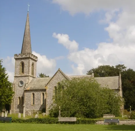
Stanmer Church
Historic churches · 1.4 km

East Slope Amphitheatre
Theatres · 1.4 km

Stanmer
Towns & cities · 1.4 km

Stanmer House
Historic houses · 1.5 km
Stanmer Craft Museum
Museums · 1.5 km

Giant Turtle #2
National landscapes (AONB) · 1.5 km

Giant Turtle #1
National landscapes (AONB) · 1.6 km

Professor Sir Harold Kroto
Memorials & monuments · 1.6 km

University of Sussex Library
Historic libraries · 1.6 km
Falmer is a town in East Sussex, within the South East England region. Visitors can explore the Ridgeview Wine Estate vineyard and enjoy the views from Ditchling Beacon. The area also features the Half Moon Inn and the Five Bells Inn for refreshments.
At a glance
- Population
- 153
- Administrative county
- East Sussex
- Constituency
- Lewes
- Top categories near here
Things to see in Falmer
25 attractions within 12 km — showing the 24 most editorially-significant. Full guide: things to do in Falmer →
 📷 5
📷 5 📷 5
📷 5Mountains & hills · South East England
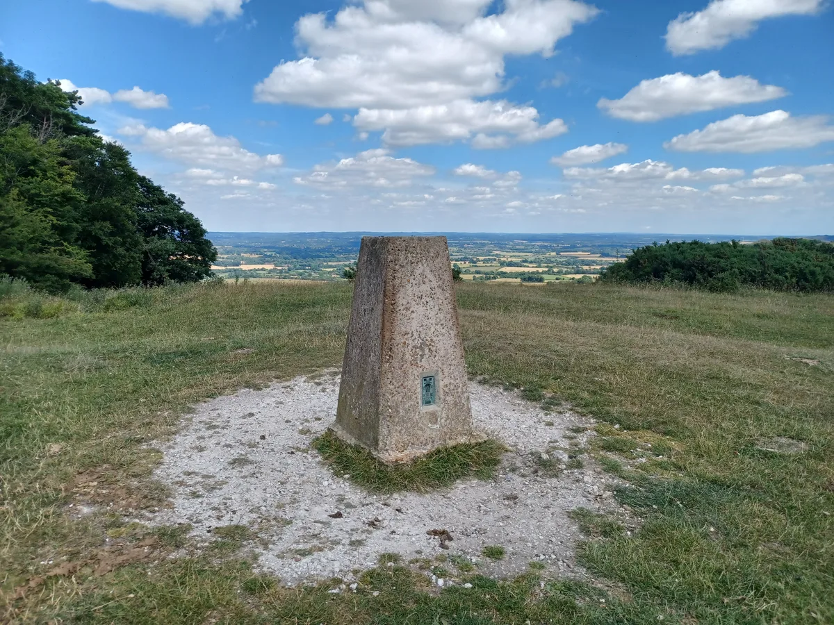
Ditchling Beacon
Ditchling Beacon — Named summit at 249 m.
 Flagship📷 10
Vineyards · South East England
Ridgeview Wine Estate
Sussex's family sparkling-wine estate; royal supplier since 2008.
 📷 5
📷 5Battlefields & battle sites · South East England
Kingley Vale
Kingley Vale in England South East, United Kingdom.
 📷 5
📷 5Manor houses · South East England
Plumpton Place
Plumpton Place — a manor in england-south-east, United Kingdom.
 📷 5
📷 5Manor houses · South East England
Chiltington Ferrings
Chiltington Ferrings — a manor in england-south-east, United Kingdom.
 📷 5
📷 5Manor houses · South East England
Balneath Manor
Balneath Manor — Grade II listed building-listed manor in england-south-east, United Kingdom.
 📷 5
📷 5Historic bridges · South East England
Coppard's Bridge
Coppard's Bridge — Grade II listed building-listed bridge in england-south-east, United Kingdom.
 📷 5
📷 5Memorials & monuments · South East England
Plumpton Green War Memorial
Plumpton Green War Memorial — Grade II listed building-listed memorial in england-south-east, United Kingdom.
📷 5Memorials & monuments · South East England
Memorial Lychgate, All Saints Church
Memorial Lychgate, All Saints Church — Grade II listed building-listed memorial in england-south-east, United Kingdom.
 📷 5
📷 5Public art & sculpture · South East England
Plumpton Village Sign
Plumpton Village Sign — a public art in england-south-east, United Kingdom.
 📷 5
📷 5Museums · South East England
Chailey
Chailey is a village and civil parish in the Lewes District of East Sussex, England. It is located 7 miles north of Lewes, on the A272 road from Winchester to Canterbury. The Prime Meridian passes jus
 📷 5
📷 5Campsites · South East England
Blackberry Wood (Meadow Campsite)
Blackberry Wood (Meadow Campsite) — a campsite in england south east.
 📷 5
📷 5Campsites · South East England
Blackberry Woods
Blackberry Woods — a campsite in england south east.
 📷 5
📷 5Campsites · South East England
Housedean Farm Campsite
Housedean Farm Campsite — a campsite in england south east.
 📷 5
📷 5Vineyards · South East England
Hillfort, a beacon and dewpond on Ditchling Beacon
Hillfort, a beacon and dewpond on Ditchling Beacon — a UK vineyard in england south east, producing English or Welsh wine from cool-climate grape varieties.
 📷 5
📷 5 📷 5
📷 5 📷 5
📷 5 📷 5
📷 5 📷 5
📷 5Archaeological sites · South East England
Field System
Field System — archaeological in england south east.
 📷 5
📷 5Mountains & hills · South East England
Balmer Huff
Balmer Huff — mountain in england south east. Elevation: 170 m.
📷 5Mountains & hills · South East England
Bow Hill
Bow Hill — mountain in england south east. Elevation: 153 m.
 📷 5
📷 5Historic pubs · South East England
The Five Bells Inn
The Five Bells Inn in England South East, United Kingdom.
Nearby
📷 5Mountains & hills · South East England
Bow Hill
Bow Hill — mountain in england south east. Elevation: 153 m.
📷 5Viewpoints · South East England
Observatory ruin
Observatory ruin is a viewpoint in the United Kingdom.
📷 5Vineyards · South East England
Medieval settlement at Stanmer
Medieval settlement at Stanmer — a UK vineyard in england south east, producing English or Welsh wine from cool-climate grape varieties.
📷 5Historic churches · South East England
Stanmer Church
Stanmer Church — grade II listed church in England.
📷 5Theatres · South East England
East Slope Amphitheatre
East Slope Amphitheatre is a theatre in the United Kingdom.
📷 5Towns & cities · South East England
Stanmer
Stanmer — village on the eastern outskirts of Brighton, in East Sussex, England.
Where to eat & stay near Falmer
Places to stay
📷 5Campsites · South East England
Housedean Farm Campsite
Housedean Farm Campsite — a campsite in england south east.
📷 5Campsites · South East England
Housedean Farm Campsite
Housedean Farm Campsite — a campsite in england south east.
📷 5Campsites · South East England
Blackberry Wood (Meadow Campsite)
Blackberry Wood (Meadow Campsite) — a campsite in england south east.
📷 5Campsites · South East England
Blackberry Woods
Blackberry Woods — a campsite in england south east.
 📷 5
📷 5Campsites · South East England
Chalky Downs Campsite
Chalky Downs Campsite — a campsite in england south east.
 📷 5
📷 5Places to eat & drink
 📷 5
📷 5Historic pubs · South East England
The Half Moon Inn
The Half Moon Inn in England South East, United Kingdom.
_(June_2019)_(2).JPG?width=1200) 📷 5
📷 5Historic pubs · South East England
The Black Horse Inn
The Black Horse Inn — Historic pub — listed building or notable heritage status.
 📷 5
📷 5Cafés · South East England
Cowley Club Café
Cowley Club Café — a café in england south east.
 📷 5
📷 5Historic pubs · South East England
Kissing Coppers
Kissing Coppers — Public artwork (graffiti) by Banksy.
 📷 5
📷 5Historic pubs · South East England
The Rainbow Inn
The Rainbow Inn in England South East, United Kingdom.
 📷 5
📷 5Historic pubs · South East England
King and Queen, Brighton
King and Queen, Brighton in England South East, United Kingdom.
More towns in this region
 Flagship📷 10
Towns & cities · South East England
Betchworth
Betchworth — village and civil parish in the Mole Valley district of Surrey, England.
 Flagship📷 10
Towns & cities · South East England
Boxley
Boxley — village and civil parish in Maidstone District, Kent, England, UK.
 Flagship📷 10
Towns & cities · South East England
Effingham
Effingham — village and civil parish in Guildford borough, Surrey, England, UK.
 Flagship📷 10
Towns & cities · South East England
Englefield Green
Englefield Green — village in the borough of Runnymede, Surrey, UK.
Frequently asked questions
- Where is Falmer?
- Falmer is in East Sussex, South-East England, United Kingdom (postcode BN1), in the parish of Falmer.
- What is Falmer?
- Falmer — village in Lewes District, East Sussex, England, UK.
- How do I get to Falmer?
- The nearest railway station is Falmer, about 2.0 km away. Drivers can use postcode BN1.
- Is Falmer a protected site?
- Yes — Falmer is part of the Clayton to Offham Escarpment SSSI Site of Special Scientific Interest and the High Weald National Landscape (AONB).
- Is Falmer free to visit?
- Yes, Falmer is free to enter.
- How do I get to Falmer?
- The nearest railway station is Falmer, about 2.0 km away. Drivers can navigate to postcode BN1.