
Wildlife reserves · East of England
Dingle Marshes
In or near Dunwich.
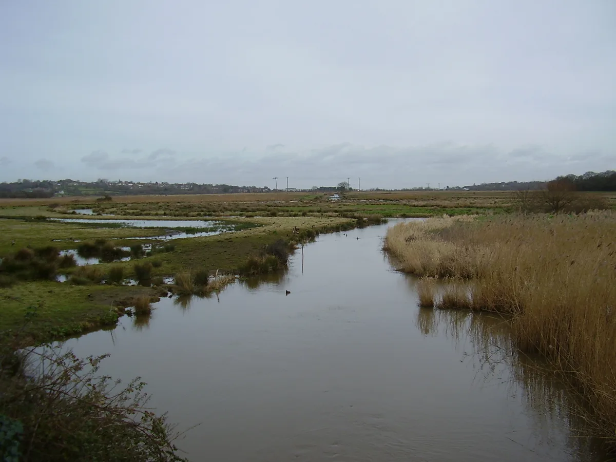
Dingle Marshes — Suffolk Wildlife Trust and RSPB nature reserve.

Wikimedia Commons contributors — see linked file page for photographer and licence licence

Plan your visit
- Typical visit
- 2 h–4 h
- Best time of year
- Autumn & winter (migration & wildfowl)
- Nearest railway station
- Blythburgh · 4.7 km
- Free entry
- Dog-friendly
Getting there & planning your visit
Dingle Marshes is located in East Suffolk, postcode IP17 3DZ, and is accessible via the nearest railway station, Blythburgh, which is 4.7 km away. Entry to the reserve is free.
About
Dingle Marshes is a wildlife reserve in the United Kingdom. It covers approximately 93 km². Managed by Royal Society for the Protection of Birds. Wikidata describes it as: "Suffolk Wildlife Trust and RSPB nature reserve". Coordinates: 52.2854°, 1.6293°.
Photo gallery
Protected designations
- Site of Special Scientific Interest: Minsmere-Walberswick Heaths and Marshes SSSI
- National Nature Reserve: SUFFOLK COAST
- Area of Outstanding Natural Beauty: Suffolk Coast & Heaths
- Ramsar wetland: Minsmere-Walberswick
Designations sourced from Natural England open data under OGL v3.
From the Wikipedia article
Dingle Marshes is a 93-hectare (230-acre) wildlife reserve on the North Sea coast of the English county of Suffolk. The reserve is located between Dunwich and Walberswick, approximately 4 miles (6.4 km) south-west of Southwold. The marshes make up part of the Suffolk Coast National Nature Reserve along with reserves at Walberswick and Hen Reedbeds. They are owned jointly by the RSPB and Suffolk Wildlife Trust and are managed by these two organisations and Natural England. The site is in the Dunwich Heaths and Marshes Nature Conservation Review site, Grade I, the Minsmere-Walberswick Ramsar internationally important wetland site, the Minsmere to Walberswick Heaths and Marshes Special Area of Conservation, and the Minsmere-Walberswick Special Protection Area under the European Union Directive on the Conservation of Wild Birds. It is also within the Minsmere-Walberswick Heaths and Marshes Site of Special Scientific Interest and is a Natura 2000 site. It is an internationally important site for the starlet sea anemone as well as a key site for bitterns and marsh harriers within the UK. It was purchased in 1999 at a cost of £1 million, aided by a grant from the Heritage Lottery Fund of £559,000.
Excerpt from Wikipedia under CC BY-SA 4.0. See the source article linked in Sources below.
- Coordinates
- 52.2854, 1.6293
- County
- Suffolk
- District
- East Suffolk
- Parish
- Dunwich
- Postcode
- IP17 3DZ
- Parliamentary constituency
- Suffolk Coastal
- Nearest railway station
- Blythburgh — 4.7 km
Sources
- wikidata: Q5278219 (CC0)
- wikipedia: Dingle Marshes (CC BY-SA 4.0)
- commons: Marsh-Bog at Inch - geograph.org.uk - 15801.jpg (CC BY-SA 4.0)
Featured in this guide
Other places nearby
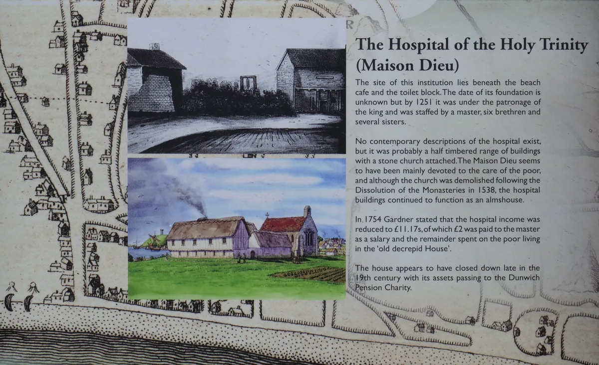
Hospital of the Holy Trinity (site of)
Archaeological sites · 0.8 km

Dunwich Village Sign
Public art & sculpture · 0.8 km

Dunwich War Memorial
Memorials & monuments · 0.8 km

Dunwich War Memorial Cross
Memorials & monuments · 0.9 km
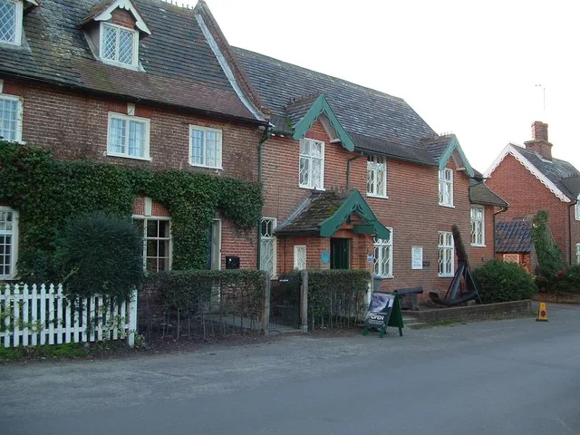
Dunwich Museum
Museums · 0.9 km

Chapel of St James' Hospital
Chapels · 0.9 km

Dunwich
Towns & cities · 0.9 km
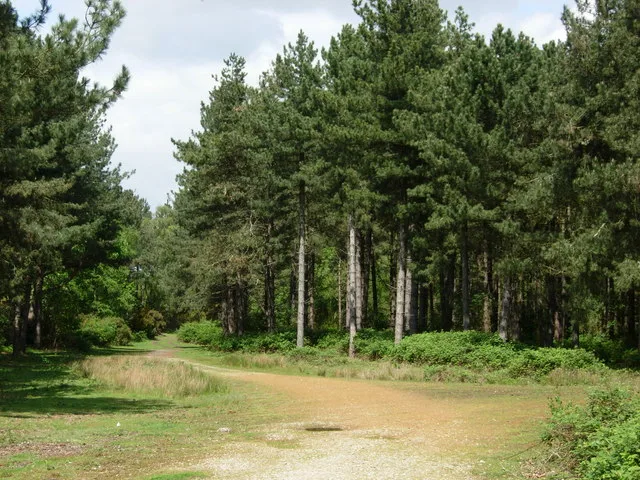
Dunwich Forest
Wildlife reserves · 1.0 km
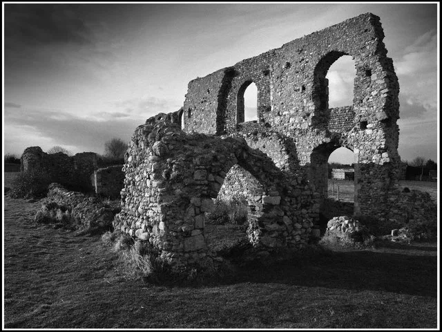
Greyfriars, Dunwich
Abbeys & priories · 1.1 km

Dunwich Greyfriars
Historic houses · 1.1 km

Grave of Jacob Forster
Follies · 1.1 km

Potton Hall Campsite
Campsites · 2.3 km
Nearby
📷 3Archaeological sites · East of England
Hospital of the Holy Trinity (site of)
Hospital of the Holy Trinity (site of) — archaeological site in Dunwich, East Suffolk, England, UK.
📷 3Public art & sculpture · East of England
Dunwich Village Sign
Dunwich Village Sign — a public art in East of England, United Kingdom.
📷 3Memorials & monuments · East of England
Dunwich War Memorial
Dunwich War Memorial is a memorial in the United Kingdom.
📷 3Memorials & monuments · East of England
Dunwich War Memorial Cross
Dunwich War Memorial Cross — Grade II listed building-listed memorial in england-east, United Kingdom.
📷 3Museums · East of England
Dunwich Museum
Dunwich Museum — museum in Dunwich, Suffolk, England, UK.
📷 3Chapels · East of England
Chapel of St James' Hospital
Chapel of St James' Hospital — remains of leper hospital at Dunwich, Suffolk, England, UK.
Where to eat & stay near Dingle Marshes
Places to stay
📷 5 📷 5
📷 5Caravan parks · East of England
Cliff House Estate Caravan Park
Cliff House Estate Caravan Park — a caravan park in england east.
 📷 5
📷 5Caravan parks · East of England
Walberswick Caravan Site
Walberswick Caravan Site — a caravan park in england east.
 📷 5
📷 5Campsites · East of England
Southwold Camping and Caravan Site
Southwold Camping and Caravan Site — a campsite in england east.
 📷 5
📷 5Caravan parks · East of England
Haw Wood Caravan Park
Haw Wood Caravan Park — a caravan park in england east.
 📷 5
📷 5Places to eat & drink
 📷 5
📷 5 📷 5
📷 5Historic pubs · East of England
Cherry Tree Public House
Cherry Tree Public House in England East, United Kingdom.
 📷 7
📷 7Historic pubs · East of England
The Parrot And Punchbowl Public House
The Parrot And Punchbowl Public House in England East, United Kingdom.
 📷 6
📷 6Historic pubs · East of England
The Swan, Peasenhall
The Swan, Peasenhall in England East, United Kingdom.
 📷 5
📷 5Historic pubs · East of England
Huntingfield Arms
Huntingfield Arms in England East, United Kingdom.
 📷 7
📷 7Historic pubs · East of England
George and Dragon, Farnham
George and Dragon, Farnham in England East, United Kingdom.
More places run by Royal Society for the Protection of Birds
 📷 5
📷 5Hill forts · South East England
Shornemead Fort
Shornemead Fort — fort in Shorne, Kent, England, UK.
 📷 5
📷 5Wildlife reserves · South East England
Amberley Wild Brooks
Amberley Wild Brooks — nature reserve in the United Kingdom.
 📷 5
📷 5Wildlife reserves · South East England
Blean Woods RSPB Reserve
Blean Woods RSPB Reserve — RSPB nature reserve in the United Kingdom.
 📷 5
📷 5Wildlife reserves · South East England
Brading Marshes RSPB reserve
Brading Marshes RSPB reserve — RSPB nature reserve on the Isle of Wight.
More places in this region
 Flagship📷 10
Wildlife reserves · East of England
Amwell Quarry
Amwell Quarry — nature reserve in United Kingdom.
 Flagship📷 10
Wildlife reserves · East of England
Aubrey Buxton Nature Reserve
Aubrey Buxton Nature Reserve — Essex Wildlife Trust Nature reserve.
 Flagship📷 10
Wildlife reserves · East of England
Canvey Wick
Canvey Wick — nature reserve in Essex, United Kingdom.
 Flagship📷 10
Wildlife reserves · East of England
Crowsheath Wood
Crowsheath Wood — Essex Wildlife Trust Nature reserve.
Frequently asked questions
- Where is Dingle Marshes?
- Dingle Marshes is in Suffolk, East of England, United Kingdom (postcode IP17 3DZ), in the parish of Dunwich.
- What is Dingle Marshes?
- Dingle Marshes — Suffolk Wildlife Trust and RSPB nature reserve.
- How do I get to Dingle Marshes?
- The nearest railway station is Blythburgh, about 4.7 km away. The nearest town is Dunwich. Drivers can use postcode IP17 3DZ.
- Who owns Dingle Marshes?
- Dingle Marshes is owned by Suffolk Wildlife Trust and operated by Royal Society for the Protection of Birds.
- Is Dingle Marshes a protected site?
- Yes — Dingle Marshes is part of the Minsmere-Walberswick Heaths and Marshes SSSI Site of Special Scientific Interest and the SUFFOLK COAST National Nature Reserve.
- Is Dingle Marshes free to visit?
- Yes, Dingle Marshes is free to enter.
- How do I get to Dingle Marshes?
- The nearest railway station is Blythburgh, about 4.7 km away. Drivers can navigate to postcode IP17 3DZ.
- Are dogs allowed at Dingle Marshes?
- Most wildlife reserves allow dogs on lead only, with restrictions during ground-nesting bird season (March-July). Check signage at the reserve.