
Other places · Central Scotland
Dalgety Bay
Also known as: Bágh Dhealgadaidh
In or near North Queensferry.
Dalgety Bay in Scotland Islands, United Kingdom.

Simon Johnston — CC BY-SA 2.0 via Wikimedia Commons licence

Plan your visit
- Typical visit
- 1 h–2 h
- Nearest railway station
- Dalgety Bay · 0.1 km
- Wheelchair accessible
Getting there & planning your visit
Dalgety Bay is located in Fife, with the nearest railway station being Dalgety Bay, just 0.1 km away. Entry is free, and the site is wheelchair accessible. The postcode for sat-nav is KY11 9NJ.
About
Dalgety Bay is a place of interest in Scotland Islands, United Kingdom — drawn from open-data sources for visitor reference. See the linked Wikipedia article for the full description.
Photo gallery
From the Wikipedia article
Dalgety Bay ( ) is a coastal town and parish in Fife, Scotland, on the north shore of the Firth of Forth, nine miles (14 kilometres) from Edinburgh city centre. The civil parish is the eighth-largest in Fife, with a population of 9,710 in 2020. Dalgety bay was named after the original village of Dalgety, evident by the ruins of the 12th century St Bridget's Kirk. The root of the place-name Dalgety is the Scottish Gaelic word dealg, 'thorn', and the full name originally meant 'the place of the thorn[-bushes]'. The new town, of which building started in 1965, takes its name from the main bay it adjoins, but the town stretches over many bays and coves including Inverkeithing Bay, Donibristle Bay and St David's Bay. Dalgety Bay is a commuter town and around 30% of the towns' workers work in Edinburgh. While the architecture of the town reflects construction by volume housebuilders, the town is a regular winner of the Best Kept Small Town title. Dalgety Bay has 26 Historic Scotland Listed Buildings or structures, and features on the Fife Coastal Path, one of Scotland's Great Trails.
Excerpt from Wikipedia under CC BY-SA 4.0. See the source article linked in Sources below.
Background
History
Dalgety Bay began as the village of Dalgety, which was built on the site of the 12th century St Bridget's Kirk.The land surrounding the town was part of the estate owned by the Earls of Moray who built Donibristle House as their residence. In 1592 James Stewart, 2nd Earl of Moray was murdered on the seashore near Donibristle by his rival George Gordon, Earl of Huntly, which is remembered in the popular ballad The Bonnie Earl O' Moray. Towards the end of the 18th century, the village was destroyed by order of the Earls of Moray. and the inhabitants dispersed. During the First World War Morton Gray Stuart, 17th Earl of Moray donated a portion of his land to the Crown, which built an airfield…
Sourced from Wikipedia under CC BY-SA 4.0.
- Coordinates
- 56.0429, -3.3676
- District
- Fife
- Postcode
- KY11 9NJ
- Parliamentary constituency
- Cowdenbeath and Kirkcaldy
- Nearest railway station
- Dalgety Bay — 0.1 km
Sources
- wikidata: Q1984807 (CC0)
- wikipedia: Dalgety Bay (CC BY-SA 4.0)
Other places nearby
Dalgety Bay railway station
Heritage railway stations · 0.1 km
Donibristle Airfield Memorial
Memorials & monuments · 0.1 km

Bella the Dog Memorial
Memorials & monuments · 0.2 km

Hillend
Other places · 0.4 km

Letham Hill
Mountains & hills · 0.6 km

Scots Mill
Historic houses · 1.0 km

standing stone 110m SW of Aberdour Lodge
Windmills · 1.1 km

The Artful Bear
Public art & sculpture · 1.1 km

Royal Naval Air Station Donibristle
Other places · 1.2 km
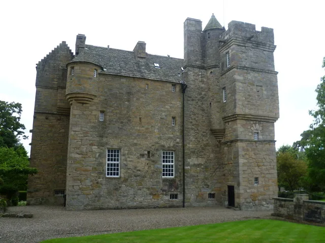
Fordell Castle
Castles · 1.2 km

Spencerfield House
Historic houses · 1.2 km

Inverkeithing
Battlefields & battle sites · 1.4 km
Nearby
📷 5Heritage railway stations · Central Scotland
Dalgety Bay railway station
Dalgety Bay railway station in Scotland Islands, United Kingdom.
📷 3Memorials & monuments · Central Scotland
Donibristle Airfield Memorial
Donibristle Airfield Memorial — a memorial in Central Scotland, United Kingdom.
📷 3Memorials & monuments · Central Scotland
Bella the Dog Memorial
Bella the Dog Memorial — a memorial in Central Scotland, United Kingdom.
📷 5📷 5Mountains & hills · Central Scotland
Letham Hill
Letham Hill — a hill or mountain in scotland central.
📷 3Historic houses · Central Scotland
Scots Mill
Scots Mill — a historic house in Central Scotland, United Kingdom.
Where to eat & stay near Dalgety Bay
Places to stay
 📷 5
📷 5 📷 5
📷 5Campsites · Central Scotland
Green Oak Nature Retreat
Green Oak Nature Retreat — a campsite in scotland central.
 📷 5
📷 5Hotels · Central Scotland
DoubleTree by Hilton Edinburgh - Queensferry Crossing
DoubleTree by Hilton Edinburgh - Queensferry Crossing — a hotel in scotland central. 3-star. Brand: DoubleTree.
 📷 5
📷 5 📷 5
📷 5Hotels · Central Scotland
Garvock House Hotel
Garvock House Hotel — a hotel in scotland central.
 📷 5
📷 5Places to eat & drink
 📷 6
📷 6Historic pubs · Central Scotland
The Burgh Arms
The Burgh Arms in Scotland Islands, United Kingdom.
 📷 5
📷 5Historic pubs · Central Scotland
The Star Tavern, 71-73 High Street, Burntisland
The Star Tavern, 71-73 High Street, Burntisland in Scotland Central, United Kingdom.
 📷 7
📷 7Historic pubs · Central Scotland
Granton Tavern, 160 Lower Granton Road, Edinburgh
Granton Tavern, 160 Lower Granton Road, Edinburgh in Scotland Central, United Kingdom.
 📷 6
📷 6Historic pubs · Central Scotland
Starbank Arms, 62-64 Laverockbank Road, Edinburgh
Starbank Arms, 62-64 Laverockbank Road, Edinburgh in Scotland Central, United Kingdom.
 📷 5
📷 5Restaurants · Central Scotland
Champany Inn
Champany Inn — a restaurant in scotland central.
 📷 7
📷 7Historic pubs · Central Scotland
Hamilton's Bar & Kitchen
Hamilton's Bar & Kitchen in Scotland Central, United Kingdom.
More places in this region
 📷 3
📷 3 📷 3
📷 3 📷 5
📷 5 📷 5
📷 5Frequently asked questions
- Where is Dalgety Bay?
- Dalgety Bay is in central Scotland, United Kingdom (postcode KY11 9NJ).
- What is Dalgety Bay?
- Dalgety Bay in Scotland Islands, United Kingdom.
- How do I get to Dalgety Bay?
- The nearest railway station is Dalgety Bay, about 0.1 km away. The nearest town is North Queensferry. Drivers can use postcode KY11 9NJ.
- How do I get to Dalgety Bay?
- The nearest railway station is Dalgety Bay, about 0.1 km away. Drivers can navigate to postcode KY11 9NJ.