
Other places · Central Scotland
Berwickshire
Also known as: Siorrachd Bhearaig
In or near Greenlaw.
Berwickshire in England North East, United Kingdom.

Wikimedia Commons licence
Plan your visit
- Typical visit
- 1 h–2 h
About
Berwickshire is a place of interest in England North East, United Kingdom — drawn from open-data sources for visitor reference. See the linked Wikipedia article for the full description.
Photo gallery
From the Wikipedia article
Berwickshire (; Scottish Gaelic: Siorrachd Bhearaig) is a historic county, registration county and lieutenancy area in south-eastern Scotland, on the English border. The county takes its name from Berwick-upon-Tweed, its original county town, which was part of Scotland at the time of the county's formation in the twelfth century, but became part of England in 1482 after several centuries of swapping back and forth between the two kingdoms. After the loss of Berwick, Duns and Greenlaw both served as county town at different periods. Berwickshire County Council existed from 1890 until 1975, when the area became part of the Borders region, with most of the historic county becoming part of the lower-tier Berwickshire district. Berwickshire district was abolished in 1996, when all the districts in the Borders region merged to become the Scottish Borders council area. The low-lying part of Berwickshire between the Tweed and the Lammermuirs is known as "the Merse", from an old Scots word for a floodplain, and this name is sometimes extended to the county as a whole. Inhabitants are called "Merse-men". Berwickshire borders Midlothian to the west, East Lothian to the north, the North Sea to the east, and Roxburghshire and the English county of Northumberland to the south.
Excerpt from Wikipedia under CC BY-SA 4.0. See the source article linked in Sources below.
Background
History
Between the late tenth and early eleventh centuries, the land between the rivers Forth and Tweed came under Scottish control. The town of Berwick-upon-Tweed was made a royal burgh by David I (reigned 1124–1153), and it would appear that the shire of Berwick, or Berwickshire, was also created during David's reign. The shire covered the town of Berwick plus a largely rural area to the north-west of it, and corresponded to the medieval province of Merse. After the town of Berwick had finally been ceded to English control in 1482, the functions of the county town (principally holding the sheriff court) were initially shared between Duns and Lauder, until 1596 when Greenlaw was declared the…
Sourced from Wikipedia under CC BY-SA 4.0.
- Coordinates
- 55.7500, -2.5000
- District
- Scottish Borders
- Postcode
- TD10 6UR
- Parliamentary constituency
- Berwickshire, Roxburgh and Selkirk
Sources
- wikidata: Q786649 (CC0)
- wikipedia: Berwickshire (CC BY-SA 4.0)
Other places nearby

Bedshiel
Reservoirs & lochs · 0.4 km

Dirrington Little Law
Mountains & hills · 2.2 km

Blackcastle Rings
Forts · 3.1 km

Blackcastle Rings
Vineyards · 3.1 km

Evelaw Tower
Historic houses · 3.1 km

Evelaw Tower (remains of)
Castles · 3.1 km

Greenlaw Moor
Other places · 3.6 km

Kyles Hill
Mountains & hills · 3.7 km
Kyles Hill
Mountains & hills · 3.7 km

Wedderlie
Villages · 4.2 km
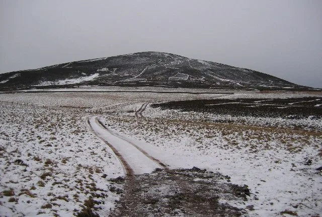
Dirrington Great Law
Natural landmarks · 4.2 km

Hare Law
Mountains & hills · 4.6 km
Nearby
📷 5📷 5Mountains & hills · Central Scotland
Dirrington Little Law
Dirrington Little Law — a hill or mountain in scotland central.
📷 3📷 5Vineyards · Scottish Lowlands
Blackcastle Rings
Blackcastle Rings — a UK vineyard in scotland central, producing English or Welsh wine from cool-climate grape varieties.
📷 4Castles · Central Scotland
Evelaw Tower (remains of)
Evelaw Tower (remains of) — a castle in scotland-central, United Kingdom.
Where to eat & stay near Berwickshire
Places to stay
 📷 5
📷 5Caravan parks · Scottish Lowlands
Blackadder Caravan Park
Blackadder Caravan Park — a caravan park in scotland central.
 📷 5
📷 5 📷 5
📷 5Caravan parks · Scottish Lowlands
Thirlestane Castle Caravan Park
Thirlestane Castle Caravan Park — a caravan park in scotland central.
 📷 7
📷 7 📷 5
📷 5 📷 7
📷 7Places to eat & drink
 📷 7
📷 7Historic pubs · Central Scotland
The Royal Bar, 15 Market Square, Duns
The Royal Bar, 15 Market Square, Duns in Scotland Central, United Kingdom.
 📷 4
📷 4Historic pubs · Scottish Lowlands
Newcastle Arms
Newcastle Arms — Historic pub — listed building or notable heritage status.
 📷 5
📷 5Historic pubs · Scottish Lowlands
The Masons Arms
The Masons Arms in Scotland Lowlands, United Kingdom.
 📷 7
📷 7Historic pubs · Scottish Lowlands
The Victoria Hotel
The Victoria Hotel in Scotland Lowlands, United Kingdom.
More places in this region
 📷 3
📷 3 📷 3
📷 3 📷 5
📷 5 📷 5
📷 5Frequently asked questions
- Where is Berwickshire?
- Berwickshire is in North-East England, United Kingdom (postcode TD10 6UR).
- What is Berwickshire?
- Berwickshire in England North East, United Kingdom.
- How do I get to Berwickshire?
- Drivers can use postcode TD10 6UR.
- How do I get to Berwickshire?
- Drivers can navigate to postcode TD10 6UR. It sits within the Berwickshire, Roxburgh and Selkirk parliamentary constituency.