Mountains & hills · North West England
Dalegarth How
Dalegarth How — a hill or mountain in england north west.

Mick Garratt — CC BY-SA 2.0 via Wikimedia Commons licence
Plan your visit
- Typical visit
- 3 h–8 h
- Best time of year
- Late spring – early autumn (May–Oct)
About
A British hill or mountain, named on Ordnance Survey maps and walked by hill-baggers. Dalegarth How is a named hill or mountain in england north west, recorded in the GeoNames UK gazetteer. British landmarks of this type are typically marked on Ordnance Survey maps and recorded in the national gazetteer for cartographic and navigational reference. Coordinates and feature classification are sourced from the GeoNames open dataset.
Photo gallery
Place summary
Dalegarth How is a mountain located in North-West England. It features prominent elevation and offers panoramic views of the surrounding landscape. The area is popular for walking and outdoor activities, attracting both casual hikers and experienced climbers. Its natural beauty and rugged terrain make it a notable feature in the region.
AI-generated from the structured facts on this page (operator, designation, listing, era). Not a substitute for visiting.
- Coordinates
- 54.3922, -3.2622
Sources
- manual: geonames-12613521 (CC BY 4.0)
Other places nearby
Loading nearby places…
Nearby
📷 5Mountains & hills · North West England
Dalegarth How
Dalegarth How — mountain in england north west. Elevation: 121 m.
 📷 3
📷 3Archaeological sites · North West England
St Catherine's Well
St Catherine's Well — a archaeological in england-north-west, United Kingdom.
 📷 5
📷 5Waterfalls · North West England
Gill Force
Gill Force — waterfall in england north west.
 📷 5
📷 5Historic churches · North West England
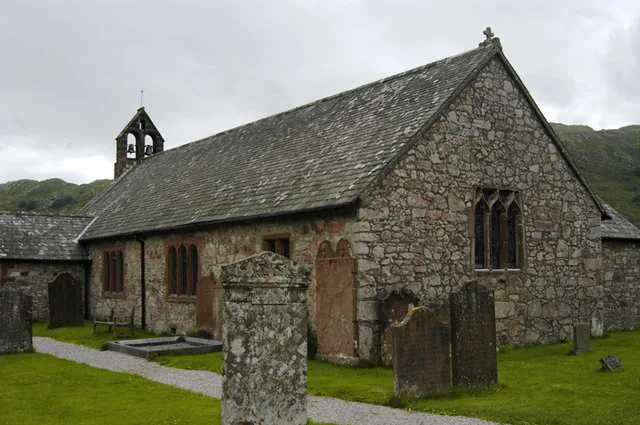
St Catherine's Church, Boot
St Catherine's Church, Boot — grade II listed church in Eskdale, Cumberland, Cumbria , England, UK.
 📷 5
📷 5Mountains & hills · North West England
Hodge How
Hodge How — mountain in england north west. Elevation: 101 m.
 📷 5
📷 5Mountains & hills · North West England
Gate Crag
Gate Crag — mountain in england north west. Elevation: 283 m.
Where to eat & stay near Dalegarth How
Places to stay
 📷 5
📷 5Campsites · North West England
Eskdale Campsite
Eskdale Campsite — a campsite in england north west.
 📷 5
📷 5Hostels · North West England
YHA Eskdale
YHA Eskdale — a hostel in england north west.
 📷 5
📷 5Campsites · North West England
Fisherground Campsite
Fisherground Campsite — a campsite in england north west.
 📷 5
📷 5Hostels · North West England
YHA Wasdale Hall
YHA Wasdale Hall — a hostel in england north west.
 📷 5
📷 5Campsites · North West England
The Barn Campsite
The Barn Campsite — a campsite in england north west.
 📷 5
📷 5Campsites · North West England
Turner Hall Farm Campsite
Turner Hall Farm Campsite — a campsite in england north west.
Places to eat & drink
 📷 5
📷 5Restaurants · North West England
The Terrace Coffee House and Restaurant
The Terrace Coffee House and Restaurant — a restaurant in england north west. Cuisine: sandwich;lunch.
 📷 5
📷 5Cafés · North East England
Grange Bridge Cottage
Grange Bridge Cottage — a café in england north east.
 📷 5
📷 5Restaurants · North West England
Holbeck Ghyll Restaurant
Holbeck Ghyll Restaurant — a restaurant in england north west.
 📷 4
📷 4Restaurants · North West England
Holbeck Ghyll
Holbeck Ghyll is a restaurant located in Windermere, Cumbria, England. "The late 19th century building was once Lord Lonsdale's hunting lodge and only became a hotel in the 1970s. It won a Michelin st
 📷 5
📷 5Cafés · North West England
Joey's Cafe
Joey's Cafe — a café in england north west.
 📷 5
📷 5Cafés · Scottish Lowlands
YHA Cafe
YHA Cafe — a café in scotland lowlands.
More mountains in this region
 📷 3
📷 3Mountains & hills · North West England
Allen Crags
Allen Crags — Named summit at 785 m.
 📷 3
📷 3Mountains & hills · North West England
Alum Pot
Alum Pot — Open shaft pothole in North Yorkshire.
 📷 3
📷 3Mountains & hills · North West England
Arnside Knott
Arnside Knott — Named summit at 159 m.
 📷 3
📷 3Mountains & hills · North West England
Aye Gill Pike
Aye Gill Pike — Named summit at 556.3 m.
Frequently asked questions
- Where is Dalegarth How?
- Dalegarth How is in North-West England, United Kingdom.
- What is Dalegarth How?
- Dalegarth How — a hill or mountain in england north west.
- How do I get to Dalegarth How?
- Its coordinates are 54.3922°, -3.2622°.