Museums · South East England
Cuckfield
In or near Ardingly.
Cuckfield ( KUUK-feeld) is a village and civil parish in the Mid Sussex District of West Sussex, England, on the southern slopes of the Weald. It lies 34 miles (55 km) south of London, 13 miles (21 km

Simon Carey — CC BY-SA 2.0 via Wikimedia Commons licence
Plan your visit
- Typical visit
- 1.5 h–3 h
- Best time of year
- Year-round
- Nearest railway station
- Beech Hurst Miniature Railway Station · 2.2 km
- Family-friendly
- Limited wheelchair access
Getting there & planning your visit
To visit Cuckfield museum, the nearest railway station is Beech Hurst Miniature Railway Station, located 2.2 km away. The postcode for your sat-nav is RH17 5EP. Please note that wheelchair accessibility is limited.
About
Cuckfield ( KUUK-feeld) is a village and civil parish in the Mid Sussex District of West Sussex, England, on the southern slopes of the Weald. It lies 34 miles (55 km) south of London, 13 miles (21 km) north of Brighton, and 31 miles (50 km) east northeast of the county town of Chichester. Nearby towns include Haywards Heath to the southeast and Burgess Hill to the south. It is surrounded on the other sides by the parish of Ansty and Staplefield formerly known as Cuckfield Rural. Aumale in Normandy has been a twin town since 1993 and Karlstadt in Bavaria since 1998.
Photo gallery
Protected designations
- Area of Outstanding Natural Beauty: High Weald
Designations sourced from Natural England open data under OGL v3.
From the Wikipedia article
Cuckfield ( KUUK-feeld) is a village and civil parish in the Mid Sussex District of West Sussex, England, on the southern slopes of the Weald. It lies 34 miles (55 km) south of London, 13 miles (21 km) north of Brighton, and 31 miles (50 km) east northeast of the county town of Chichester. Nearby towns include Haywards Heath to the southeast and Burgess Hill to the south. It is surrounded on the other sides by the parish of Ansty and Staplefield formerly known as Cuckfield Rural. Aumale in Normandy has been a twin town since 1993 and Karlstadt in Bavaria since 1998.
Excerpt from Wikipedia under CC BY-SA 4.0. See the source article linked in Sources below.
Background
History
The origin of the name, Cuckfield (earlier spelled Kukefeld, Cucufeld, and Cucufelda), is debated but it is generally associated with the cuckoo which is the village emblem. The village grew as a market town; and an important coaching stop between London and Brighton, since it lay on the turnpike. In 1820, 50 coaches a day were passing through; but when the railway to Brighton was to be constructed in the 1840s, local landowners objected to its projected route: it was therefore built through neighbouring Haywards Heath instead. The village lost its importance as a result. Today the A272 road also bypasses the village centre. It became an urban district in 1894 under the Local Government Act…
Sourced from Wikipedia under CC BY-SA 4.0.
- Coordinates
- 51.0096, -0.1407
- County
- West Sussex
- District
- Mid Sussex
- Parish
- Cuckfield
- Postcode
- RH17 5EP
- Parliamentary constituency
- Mid Sussex
- Nearest railway station
- Beech Hurst Miniature Railway Station — 2.2 km
- Official site
- www.cuckfield.org
Sources
- wikipedia: Cuckfield (CC BY-SA 4.0)
Other places nearby

Cuckfield Museum
Museums · 0.3 km
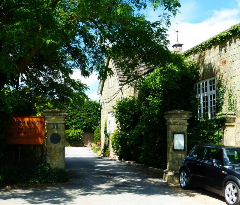
Ockenden Manor
Stately homes · 0.5 km

Monument To Charles Howard Approximately 10 Metres West Of Lychgate To Church Street
Memorials & monuments · 0.5 km

Monument To Henry Bowles, 1 Metre East Of East Window Of Church
Memorials & monuments · 0.5 km
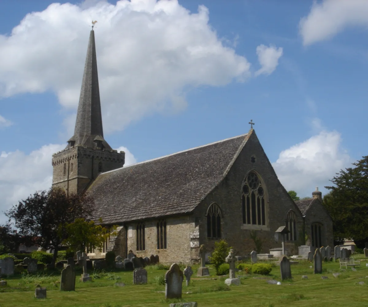
Holy Trinity Church, Cuckfield
Historic churches · 0.6 km

Kelsley Monument Approximately 5 Metres South Of Chancel Of Church
Memorials & monuments · 0.6 km
Monument Approximately 2 Metres South Of Item 8/29
Memorials & monuments · 0.6 km

Monument Approximately 1/2 Metre South Of Item 8/26
Memorials & monuments · 0.6 km

Monument To Robert Chatfield Approximately 5 Metres South Of Tower Of Church
Memorials & monuments · 0.6 km

Monument Approximately 5 Metres South Of South Porch Of Church
Memorials & monuments · 0.6 km
Monument To (Thomas?) Pockney
Memorials & monuments · 0.6 km
Monument To Richrad Uwins Approximately 6 Metres South Of Item 8/30
Memorials & monuments · 0.6 km
Nearby
📷 5Museums · South East England
Cuckfield Museum
Cuckfield Museum — a museum in england-south-east, United Kingdom.
📷 5Stately homes · South East England
Ockenden Manor
Ockenden Manor — restaurant in West Sussex, England, UK.
📷 5Memorials & monuments · South East England
Monument To Charles Howard Approximately 10 Metres West Of Lychgate To Church Street
Monument To Charles Howard Approximately 10 Metres West Of Lychgate To Church Street — Grade II listed building-listed memorial in england-south-east, United Kingdom.
📷 5Memorials & monuments · South East England
Monument To Henry Bowles, 1 Metre East Of East Window Of Church
Monument To Henry Bowles, 1 Metre East Of East Window Of Church — Grade II listed building-listed memorial in england-south-east, United Kingdom.
📷 5Historic churches · South East England
Holy Trinity Church, Cuckfield
Holy Trinity Church, Cuckfield — church in Mid Sussex, England, UK.
📷 5Memorials & monuments · South East England
Kelsley Monument Approximately 5 Metres South Of Chancel Of Church
Kelsley Monument Approximately 5 Metres South Of Chancel Of Church — Grade II listed building-listed memorial in england-south-east, United Kingdom.
Where to eat & stay near Cuckfield
Places to stay
 📷 5
📷 5Caravan parks · South East England
Woodside Park
Woodside Park — a caravan park in england south east.
 📷 5
📷 5Campsites · South East England
Bluebell Camp Site
Bluebell Camp Site — a campsite in england south east.
 📷 5
📷 5Campsites · South East England
Wild Boar Wood Campsite
Wild Boar Wood Campsite — a campsite in england south east.
📷 5 📷 5
📷 5Campsites · South East England
Kitt's Cottage Campsite
Kitt's Cottage Campsite — a campsite in england south east.
 📷 5
📷 5Campsites · South East England
Hook Farm Campsite
Hook Farm Campsite — a campsite in england south east.
Places to eat & drink
 📷 7
📷 7Historic pubs · South East England
The Sergison Arms Public House
The Sergison Arms Public House in England South East, United Kingdom.
 📷 5
📷 5Historic pubs · South East England
The Jolly Tanners Public House
The Jolly Tanners Public House in England South East, United Kingdom.
 📷 5
📷 5Historic pubs · South East England
The Five Bells Inn
The Five Bells Inn in England South East, United Kingdom.
 📷 5
📷 5 📷 5
📷 5Historic pubs · South East England
White Hart Inn
White Hart Inn in England South East, United Kingdom.
 📷 5
📷 5Historic pubs · South East England
Old Punch Bowl
Old Punch Bowl in England South East, United Kingdom.
More museums in this region
 📷 5
📷 5Museums · South East England
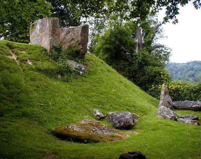
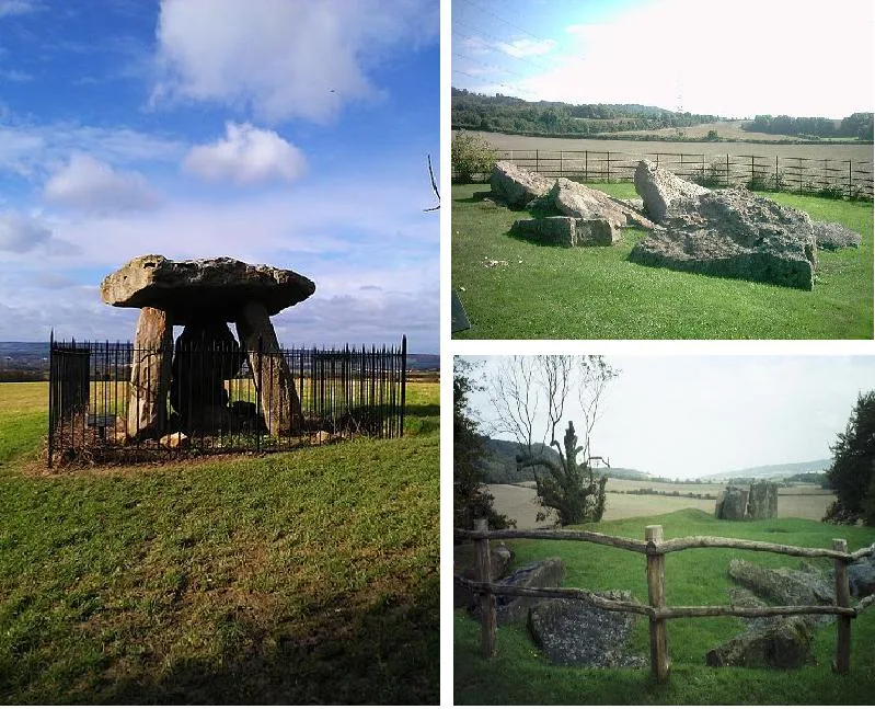
Coldrum Long Barrow
Coldrum Long Barrow — neolithic chambered long barrow near Trottiscliffe, Kent, England, UK.
 📷 5
📷 5Museums · South East England
Guildford House
Guildford House — house in Guildford, Surrey, England, UK.
 📷 5
📷 5Museums · South East England
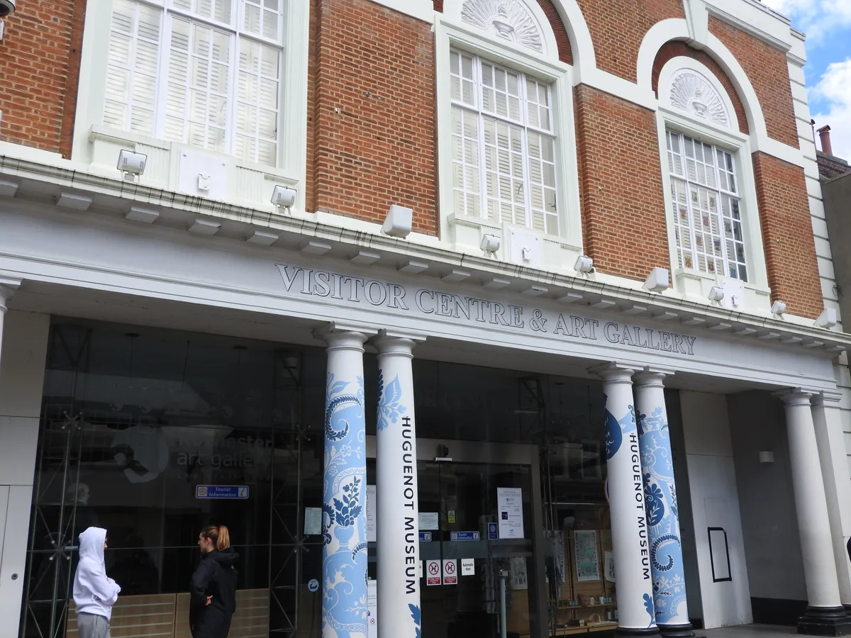
Huguenot Museum
Huguenot Museum — museum in Rochester, England, UK.
 📷 5
📷 5Museums · South East England
Medway megaliths
Medway megaliths — group of long barrows in Kent, England.
Frequently asked questions
- Where is Cuckfield?
- Cuckfield is in West Sussex, South-East England, United Kingdom (postcode RH17 5EP), in the parish of Cuckfield.
- What is Cuckfield?
- Cuckfield ( KUUK-feeld) is a village and civil parish in the Mid Sussex District of West Sussex, England, on the southern slopes of the Weald. It lies 34 miles (55 km) south of London, 13 miles (21 km
- How do I get to Cuckfield?
- The nearest railway station is Beech Hurst Miniature Railway Station, about 2.2 km away. Drivers can use postcode RH17 5EP.
- Is Cuckfield a protected site?
- Yes — Cuckfield is part of the High Weald National Landscape (AONB).
- How do I get to Cuckfield?
- The nearest railway station is Beech Hurst Miniature Railway Station, about 2.2 km away. Drivers can navigate to postcode RH17 5EP.