Natural landmarks · Northern Ireland
County Down
Also known as: Swydd Down, Contae an Dúin
In or near Dromara.
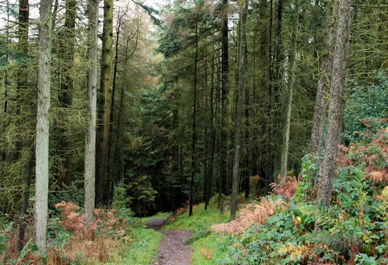
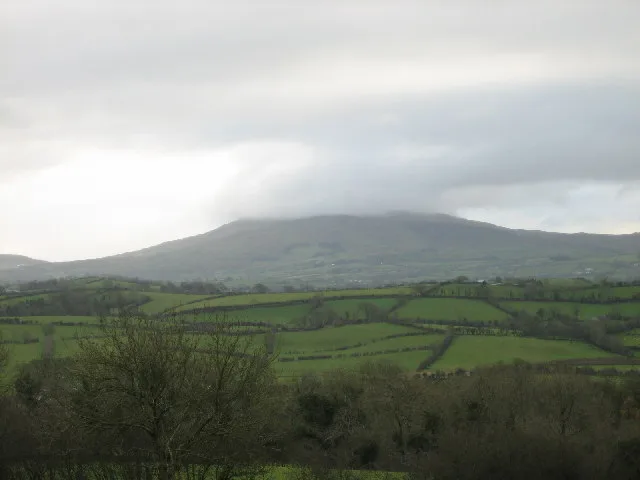
County Down in Northern Ireland, United Kingdom.

Wikimedia Commons licence
Plan your visit
- Typical visit
- 1 h–2 h
- Free entry
- Dog-friendly
About
County Down is a place of interest in Northern Ireland, United Kingdom — drawn from open-data sources for visitor reference. See the linked Wikipedia article for the full description.
Photo gallery
From the Wikipedia article
County Down (Irish: Contae an Dúin) is one of the six counties of Northern Ireland, one of the nine counties of Ulster and one of the traditional thirty-two counties of Ireland. It covers an area of 961 mi2 (2,490 km2) and has a population of 552,261. It borders County Antrim to the north, the Irish Sea to the east, County Armagh to the west, and County Louth across Carlingford Lough to the southwest. In the east of the county is Strangford Lough and the Ards Peninsula. The largest settlement is Bangor, a city on the northeast coast. Three other large towns and cities are on its border: Newry lies on the western border with County Armagh. Lisburn and Belfast lie on the northern border with County Antrim. Down contains the southernmost point of Northern Ireland (Cranfield Point) and the easternmost point of Ireland (Burr Point). It was one of two counties of Northern Ireland to have a Protestant majority in the 2001 census. The other Protestant-majority County was County Antrim to the north. In the 2021 Census, it was the only county with a Protestant background majority, as Antrim has a Protestant background plurality. In the 2021 census, Ards and North Down had the highest number of "No Religion" responses (30.6%) for Northern Ireland. In March 2018, The Sunday Times published its list of Best Places to Live in Britain, including five in Northern Ireland. The list included three in County Down: Holywood, Newcastle, and Strangford. The county has two cities: Newry and Bangor. Bangor is the more recent, gaining city status in December 2022.
Excerpt from Wikipedia under CC BY-SA 4.0. See the source article linked in Sources below.
Background
History
]] In the 2nd century the region was home to the Voluntii tribe, according to Ptolemy. From the 400s–1177 County Down formed a central part of the kingdom of Ulaid. Ulaid was a frequent target of Viking raids in the eighth and ninth centuries. Fierce local resistance prevented the Norse from setting up permanent settlements in the region. In 1001, a fleet led by Sigtrygg Silkbeard raided much of the region in retribution for the Ulaiden's refusal to offer him sanctuary from Brian Boru the previous year. The region was invaded by the Normans in 1177. From the 1180s–1600s the region saw waves of English and Scottish immigration. In 1569, the Irish Parliament passed "An Act for turning of…
Visiting
"Star of the County Down" is a popular Irish ballad. The county is named in the lyrics of the song "Around the World", from the film Around the World in 80 Days, which was an American top ten hit for Bing Crosby and UK top ten hit for Ronnie Hilton, both in 1957, although it was Mantovani's instrumental version which was actually used in the film. Rihanna's video "We Found Love" was filmed there in 2011, causing complaints when the singer removed her clothes to reveal a bikini. The Ulster singer Van Morrison has made reference to the County Down in the lyrics to several songs including "Northern Muse (Solid Ground)", "Mystic of the East" and the nostalgic "Coney Island", which names several…
Sourced from Wikipedia under CC BY-SA 4.0.
- Coordinates
- 54.3600, -5.9400
- District
- Newry, Mourne and Down
- Postcode
- BT25 2LA
- Parliamentary constituency
- South Down
- Established
- 1600
Sources
- wikidata: Q190684 (CC0)
- wikipedia: County Down (CC BY-SA 4.0)
Other places nearby
Drumkeeragh Forest
Archaeological sites · 1.0 km

Treetop Trail
Mountain bike trails · 1.6 km

Dunmore
Villages · 2.5 km

River Lagan
Natural landmarks · 2.8 km

McCartan's Castle
Castles · 3.1 km
Slieve Croob
Mountains & hills · 3.1 km

Slieve Croob
Natural landmarks · 3.1 km

Spa
Natural landmarks · 3.1 km

Slievenisky
Mountains & hills · 3.6 km
Sliabh an Uisce
Mountains & hills · 3.6 km

Kinelarty
Natural landmarks · 4.2 km
Crocknafoyle
Mountains & hills · 4.3 km
Nearby
📷 3Archaeological sites · Northern Ireland
Drumkeeragh Forest
Drumkeeragh Forest is a archaeological site in the United Kingdom.
📷 5Mountain bike trails · Northern Ireland
Treetop Trail
Treetop Trail — a mtb trail in northern ireland.
📷 5📷 5Natural landmarks · Northern Ireland
River Lagan
River Lagan in Northern Ireland, United Kingdom.
📷 3Castles · Northern Ireland
McCartan's Castle
McCartan's Castle — a castle in northern-ireland, United Kingdom.
📷 4Where to eat & stay near County Down
Places to stay
 📷 5
📷 5Campsites · Northern Ireland
Slieve Croob Camping
Slieve Croob Camping — a campsite in northern ireland.
 📷 5
📷 5Campsites · Northern Ireland
Castlewellan Touring-in-the-Trees
Castlewellan Touring-in-the-Trees — a campsite in northern ireland.
 📷 5
📷 5Campsites · Northern Ireland
Castlewellan Forest Park - Camping
Castlewellan Forest Park - Camping — a campsite in northern ireland.
 📷 5
📷 5Caravan parks · Northern Ireland
Castlewellan Forest Park - Caravan Site
Castlewellan Forest Park - Caravan Site — a caravan park in northern ireland.
 📷 5
📷 5Caravan parks · Northern Ireland
Tollymore Forest
Tollymore Forest — a caravan park in northern ireland.
 📷 5
📷 5Campsites · Northern Ireland
Tollymore Forest Park - Campsite
Tollymore Forest Park - Campsite — a campsite in northern ireland.
Places to eat & drink
 📷 3
📷 3Historic pubs · Northern Ireland
Soma Festival
The Soma Festival (Sanskrit: सोम, or sóma, meaning drink of the Gods, see Soma (drink); Irish: Féile Soma) is an annual music, arts, and cultural festival. The festival includes concerts, musical perf
 📷 5
📷 5More natural landmarks in this region
 Flagship📷 4
Natural landmarks · Northern Ireland
Lough Erne
Lough Erne — lake in County Fermanagh, Northern Ireland, UK.
 Flagship📷 4
Natural landmarks · Northern Ireland
Lough Neagh
Lough Neagh — large lake in Northern Ireland.
 📷 3
📷 3Natural landmarks · Northern Ireland
Ballysaggart Lough
Ballysaggart Lough — lake in the United Kingdom.
 📷 5
📷 5Natural landmarks · Northern Ireland
Belmore Mountain
Belmore Mountain — mountain in the United Kingdom.
Frequently asked questions
- Where is County Down?
- County Down is in Northern Ireland, United Kingdom (postcode BT25 2LA).
- What is County Down?
- County Down in Northern Ireland, United Kingdom.
- How do I get to County Down?
- Drivers can use postcode BT25 2LA.
- When was County Down built?
- Built or established in 1600.
- Is County Down free to visit?
- Yes, County Down is free to enter.
- How do I get to County Down?
- Drivers can navigate to postcode BT25 2LA. It sits within the South Down parliamentary constituency.