
Archaeological sites · North Wales
Coed-y-Brenin
Also known as: Coed y Brenin
In or near Llanfachreth.
Coed-y-Brenin is a archaeological site in the United Kingdom.

Wikimedia Commons contributors — see linked file page for photographer and licence licence

Plan your visit
- Typical visit
- 45 min–1.5 h
- Free entry
- Dog-friendly
About
Coed-y-Brenin is an archaeological site in the United Kingdom. Coordinates: 52.8250°, -3.9160°. This entry is part of The Great Britain Guide, a free, ad-free, open-data tourist directory.
Photo gallery
From the Wikipedia article
Coed y Brenin (Welsh for King's Forest) is a forest in the Snowdonia National Park, North Wales near Dolgellau at grid reference SH7127. It is popular for its mountain bike trails and hiking paths. It has several man-made mountain bike singletrack courses in a woodland setting, varying in length from 12 to 38 km (7.5 to 23.6 mi), and one dual slalom course. The site is owned and operated by Natural Resources Wales, and covers an area of some 9,000 acres (36 km2) around the valleys of the rivers Mawddach, Eden, Gain and Wen. There is no charge for using the trails, but there is a charge for the car park at Coed y Brenin Visitor Centre. This costs £2 for first 2hours and then 40p per 20minutes capped at maximum £7. All of the proceeds go towards the maintenance and improvement of the forest trails. Coed y Brenin was identified as a potential mountain bike race course in 1990, and the first races were held there in 1991. The initial course had to be chopped out of an impassable rock-strewn terrain. Shortly afterwards a Mountain Biking hire shop, together with a visitor centre and café were opened at Maesgwm. Five waymarked trails were developed by Dafydd Davis who was employed by Forest Enterprise as a Forest Sports Development Adviser, grew Coed y Brenin into a major UK mountain biking centre. Davis received an MBE in the 2004 Queen's Birthday Honours list for 'services to forestry' relating to his work on this resort. A new £1.6 million visitor centre opened in the summer of 2006. Since the opening of the centre, the trail offering has grown to eight mountain biking trails, eight walking trails and five running trails. These trails are way marked. The visitor information desk is available seven days per week, throughout the year (except Christmas Day, Boxing Day and New Year's Day) during the gift shop opening hours of 10:00hrs and 16:00hrs. There are a number of picnic tables around the main car parks within Coed y Brenin Forest Park plus many more on the waymarked…
Excerpt from Wikipedia under CC BY-SA 4.0. See the source article linked in Sources below.
- Coordinates
- 52.8250, -3.9160
- District
- Gwynedd
- Parish
- Ganllwyd
- Postcode
- LL40 2HY
- Parliamentary constituency
- Dwyfor Meirionnydd
Sources
- wikidata: Q5140497 (CC0)
- wikipedia: Coed-y-Brenin (CC BY-SA 4.0)
- commons: Coed Y Brenin. - geograph.org.uk - 240222.jpg (CC BY-SA 4.0)
Featured in this guide
Other places nearby

Tarw
Mountain bike trails · 0.7 km

Gwynedd
Historic churches · 0.9 km

Pont Dol-Gefeliau
Historic bridges · 1.1 km
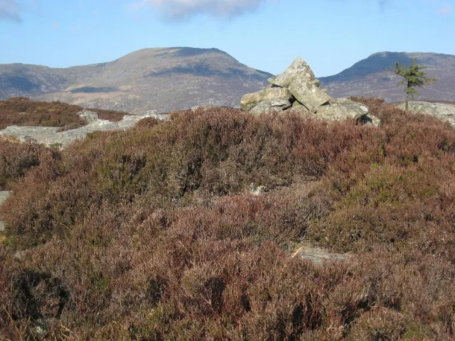
Craig Y Ganllwyd
Mountains & hills · 1.2 km

Craig Aberserw
Mountains & hills · 1.5 km

Temtiwr
Mountain bike trails · 2.0 km
Minor Taur
Mountain bike trails · 2.1 km

MBR
Mountain bike trails · 2.2 km

Pistyll Cain
Waterfalls · 2.5 km

Cyflym Coch
Mountain bike trails · 2.5 km

Rhaeadr Mawddach
Waterfalls · 2.6 km

Cae Gwyn Farm Holidays
Campsites · 2.8 km
Nearby
📷 5📷 5Historic churches · North Wales
Gwynedd
Gwynedd (Welsh: [ˈɡwɨnɛð]) is a county in the north-west of Wales. It borders Anglesey across the Menai Strait to the north, Conwy County Borough, Denbighshire, and Powys to the east, Ceredigion over
📷 5Historic bridges · North Wales
Pont Dol-Gefeliau
Pont Dol-Gefeliau — Grade II listed building-listed bridge in wales-north, United Kingdom.
📷 3📷 3Mountains & hills · North Wales
Craig Aberserw
Craig Aberserw — a mountain in wales-north, United Kingdom, 446 m.
📷 5Where to eat & stay near Coed-y-Brenin
Places to stay
📷 5Campsites · North Wales
Cae Gwyn Farm Holidays
Cae Gwyn Farm Holidays — a campsite in wales north.
 📷 5
📷 5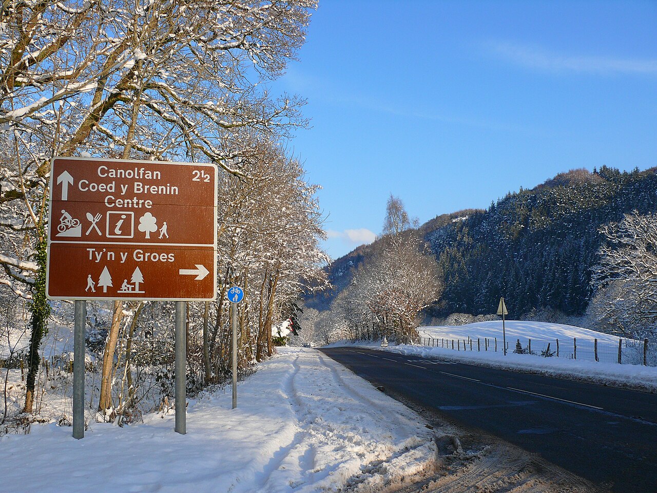 📷 5
📷 5 📷 5
📷 5Caravan parks · North Wales
Trawsfynydd Holiday Village
Trawsfynydd Holiday Village — a caravan park in wales north.
 📷 5
📷 5Hostels · North Wales
Rhiw Goch Bunkhouse
Rhiw Goch Bunkhouse — a hostel in wales north.
 📷 5
📷 5Places to eat & drink
 📷 7
📷 7 📷 7
📷 7 📷 7
📷 7 📷 5
📷 5 📷 7
📷 7 📷 7
📷 7More archaeological sites in this region
 📷 3
📷 3Archaeological sites · North Wales
Gwydir Forest
Gwydir Forest — forest in Conwy County Borough, Wales.
 📷 3
📷 3Archaeological sites · North Wales
Newborough Forest
Newborough Forest — forest in Anglesey, North Wales.
 📷 4
📷 4Archaeological sites · North Wales
Canovium
Canovium was a fort in the Roman province of Britannia. Its site is located at Caerhun in the Conwy valley, in the county borough of Conwy, in North Wales.
 📷 3
📷 3Archaeological sites · North Wales
Beddrod Siambr Llugwy
Beddrod Siambr Llugwy — a archaeological in wales-north, United Kingdom.
Frequently asked questions
- Where is Coed-y-Brenin?
- Coed-y-Brenin is in North Wales, United Kingdom (postcode LL40 2HY), in the parish of Ganllwyd.
- What is Coed-y-Brenin?
- Coed-y-Brenin is a archaeological site in the United Kingdom.
- How do I get to Coed-y-Brenin?
- Drivers can use postcode LL40 2HY.
- Is Coed-y-Brenin free to visit?
- Yes, Coed-y-Brenin is free to enter.
- How do I get to Coed-y-Brenin?
- Drivers can navigate to postcode LL40 2HY. It sits within the Dwyfor Meirionnydd parliamentary constituency.