Mountains & hills · North Wales
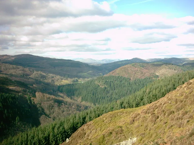
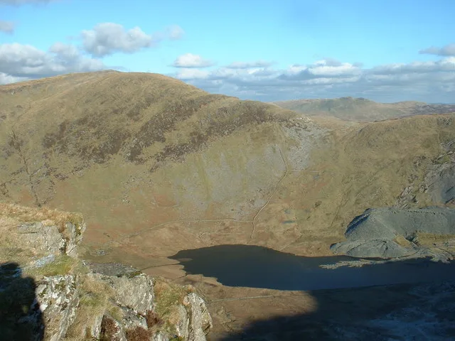
Craig Y Ganllwyd
In or near Llanfachreth.
Craig Y Ganllwyd — Named summit at 427 m.

Wikimedia Commons contributors — see linked file page for photographer and licence licence
Plan your visit
- Typical visit
- 3 h–8 h
- Best time of year
- Late spring – early autumn (May–Oct)
- Free entry
- Dog-friendly
About
Craig Y Ganllwyd is a named summit in the United Kingdom. Wikidata describes it as: "Named summit at 427 m.". Coordinates: 52.8145°, -3.9181°.
Photo gallery
Place summary
Craig Y Ganllwyd is a mountain located in North Wales, within the parish of Ganllwyd. It is notable for its striking natural landscape and forms part of the scenic beauty characteristic of the region. The postcode for this area is LL40.
AI-generated from the structured facts on this page (operator, designation, listing, era). Not a substitute for visiting.
- Coordinates
- 52.8145, -3.9181
- District
- Gwynedd
- Parish
- Ganllwyd
- Postcode
- LL40 2HU
- Parliamentary constituency
- Dwyfor Meirionnydd
Sources
- osm: n268647835 (ODbL)
- commons: Craig y Ganllwyd. - geograph.org.uk - 398238.jpg (CC BY-SA 4.0)
Other places nearby

Tarw
Mountain bike trails · 0.6 km
Coed-y-Brenin
Archaeological sites · 1.2 km

Craig Aberserw
Mountains & hills · 1.5 km

Pont Dol-Gefeliau
Historic bridges · 1.7 km

Rhaeadr Du Waterfalls
Natural landmarks · 2.0 km

Temtiwr
Mountain bike trails · 2.0 km

Gwynedd
Historic churches · 2.1 km

Coed Ganllwyd National Nature Reserve
Forests & woodlands · 2.1 km

Coed Ganllwyd National Nature Reserve
Forests & woodlands · 2.2 km

MBR
Mountain bike trails · 2.2 km
Minor Taur
Mountain bike trails · 2.2 km

Q20596265
Natural landmarks · 2.3 km
Nearby
📷 5📷 3Archaeological sites · North Wales
Coed-y-Brenin
Coed-y-Brenin is a archaeological site in the United Kingdom.
📷 3Mountains & hills · North Wales
Craig Aberserw
Craig Aberserw — a mountain in wales-north, United Kingdom, 446 m.
📷 5Historic bridges · North Wales
Pont Dol-Gefeliau
Pont Dol-Gefeliau — Grade II listed building-listed bridge in wales-north, United Kingdom.
📷 3Natural landmarks · North Wales
Rhaeadr Du Waterfalls
Rhaeadr Du Waterfalls — a other in wales-north, United Kingdom.
📷 5Where to eat & stay near Craig Y Ganllwyd
Places to stay
 📷 5
📷 5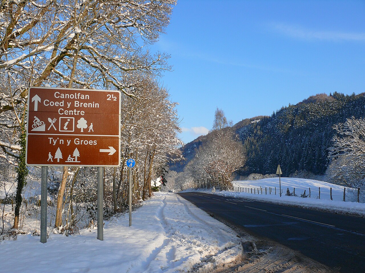 📷 5
📷 5 📷 5
📷 5Campsites · North Wales
Cae Gwyn Farm Holidays
Cae Gwyn Farm Holidays — a campsite in wales north.
 📷 5
📷 5Caravan parks · North Wales
Trawsfynydd Holiday Village
Trawsfynydd Holiday Village — a caravan park in wales north.
 📷 5
📷 5Hostels · North Wales
Rhiw Goch Bunkhouse
Rhiw Goch Bunkhouse — a hostel in wales north.
 📷 7
📷 7Places to eat & drink
 📷 7
📷 7 📷 7
📷 7 📷 7
📷 7 📷 5
📷 5 📷 7
📷 7 📷 7
📷 7More mountains in this region
 📷 5
📷 5Mountains & hills · North Wales
Cemlyn Bay and lagoon
Cemlyn Bay and lagoon — Site of Special Scientific Interest in Wales.
 📷 3
📷 3Mountains & hills · North Wales
Aberffraw Bay
Aberffraw Bay — bay on the west coast of Anglesey, in Wales, UK.
 📷 3
📷 3 📷 3
📷 3Mountains & hills · North Wales
Aran Benllyn
Aran Benllyn — Named summit at 884 m.
Frequently asked questions
- Where is Craig Y Ganllwyd?
- Craig Y Ganllwyd is in North Wales, United Kingdom (postcode LL40 2HU), in the parish of Ganllwyd.
- What is Craig Y Ganllwyd?
- Craig Y Ganllwyd — Named summit at 427 m.
- How do I get to Craig Y Ganllwyd?
- Drivers can use postcode LL40 2HU.
- Is Craig Y Ganllwyd free to visit?
- Yes, Craig Y Ganllwyd is free to enter.
- How do I get to Craig Y Ganllwyd?
- Drivers can navigate to postcode LL40 2HU. It sits within the Dwyfor Meirionnydd parliamentary constituency.