
Wildlife reserves · South East England
Cholsey Marsh
In or near Ipsden.
Cholsey Marsh — nature reserve near Cholsey, Oxfordshire, England.

Wikimedia Commons licence
Plan your visit
- Typical visit
- 2 h–4 h
- Best time of year
- Autumn & winter (migration & wildfowl)
- Nearest railway station
- Cholsey · 1.8 km
- Free entry
- Dog-friendly
Getting there & planning your visit
Cholsey Marsh is located in South Oxfordshire, with the nearest railway station being Cholsey, approximately 1.8 km away. The postcode for Cholsey Marsh is OX10 6AX, and entry to the reserve is free.
About
Cholsey Marsh is a wildlife reserve in the United Kingdom. Wikidata describes it as: "nature reserve near Cholsey, Oxfordshire, England". Coordinates: 51.5652°, -1.1343°.
Photo gallery
360° viewimagery from 2019
Imagery © Mapillary contributors, CC BY-SA 4.0
Official information
Cholsey Marsh is a tranquil riverside marsh that serves as a habitat for various plants, insects, and birds, including the nationally rare Desmoulin's whorl snail. Visitors can enjoy birdwatching and explore the diverse wildlife along the Thames Path National Trail.
Protected designations
- Area of Outstanding Natural Beauty: Chilterns
- Area of Outstanding Natural Beauty: North Wessex Downs
Designations sourced from Natural England open data under OGL v3.
From the Wikipedia article
Cholsey Marsh is a 19-hectare (47-acre) nature reserve near Cholsey in Oxfordshire, England. It is managed by the Berkshire, Buckinghamshire and Oxfordshire Wildlife Trust. The Thames Path runs through this marsh on the bank of the River Thames. Wet reed and sedge beds provide a habitat for diverse wildlife and there are also areas of grassland, willow scrub and two large ponds. Flora include marsh-marigold, meadowsweet and the rare summer snowflake.
Excerpt from Wikipedia under CC BY-SA 4.0. See the source article linked in Sources below.
- Coordinates
- 51.5652, -1.1343
- County
- Oxfordshire
- District
- South Oxfordshire
- Parish
- South Stoke
- Postcode
- OX10 6AX
- Parliamentary constituency
- Henley and Thame
- Nearest railway station
- Cholsey — 1.8 km
- Opening
- Open at all times
- Official site
- www.bbowt.org.uk
Sources
- wikidata: Q89131819 (CC0)
- wikipedia: Cholsey Marsh (CC BY-SA 4.0)
Other places nearby

Cholsey Marsh
Forests & woodlands · 0.1 km

The Great Hall
Cinemas · 0.5 km

Moulsford Railway Bridge (1892)
Historic bridges · 1.0 km
Moulsford Railway Bridge (1839)
Historic bridges · 1.0 km

North Stoke
Villages · 1.1 km

Silly Bridge (MLN1/47 79)
Historic bridges · 1.2 km

White Hill
Mountains & hills · 1.3 km

Cholsey
Villages · 1.6 km

South Stoke
Villages · 1.7 km

Moulsford
Villages · 1.8 km

Cranford House School
Historic houses · 1.9 km
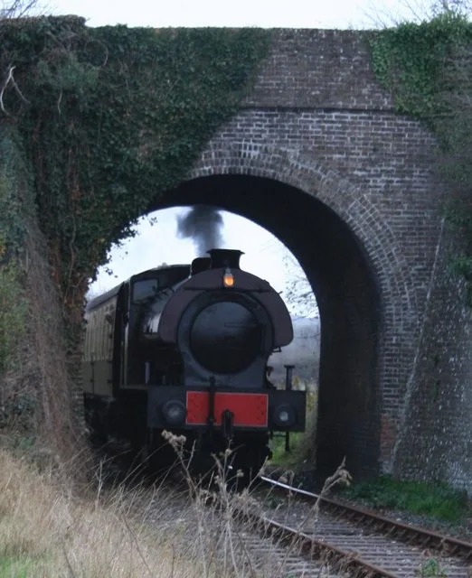
Cholsey & Wallingford Railway
Heritage railways · 1.9 km
Nearby
📷 5Forests & woodlands · South East England
Cholsey Marsh
Cholsey Marsh is a forest or woodland in the United Kingdom.
📷 5Cinemas · South East England
The Great Hall
The Great Hall — a cinema in england south east.
📷 5Historic bridges · South East England
Moulsford Railway Bridge (1892)
Moulsford Railway Bridge (1892) is a historic bridge in the United Kingdom.
📷 5Historic bridges · South East England
Moulsford Railway Bridge (1839)
Moulsford Railway Bridge (1839) is a historic bridge in the United Kingdom.
📷 5📷 5Historic bridges · South East England
Silly Bridge (MLN1/47 79)
Silly Bridge (MLN1/47 79) — Grade II listed building-listed bridge in england-south-east, United Kingdom.
Where to eat & stay near Cholsey Marsh
Places to stay
 📷 5
📷 5Campsites · South East England
Ridgeway View Campsite
Ridgeway View Campsite — a campsite in england south east.
 📷 5📷 5
Campsites · South East England
Braziers Park Campsite
Braziers Park Campsite — a campsite in england south east.
📷 5📷 5 📷 5
📷 5Campsites · South East England
Newnham Manor Caravan Park
Newnham Manor Caravan Park — a campsite in england south east.
Places to eat & drink
 📷 5
📷 5Historic pubs · South East England
Row Barge Public House
Row Barge Public House in England South East, United Kingdom.
 📷 5
📷 5 📷 5
📷 5Historic pubs · South East England
Town Arms
Town Arms — Historic pub — listed building or notable heritage status.
 📷 7
📷 7Historic pubs · South East England
The Chequers Inn Public House
The Chequers Inn Public House in England South East, United Kingdom.
 📷 7
📷 7Historic pubs · South East England
The Bull Hotel
The Bull Hotel in England South East, United Kingdom.
 📷 5
📷 5Historic pubs · South East England
The Catherine Wheel Public House
The Catherine Wheel Public House in England South East, United Kingdom.
More places in this region
 📷 5
📷 5 📷 5
📷 5Wildlife reserves · South East England
Burham Down
Burham Down — nature reserve in Kent, England, UK.
 📷 5
📷 5Wildlife reserves · South East England
Combe Bottom
Combe Bottom — nature reserve in Surrey, England.
 📷 5
📷 5Wildlife reserves · South East England
Dryhill Nature Reserve
Dryhill Nature Reserve is a wildlife reserve in the United Kingdom.
Frequently asked questions
- Where is Cholsey Marsh?
- Cholsey Marsh is in Oxfordshire, South-East England, United Kingdom (postcode OX10 6AX), in the parish of South Stoke.
- What is Cholsey Marsh?
- Cholsey Marsh — nature reserve near Cholsey, Oxfordshire, England.
- How do I get to Cholsey Marsh?
- The nearest railway station is Cholsey, about 1.8 km away. The nearest town is Ipsden. Drivers can use postcode OX10 6AX.
- Who owns Cholsey Marsh?
- Cholsey Marsh is owned by Berkshire, Buckinghamshire and Oxfordshire Wildlife Trust.
- Is Cholsey Marsh a protected site?
- Yes — Cholsey Marsh is part of the Chilterns National Landscape (AONB) and the North Wessex Downs National Landscape (AONB).
- Is Cholsey Marsh free to visit?
- Yes, Cholsey Marsh is free to enter.
- How do I get to Cholsey Marsh?
- The nearest railway station is Cholsey, about 1.8 km away. Drivers can navigate to postcode OX10 6AX.
- Are dogs allowed at Cholsey Marsh?
- Most wildlife reserves allow dogs on lead only, with restrictions during ground-nesting bird season (March-July). Check signage at the reserve.