
Campsites · South East England
East Campsite
In or near Ipsden.
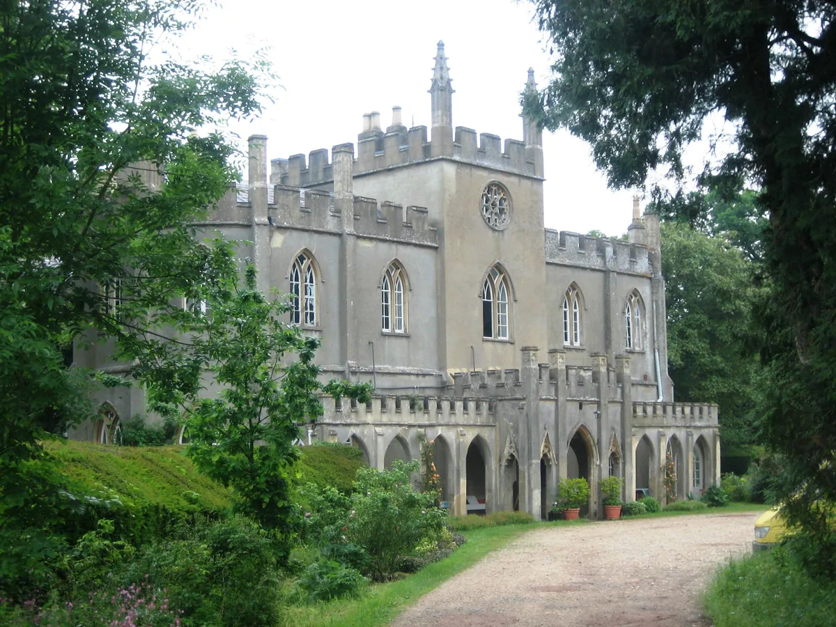
East Campsite — a campsite in england south east.

Stuart Logan — CC BY-SA 2.0 via Wikimedia Commons licence

Plan your visit
- Typical visit
- 1 h–2 h
- Nearest railway station
- Goring & Streatley · 5.2 km
About
East Campsite is a campsite located in england south east. Campsite listed with verified location and OSM metadata. Pitch availability, facilities (toilets, showers, electric hookup) and seasonal opening vary — confirm directly.
Photo gallery
Protected designations
- Area of Outstanding Natural Beauty: Chilterns
- Area of Outstanding Natural Beauty: North Wessex Downs
Designations sourced from Natural England open data under OGL v3.
Place summary
East Campsite is located in South-East England. This campsite offers visitors a natural setting for outdoor stays, typically featuring pitches for tents and caravans. Guests can expect basic amenities to support camping activities, making it suitable for those seeking a rustic experience in the countryside.
AI-generated from the structured facts on this page (operator, designation, listing, era). Not a substitute for visiting.
- Coordinates
- 51.5557, -1.0823
- County
- Oxfordshire
- District
- South Oxfordshire
- Parish
- Ipsden
- Postcode
- OX10 6AN
- Parliamentary constituency
- Henley and Thame
- Nearest railway station
- Goring & Streatley — 5.2 km
Sources
- osm: w424543342 (ODbL)
Other places nearby
Braziers Park Campsite
Campsites · 0.1 km
Orchard
Campsites · 0.1 km
West Campsite
Campsites · 0.2 km

Braziers Park
Manor houses · 0.2 km

The Reade Memorial
Memorials & monuments · 1.1 km
Ipsden
Towns & cities · 1.1 km

Roman Coins Found
Archaeological sites · 1.2 km

Ipsden War Memorial
Memorials & monuments · 1.2 km

Judges' Ride
Mountain bike trails · 1.2 km

The Devil's Churchyard (Enclosure)
Archaeological sites · 1.6 km

Watch Folly
Mountains & hills · 1.7 km

Warren Bank
Forests & woodlands · 2.0 km
Nearby
📷 5Campsites · South East England
Braziers Park Campsite
Braziers Park Campsite — a campsite in england south east.
📷 5📷 5📷 5Manor houses · South East England
Braziers Park
Braziers Park — a manor in South East England, United Kingdom.
📷 5Memorials & monuments · South East England
The Reade Memorial
The Reade Memorial — a memorial in South East England, United Kingdom.
Flagship📷 10Towns & cities · South East England
Ipsden
Ipsden — village and civil parish in South Oxfordshire, England.
Where to eat & stay near East Campsite
Places to stay
📷 5Campsites · South East England
Braziers Park Campsite
Braziers Park Campsite — a campsite in england south east.
📷 5📷 5 📷 5
Campsites · South East England
Ridgeway View Campsite
Ridgeway View Campsite — a campsite in england south east.
 📷 5
Campsites · South East England
Newnham Manor Caravan Park
Newnham Manor Caravan Park — a campsite in england south east.
 📷 5
Campsites · South East England
Riverside Campsite
Riverside Campsite — a campsite in england west midlands.
Places to eat & drink
 📷 5
Historic pubs · South East England
Cherry Tree Public House
Cherry Tree Public House in England South East, United Kingdom.
 📷 5
Historic pubs · South East England
The Crooked Billet Public House
The Crooked Billet Public House in England South East, United Kingdom.
 📷 5
Historic pubs · South East England
The Catherine Wheel Public House
The Catherine Wheel Public House in England South East, United Kingdom.
 📷 5
Historic pubs · South East England
Row Barge Public House
Row Barge Public House in England South East, United Kingdom.
 📷 5
 📷 5
Historic pubs · South East England
Town Arms
Town Arms — Historic pub — listed building or notable heritage status.
More places in this region
 📷 5
Campsites · South East England
Hammonds Glamping
Hammonds Glamping — a campsite in england london.
 📷 5
Campsites · South East England
Chantry Wood Campsite
Chantry Wood Campsite — a campsite in england london.
 📷 5
Campsites · South East England
Ranmore Common Campsite
Ranmore Common Campsite — a campsite in england london.
 📷 5
Frequently asked questions
- Where is East Campsite?
- East Campsite is in Oxfordshire, South-East England, United Kingdom (postcode OX10 6AN), in the parish of Ipsden.
- What is East Campsite?
- East Campsite — a campsite in england south east.
- How do I get to East Campsite?
- The nearest railway station is Goring & Streatley, about 5.2 km away. The nearest town is Ipsden. Drivers can use postcode OX10 6AN.
- Is East Campsite a protected site?
- Yes — East Campsite is part of the Chilterns National Landscape (AONB) and the North Wessex Downs National Landscape (AONB).
- How do I get to East Campsite?
- The nearest railway station is Goring & Streatley, about 5.2 km away. Drivers can navigate to postcode OX10 6AN.