
Memorials & monuments · North East England
Chester-le-Street railway station
In or near Chester-le-Street.
Chester-le-Street railway station in England North East, United Kingdom.

Roger Smith — CC BY-SA 2.0 via Wikimedia Commons licence

Plan your visit
- Typical visit
- 15 min–45 min
- Nearest railway station
- Chester-le-Street · 0.1 km
- Free entry
- Dog-friendly
About
Chester-le-Street railway station is a place of interest in England North East, United Kingdom — drawn from open-data sources for visitor reference. See the linked Wikipedia article for the full description.
Photo gallery
From the Wikipedia article
Chester-le-Street is a railway station on the East Coast Main Line, which runs between London King's Cross and Edinburgh Waverley. The station is situated 8 miles 24 chains (8.3 miles; 13 kilometres) south of Newcastle, serving the market town of Chester-le-Street in County Durham, England. It is owned by Network Rail and managed by Northern Trains.
Excerpt from Wikipedia under CC BY-SA 4.0. See the source article linked in Sources below.
Background
History
The Team Valley Line of the North Eastern Railway, which connected Newton Hall Junction, near , with was authorised in 1848. However, the line was not opened until 2 March 1868, with the powers having been renewed in 1862. At first only freight trains used the route, but passenger services began on 1 December 1868, with the station opening on the same day. In the 1960s, the station was listed for closure as part of the Beeching Axe, which led to it being mentioned in the song Slow Train by Flanders and Swann. However, the station was saved, and still remains open today. In February and March 2022, tactile paving was added to the platform edges.
Sourced from Wikipedia under CC BY-SA 4.0.
- Coordinates
- 54.8550, -1.5780
- District
- County Durham
- Parish
- County Durham, unparished area
- Postcode
- DH3 3EE
- Parliamentary constituency
- North Durham
- Nearest railway station
- Chester-le-Street — 0.1 km
Sources
- wikidata: Q2642125 (CC0)
- wikipedia: Chester-le-Street railway station (CC BY-SA 4.0)
Other places nearby

President 3 & 4
Theatres · 0.2 km

Essoldo Chester-le-Street
Theatres · 0.3 km
To Our Glorious Dead
Memorials & monuments · 0.4 km
Cade's Road
Archaeological sites · 0.4 km
Chare
Other places · 0.4 km
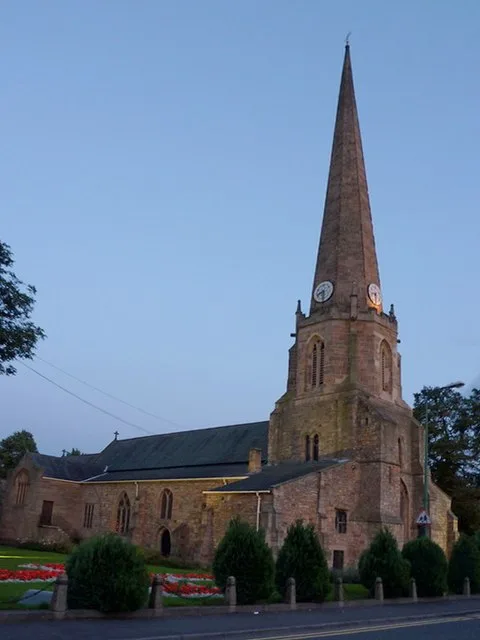
St Mary and St Cuthbert, Chester-le-Street
Historic churches · 0.4 km

Chester Burn Viaduct
Historic bridges · 0.4 km
Concangis
Archaeological sites · 0.4 km
Concangis Fort Officer's Quarters
Archaeological sites · 0.4 km

Concangis Fort Officer's Quarters
Archaeological sites · 0.4 km

Queen's Hall Cinema
Theatres · 0.4 km

Chester Le Street Hospital
Other places · 0.5 km
Nearby
📷 4Theatres · North East England
President 3 & 4
President 3 & 4 in England North East, United Kingdom.
📷 3Theatres · North East England
Essoldo Chester-le-Street
Essoldo Chester-le-Street in England North East, United Kingdom.
📷 3Memorials & monuments · North East England
To Our Glorious Dead
To Our Glorious Dead is a memorial in the United Kingdom.
📷 4Archaeological sites · North East England
Cade's Road
Cade's Road in England North East, United Kingdom.
📷 4📷 5Historic churches · North East England
St Mary and St Cuthbert, Chester-le-Street
St Mary and St Cuthbert, Chester-le-Street — church in Chester-le-Street, County Durham, England, UK.
Where to eat & stay near Chester-le-Street railway station
Places to stay
 📷 5
📷 5Caravan parks · North East England
Plum Tree Park
Plum Tree Park — a caravan park in scotland lowlands.
 📷 5
📷 5Caravan parks · North East England
Finchale Abbey Touring Park
Finchale Abbey Touring Park — a caravan park in scotland lowlands.
 📷 5
📷 5 📷 5
📷 5Caravan parks · North East England
Bobby Shafto Caravan Park
Bobby Shafto Caravan Park — a caravan park in scotland lowlands.
 📷 5
📷 5Caravan parks · North East England
Bewicke Main Residential Caravan Park
Bewicke Main Residential Caravan Park — a caravan park in scotland lowlands.
 📷 5
📷 5Hotels · North East England
Bowes Incline Hotel
Bowes Incline Hotel — a hotel in scotland lowlands.
Places to eat & drink
 📷 4
📷 4Historic pubs · North East England
Perkinsville
Perkinsville in England North East, United Kingdom.
 📷 3
📷 3Historic pubs · North East England
Nettlesworth
Nettlesworth in England North East, United Kingdom.
 📷 5
📷 5Historic pubs · North East England
The Shepherd & Shepherdess
The Shepherd & Shepherdess in Scotland Lowlands, United Kingdom.
 📷 4
📷 4 📷 7
📷 7Historic pubs · North East England
Marquis Of Granby Public House
Marquis Of Granby Public House in England North East, United Kingdom.
 📷 5
📷 5Restaurants · North East England
Stables Bar & Restaurant
Stables Bar & Restaurant — a restaurant in scotland lowlands.
More memorials in this region
 📷 3
📷 3Memorials & monuments · North East England
Hurworth and Neasham War Memorial
Hurworth and Neasham War Memorial — Grade II listed building-listed memorial in england-yorkshire, United Kingdom.
 📷 3
📷 3Memorials & monuments · North East England
Fryingpan Stone
Fryingpan Stone — a memorial in england-yorkshire, United Kingdom.
 📷 3
📷 3Memorials & monuments · North East England
Yoak Stone
Yoak Stone — a memorial in england-yorkshire, United Kingdom.
 📷 3
📷 3Memorials & monuments · North East England
Pump Cottage 1680
Pump Cottage 1680 — a memorial in england-yorkshire, United Kingdom.
Frequently asked questions
- Where is Chester-le-Street railway station?
- Chester-le-Street railway station is in North-East England, United Kingdom (postcode DH3 3EE), in the parish of County Durham, unparished area.
- What is Chester-le-Street railway station?
- Chester-le-Street railway station in England North East, United Kingdom.
- How do I get to Chester-le-Street railway station?
- The nearest railway station is Chester-le-Street, about 0.1 km away. Drivers can use postcode DH3 3EE.
- Who owns Chester-le-Street railway station?
- Chester-le-Street railway station is owned by Northern Trains.
- Is Chester-le-Street railway station free to visit?
- Yes, Chester-le-Street railway station is free to enter.
- How do I get to Chester-le-Street railway station?
- The nearest railway station is Chester-le-Street, about 0.1 km away. Drivers can navigate to postcode DH3 3EE.