Archaeological sites · North East England
Concangis
In or near Chester-le-Street.
Concangis was an auxiliary castra in the Roman province of Lower Britain (Britannia Inferior). Its ruins are located in Chester-le-Street, County Durham, in England, and are now known as Chester-le-St

Roger Templeman — CC BY-SA 2.0 via Wikimedia Commons licence
Plan your visit
- Typical visit
- 45 min–1.5 h
- Nearest railway station
- Chester-le-Street · 0.4 km
- Free entry
- Dog-friendly
About
Concangis was an auxiliary castra in the Roman province of Lower Britain (Britannia Inferior). Its ruins are located in Chester-le-Street, County Durham, in England, and are now known as Chester-le-Street Roman Fort. It is situated 6 miles (10 km) north of the city of Durham and 8 miles (13 km) south of Newcastle upon Tyne.
Photo gallery
From the Wikipedia article
Concangis was an auxiliary castra in the Roman province of Lower Britain (Britannia Inferior). Its ruins are located in Chester-le-Street, County Durham, in England, and are now known as Chester-le-Street Roman Fort. It is situated 6 miles (10 km) north of the city of Durham and 8 miles (13 km) south of Newcastle upon Tyne.
Excerpt from Wikipedia under CC BY-SA 4.0. See the source article linked in Sources below.
Background
History
The Roman fort of Concangis is located east of the forts of Longovicium (Lanchester) and Vindomora (Ebchester) and 8 mi south of Pons Aelius (Newcastle upon Tyne). It is east of the main Roman road of Dere Street, which connected other forts near Hadrian's Wall and beyond to Eboracum (York), and is close to Cade's Road, which is thought to have run from Eboracum to Pons Aelius. It is also speculated that Concangis may have been linked to Dere Street via a branch road heading west connecting to Longovicium (on Dere Street), but this has yet to be confirmed. The discovery by Raymond Selkirk of an abutment on the Cong Burn suggests that a bridge had been built there and had connected this fort…
Sourced from Wikipedia under CC BY-SA 4.0.
- Coordinates
- 54.8566, -1.5723
- District
- County Durham
- Parish
- County Durham, unparished area
- Postcode
- DH3 3QF
- Parliamentary constituency
- North Durham
- Nearest railway station
- Chester-le-Street — 0.4 km
Sources
- wikipedia: Concangis (CC BY-SA 4.0)
Other places nearby
Concangis Fort Officer's Quarters
Archaeological sites · 0.0 km

Concangis Fort Officer's Quarters
Archaeological sites · 0.0 km
To Our Glorious Dead
Memorials & monuments · 0.1 km
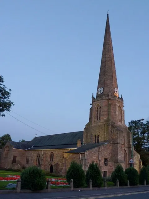
St Mary and St Cuthbert, Chester-le-Street
Historic churches · 0.1 km
Cade's Road
Archaeological sites · 0.1 km
Chare
Other places · 0.1 km

Park View School
Historic churches · 0.2 km
Essoldo Chester-le-Street
Theatres · 0.2 km

President 3 & 4
Theatres · 0.3 km

Queen's Hall Cinema
Theatres · 0.3 km

Chester-le-Street
Towns & cities · 0.3 km

Chester-le-Street Rural District
Other places · 0.4 km
Nearby
📷 3Archaeological sites · North East England
Concangis Fort Officer's Quarters
Concangis Fort Officer's Quarters — a archaeological in scotland-lowlands, United Kingdom.
📷 5Archaeological sites · North East England
Concangis Fort Officer's Quarters
Concangis Fort Officer's Quarters — archaeological in scotland lowlands.
📷 3Memorials & monuments · North East England
To Our Glorious Dead
To Our Glorious Dead is a memorial in the United Kingdom.
📷 5Historic churches · North East England
St Mary and St Cuthbert, Chester-le-Street
St Mary and St Cuthbert, Chester-le-Street — church in Chester-le-Street, County Durham, England, UK.
📷 4Archaeological sites · North East England
Cade's Road
Cade's Road in England North East, United Kingdom.
📷 4Where to eat & stay near Concangis
Places to stay
 📷 5
📷 5Caravan parks · North East England
Plum Tree Park
Plum Tree Park — a caravan park in scotland lowlands.
 📷 5
📷 5Caravan parks · North East England
Finchale Abbey Touring Park
Finchale Abbey Touring Park — a caravan park in scotland lowlands.
 📷 5
📷 5 📷 5
📷 5Caravan parks · North East England
Bewicke Main Residential Caravan Park
Bewicke Main Residential Caravan Park — a caravan park in scotland lowlands.
 📷 5
📷 5Caravan parks · North East England
Bobby Shafto Caravan Park
Bobby Shafto Caravan Park — a caravan park in scotland lowlands.
 📷 5
📷 5Hotels · North East England
Bowes Incline Hotel
Bowes Incline Hotel — a hotel in scotland lowlands.
Places to eat & drink
 📷 4
📷 4Historic pubs · North East England
Perkinsville
Perkinsville in England North East, United Kingdom.
 📷 3
📷 3Historic pubs · North East England
Nettlesworth
Nettlesworth in England North East, United Kingdom.
 📷 5
📷 5Historic pubs · North East England
The Shepherd & Shepherdess
The Shepherd & Shepherdess in Scotland Lowlands, United Kingdom.
 📷 4
📷 4 📷 5
📷 5Historic pubs · North East England
The Old Mill Public House
The Old Mill Public House in England North East, United Kingdom.
 📷 7
📷 7Historic pubs · North East England
Marquis Of Granby Public House
Marquis Of Granby Public House in England North East, United Kingdom.
More archaeological sites in this region
 📷 5
📷 5Archaeological sites · North East England
Medieval Manorial Site of Low Dinsdale
Medieval Manorial Site of Low Dinsdale — archaeological in england yorkshire.
 📷 3
📷 3Archaeological sites · North East England
Old Smelting Mill
Old Smelting Mill — a archaeological in england-north-west, United Kingdom.
 📷 5
📷 5Archaeological sites · North East England
Roper Castle or Round Table (Roman Signal Station)
Roper Castle or Round Table (Roman Signal Station) — archaeological in england north west.
 📷 5
📷 5Archaeological sites · North East England
Nine Standards Rigg
Nine Standards Rigg — archaeological in england north west. Elevation: 662 m.
Frequently asked questions
- Where is Concangis?
- Concangis is in North-East England, United Kingdom (postcode DH3 3QF), in the parish of County Durham, unparished area.
- What is Concangis?
- Concangis was an auxiliary castra in the Roman province of Lower Britain (Britannia Inferior). Its ruins are located in Chester-le-Street, County Durham, in England, and are now known as Chester-le-St
- How do I get to Concangis?
- The nearest railway station is Chester-le-Street, about 0.4 km away. Drivers can use postcode DH3 3QF.
- Is Concangis free to visit?
- Yes, Concangis is free to enter.
- How do I get to Concangis?
- The nearest railway station is Chester-le-Street, about 0.4 km away. Drivers can navigate to postcode DH3 3QF.