
Historic bridges · North East England
Chester Burn Viaduct
In or near Chester-le-Street.
Chester Burn Viaduct is a historic bridge in the United Kingdom.

Wikimedia Commons contributors — see linked file page for photographer and licence licence

Plan your visit
- Typical visit
- 15 min–30 min
- Nearest railway station
- Chester-le-Street · 0.5 km
- Free entry
- Dog-friendly
About
Chester Burn Viaduct is a named historic bridge in the United Kingdom. Coordinates: 54.8586°, -1.5791°. This entry is part of The Great Britain Guide, a free, ad-free, open-data tourist directory.
Photo gallery
From the Wikipedia article
Chester Burn viaduct is a railway viaduct in Chester-le-Street, County Durham, England. It is an imposing structure, dominating the marketplace and north end of the town. It carries the East Coast Main Line, the main railway from Newcastle to London. Chester-le-Street station on that line is just south of the viaduct. It is a Grade II listed structure.
Excerpt from Wikipedia under CC BY-SA 4.0. See the source article linked in Sources below.
Background
History
A railway line from Gateshead to Durham through Team Valley was proposed in 1846, and authorised in 1848. The downfall of "Railway King" George Hudson in 1849 led to its postponement, and work was delayed until 1862 when the North Eastern Railway regained the authority to build the Team Valley line, which required the building of the viaduct. The viaduct was completed in 1868 by Benjamin Carr Lawton, under the control of Thomas Elliot Harrison. The line opened the same year, on 2 March for freight and 1 December for passengers. The viaduct is still in use, carrying the East Coast Main Line.
Architecture
The viaduct consists of 11 semi-elliptical arches, each 60 ft wide and is 90 ft high, for a total length of 230 m. It is mostly red engineering brick in English bond, with seven rows of header bond around the arches and with stone for the plinths and parapet edge. The stone and bricks are all original, though there has been some resurfacing on the west. Railings and refuges added later are not part of the listed structure. It lies on a north–south axis with a slight curve, passing over Chester Burn. The viaduct was built to cross Chester Burn (also known as Cong Burn), then a centre of activity with both industrial and residential properties around its banks. In 1955 to establish a new…
Sourced from Wikipedia under CC BY-SA 4.0.
- Coordinates
- 54.8586, -1.5791
- District
- County Durham
- Parish
- County Durham, unparished area
- Postcode
- DH3 3ES
- Parliamentary constituency
- North Durham
- Nearest railway station
- Chester-le-Street — 0.5 km
Sources
- osm: w930446517 (ODbL)
- wikipedia: Chester Burn Viaduct (CC BY-SA 4.0)
- commons: Aerial view of Chester Burn Railway Viaduct, Chester-le-Street.jpg (CC BY-SA 4.0)
Other places nearby

Queen's Hall Cinema
Theatres · 0.2 km

Chester-le-Street Rural District
Other places · 0.4 km

Chester-le-Street railway station
Memorials & monuments · 0.4 km

President 3 & 4
Theatres · 0.5 km

Concangis
Archaeological sites · 0.5 km
Concangis Fort Officer's Quarters
Archaeological sites · 0.5 km

Concangis Fort Officer's Quarters
Archaeological sites · 0.5 km
To Our Glorious Dead
Memorials & monuments · 0.5 km
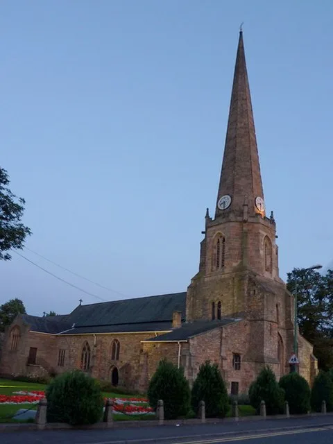
St Mary and St Cuthbert, Chester-le-Street
Historic churches · 0.5 km
Cade's Road
Archaeological sites · 0.5 km
Chare
Other places · 0.5 km
Essoldo Chester-le-Street
Theatres · 0.6 km
Nearby
📷 3Theatres · North East England
Queen's Hall Cinema
Queen's Hall Cinema in England North East, United Kingdom.
📷 3Other places · North East England
Chester-le-Street Rural District
Chester-le-Street Rural District in England North East, United Kingdom.
📷 4Memorials & monuments · North East England
Chester-le-Street railway station
Chester-le-Street railway station in England North East, United Kingdom.
📷 4Theatres · North East England
President 3 & 4
President 3 & 4 in England North East, United Kingdom.
📷 4Archaeological sites · North East England
Concangis
Concangis was an auxiliary castra in the Roman province of Lower Britain (Britannia Inferior). Its ruins are located in Chester-le-Street, County Durham, in England, and are now known as Chester-le-St
📷 3Archaeological sites · North East England
Concangis Fort Officer's Quarters
Concangis Fort Officer's Quarters — a archaeological in scotland-lowlands, United Kingdom.
Where to eat & stay near Chester Burn Viaduct
Places to stay
 📷 5
📷 5Caravan parks · North East England
Plum Tree Park
Plum Tree Park — a caravan park in scotland lowlands.
 📷 5
📷 5Caravan parks · North East England
Bobby Shafto Caravan Park
Bobby Shafto Caravan Park — a caravan park in scotland lowlands.
 📷 5
📷 5Caravan parks · North East England
Bewicke Main Residential Caravan Park
Bewicke Main Residential Caravan Park — a caravan park in scotland lowlands.
 📷 5
📷 5Caravan parks · North East England
Finchale Abbey Touring Park
Finchale Abbey Touring Park — a caravan park in scotland lowlands.
 📷 5
📷 5Hotels · North East England
Bowes Incline Hotel
Bowes Incline Hotel — a hotel in scotland lowlands.
 📷 5
📷 5Places to eat & drink
 📷 4
📷 4Historic pubs · North East England
Perkinsville
Perkinsville in England North East, United Kingdom.
 📷 3
📷 3Historic pubs · North East England
Nettlesworth
Nettlesworth in England North East, United Kingdom.
 📷 5
📷 5Historic pubs · North East England
The Shepherd & Shepherdess
The Shepherd & Shepherdess in Scotland Lowlands, United Kingdom.
 📷 4
📷 4 📷 5
📷 5Restaurants · North East England
Stables Bar & Restaurant
Stables Bar & Restaurant — a restaurant in scotland lowlands.
 📷 7
📷 7Historic pubs · North East England
Marquis Of Granby Public House
Marquis Of Granby Public House in England North East, United Kingdom.
More bridges in this region
 📷 3
📷 3Historic bridges · North East England
Bridge About 30 Metres South Of The Manor House
Bridge About 30 Metres South Of The Manor House — Grade II listed building-listed bridge in england-yorkshire, United Kingdom.
 📷 3
📷 3Historic bridges · North East England
Old Bridge Over Nor Beck, On East Side Of Road
Old Bridge Over Nor Beck, On East Side Of Road — Grade II listed building-listed bridge in england-yorkshire, United Kingdom.
 📷 3
📷 3Historic bridges · North East England
Barnard Castle Bridge
Barnard Castle Bridge is a historic bridge in the United Kingdom.
 📷 3
📷 3Historic bridges · North East England
Blandswath Bridge
Blandswath Bridge is a historic bridge in the United Kingdom.
Frequently asked questions
- Where is Chester Burn Viaduct?
- Chester Burn Viaduct is in the Scottish Lowlands, United Kingdom (postcode DH3 3ES), in the parish of County Durham, unparished area.
- What is Chester Burn Viaduct?
- Chester Burn Viaduct is a historic bridge in the United Kingdom.
- How do I get to Chester Burn Viaduct?
- The nearest railway station is Chester-le-Street, about 0.5 km away. Drivers can use postcode DH3 3ES.
- Is Chester Burn Viaduct free to visit?
- Yes, Chester Burn Viaduct is free to enter.
- How do I get to Chester Burn Viaduct?
- The nearest railway station is Chester-le-Street, about 0.5 km away. Drivers can navigate to postcode DH3 3ES.