Mountains & hills · East Midlands
Cheeks Hill
In or near Quarnford.
Cheeks Hill — Named summit at 520 m.

Wikimedia Commons contributors — see linked file page for photographer and licence licence
Plan your visit
- Typical visit
- 3 h–8 h
- Best time of year
- Late spring – early autumn (May–Oct)
- Nearest railway station
- Buxton Miniature Railway · 4.5 km
- Free entry
- Dog-friendly
About
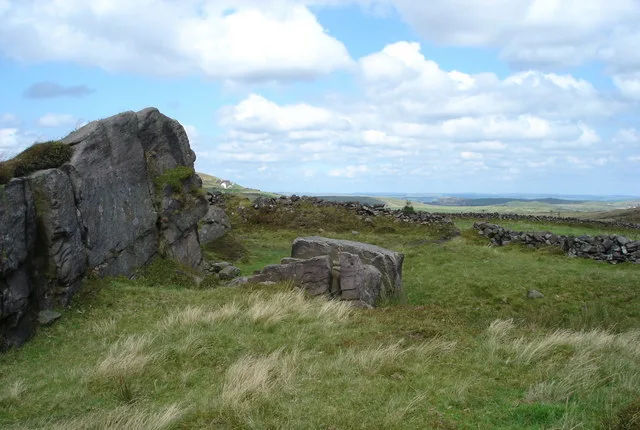
Cheeks Hill is a named summit in the United Kingdom. Wikidata describes it as: "Named summit at 520 m.". Coordinates: 53.2262°, -1.9623°.
Photo gallery
Protected designations
- Site of Special Scientific Interest: Leek Moors SSSI
Designations sourced from Natural England open data under OGL v3.
From the Wikipedia article
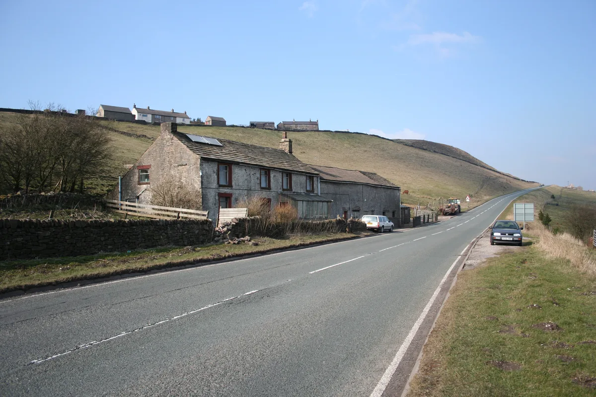
Cheeks Hill is a hill on Axe Edge Moor in the Peak District, England. It lies just south of the Cat and Fiddle Road near Buxton, and forms part of the border between Derbyshire and Staffordshire. The highest and most northerly point in Staffordshire, at 520 metres (1,710 ft) above sea level, is just south-west of its summit.
Excerpt from Wikipedia under CC BY-SA 4.0. See the source article linked in Sources below.
- Coordinates
- 53.2262, -1.9623
- County
- Staffordshire
- District
- Staffordshire Moorlands
- Parish
- Quarnford
- Postcode
- SK17 0TG
- Parliamentary constituency
- Staffordshire Moorlands
- Nearest railway station
- Buxton Miniature Railway — 4.5 km
Sources
- osm: n2819455965 (ODbL)
- wikipedia: Cheeks Hill (CC BY-SA 4.0)
- commons: Cheeks Hill - geograph.org.uk - 175759.jpg (CC BY-SA 4.0)
Other places nearby

Five Stones
Mountains & hills · 0.6 km

Axe Edge
Mountains & hills · 0.9 km
Axe Edge
Mountains & hills · 0.9 km
Axe Edge Moor
Mountains & hills · 1.1 km
_-_geograph.org.uk_-_1518946.jpg?width=1200)
Danebower Colliery ventilation chimney
Memorials & monuments · 1.6 km
Oliver Hill
Mountains & hills · 2.3 km

Thirkelow Rocks
Mountains & hills · 2.4 km

Whetstone Ridge
Mountains & hills · 2.6 km

Quarnford
Towns & cities · 2.6 km

Flash
Villages · 2.7 km

Buxton Caravan and Motorhome Club
Caravan parks · 3.1 km

Cat and Fiddle Inn
Historic pubs · 3.2 km
Nearby
📷 5Mountains & hills · East Midlands
Five Stones
Five Stones — mountain in england east midlands. Elevation: 529 m.
📷 5📷 5Mountains & hills · East Midlands
Axe Edge
Axe Edge — mountain in england east midlands. Elevation: 549 m.
📷 3📷 3Memorials & monuments · East Midlands
Danebower Colliery ventilation chimney
Danebower Colliery ventilation chimney is a memorial in the United Kingdom.
📷 3Where to eat & stay near Cheeks Hill
Places to stay
📷 5Caravan parks · East Midlands
Buxton Caravan and Motorhome Club
Buxton Caravan and Motorhome Club — a caravan park in england east midlands.
 📷 5
📷 5Hotels · East Midlands
Old Hall Hotel
Old Hall Hotel — a hotel in england east midlands.
 📷 5
📷 5Caravan parks · East Midlands
Lime Tree Park
Lime Tree Park — a caravan park in england east midlands.
 📷 5
📷 5Campsites · East Midlands
Cold Springs Farm Campsite
Cold Springs Farm Campsite — a campsite in england east midlands.
 📷 5
📷 5Campsites · West Midlands
Gradbach Scout Camp
Gradbach Scout Camp — a campsite in england west midlands.
📷 5Places to eat & drink
📷 5Historic pubs · East Midlands
Cat and Fiddle Inn
Cat and Fiddle Inn in England South East, United Kingdom.
 📷 5
📷 5Historic pubs · West Midlands
Ye Olde Rock Inn
Ye Olde Rock Inn in England West Midlands, United Kingdom.
 📷 5
📷 5Restaurants · West Midlands
Sutton Hall
Sutton Hall — a restaurant in england west midlands.
 📷 5
📷 5Historic pubs · North West England
Lord Byron Public House
Lord Byron Public House in England North West, United Kingdom.
 📷 5
📷 5Historic pubs · North West England
The Castle, Macclesfield
The Castle, Macclesfield in England North West, United Kingdom.
 📷 5
📷 5Historic pubs · North West England
2 and 4, Market Place
2 and 4, Market Place in England North West, United Kingdom.
More mountains in this region
 📷 5
📷 5Mountains & hills · East Midlands
Errwood Hall
The ruin of Errwood Hall is a popular tourist destination in the scenic Upper Goyt Valley within the Peak District of England.
📷 3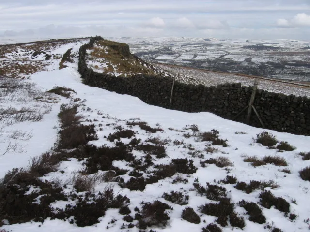 📷 3
📷 3Mountains & hills · East Midlands
Black Edge - Summit
Black Edge - Summit — Named summit at 506.7 m.
Frequently asked questions
- Where is Cheeks Hill?
- Cheeks Hill is in Staffordshire, the East Midlands, United Kingdom (postcode SK17 0TG), in the parish of Quarnford.
- What is Cheeks Hill?
- Cheeks Hill — Named summit at 520 m.
- How do I get to Cheeks Hill?
- The nearest railway station is Buxton Miniature Railway, about 4.5 km away. Drivers can use postcode SK17 0TG.
- Is Cheeks Hill a protected site?
- Yes — Cheeks Hill is part of the Leek Moors SSSI Site of Special Scientific Interest.
- Is Cheeks Hill free to visit?
- Yes, Cheeks Hill is free to enter.
- How do I get to Cheeks Hill?
- The nearest railway station is Buxton Miniature Railway, about 4.5 km away. Drivers can navigate to postcode SK17 0TG.