
Museums · East Midlands
Chapel-en-le-Frith
In or near Dove Holes.
Chapel-en-le-Frith () is a town and civil parish, in the Borough of High Peak, Derbyshire, England. It has been dubbed the "Capital of the Peak", in reference to the Peak District, historically the hi

John M — CC BY-SA 2.0 via Wikimedia Commons licence

Plan your visit
- Typical visit
- 1.5 h–3 h
- Best time of year
- Year-round
- Nearest railway station
- Chapel-en-le-Frith · 1.1 km
- Family-friendly
- Limited wheelchair access
About
Chapel-en-le-Frith () is a town and civil parish, in the Borough of High Peak, Derbyshire, England. It has been dubbed the "Capital of the Peak", in reference to the Peak District, historically the highland areas between the Saxon lands (south of the River Trent) and the Viking lands (which came as far south as Dore, South Yorkshire).
Photo gallery
From the Wikipedia article
Chapel-en-le-Frith () is a town and civil parish, in the Borough of High Peak, Derbyshire, England. It has been dubbed the "Capital of the Peak", in reference to the Peak District, historically the highland areas between the Saxon lands (south of the River Trent) and the Viking lands (which came as far south as Dore, South Yorkshire).
Excerpt from Wikipedia under CC BY-SA 4.0. See the source article linked in Sources below.
Background
History
The town was established by the Normans in the 12th century, originally as a hunting lodge within the Forest of High Peak. This led to the Anglo-Norman-derived name ("chapel in the forest"). (It appears in a Middle English form in a Latin record as , in 1401.) The population at the 2011 census was 8,635.
Visiting
Scenes from the BBC Television series The Village and The Secret of Crickley Hall were filmed in and around Chapel; Bowden Hall featured in both series. In 2015 Halfords made their Christmas advert around Rowton Grange Road in Chapel-en-le-Frith.
Sourced from Wikipedia under CC BY-SA 4.0.
- Coordinates
- 53.3220, -1.9170
- County
- Derbyshire
- District
- High Peak
- Parish
- Chapel-en-le-Frith
- Postcode
- SK23 0HR
- Parliamentary constituency
- High Peak
- Nearest railway station
- Chapel-en-le-Frith — 1.1 km
- Official site
- www.neighbourhood.statistics.gov.uk
Sources
- wikipedia: Chapel-en-le-Frith (CC BY-SA 4.0)
Other places nearby

The Playhouse
Theatres · 0.1 km

Chapel en le Frith
Villages · 0.4 km

Bridge on Bank Hall Drive adjacent to Down Lee Farm
Historic bridges · 1.0 km

Chapel-en-le-Frith railway station
Chapels · 1.1 km

Chapel Milton Viaduct
Historic bridges · 1.2 km

Chinley Independent Chapel
Chapels · 1.4 km

Chinley Camping
Campsites · 1.7 km

Combs Valley Campsite
Campsites · 2.0 km

Castle Naze
Castles · 2.1 km

Combs Reservoir
Reservoirs & lochs · 2.1 km

Promontory fort on Combs Edge
Vineyards · 2.2 km
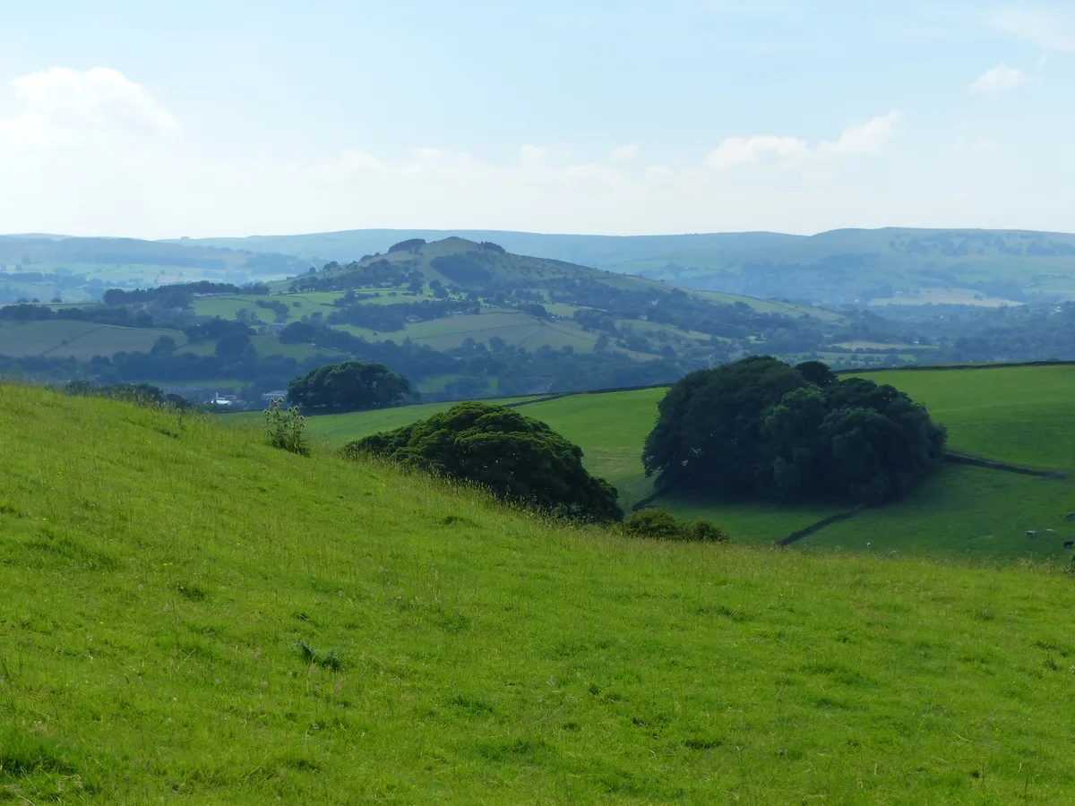
Eccles Pike
Mountains & hills · 2.2 km
Nearby
📷 3📷 5📷 3Historic bridges · East Midlands
Bridge on Bank Hall Drive adjacent to Down Lee Farm
Bridge on Bank Hall Drive adjacent to Down Lee Farm — Grade II listed building-listed bridge in england-east-midlands, United Kingdom.
📷 4Chapels · East Midlands
Chapel-en-le-Frith railway station
Chapel-en-le-Frith railway station — a Grade II-listed chapel in england-east-midlands, United Kingdom.
📷 3Historic bridges · East Midlands
Chapel Milton Viaduct
Chapel Milton Viaduct is a historic bridge in the United Kingdom.
📷 3Chapels · East Midlands
Chinley Independent Chapel
Chinley Independent Chapel — chapel in Chinley, Buxworth and Brownside, Derbyshire, England, UK.
Where to eat & stay near Chapel-en-le-Frith
Places to stay
📷 5📷 5Campsites · East Midlands
Combs Valley Campsite
Combs Valley Campsite — a campsite in england east midlands.
 📷 5
📷 5Campsites · East Midlands
chapel view campsite
chapel view campsite — a campsite in england east midlands.
 📷 5
📷 5Caravan parks · East Midlands
Ringstones Caravan Park
Ringstones Caravan Park — a caravan park in england east midlands.
 📷 5
📷 5Hostels · East Midlands
Dalehead Bunkhouse & Information Barn
Dalehead Bunkhouse & Information Barn — a hostel in england east midlands.
 📷 5
📷 5Campsites · East Midlands
Cold Springs Farm Campsite
Cold Springs Farm Campsite — a campsite in england east midlands.
Places to eat & drink
 📷 5
📷 5 📷 5
📷 5Historic pubs · East Midlands
The Hare And Hounds Hotel
The Hare And Hounds Hotel in England Yorkshire, United Kingdom.
 📷 5
📷 5Historic pubs · East Midlands
The Old Nags Head
The Old Nags Head in England Yorkshire, United Kingdom.
 📷 5
📷 5Historic pubs · North West England
Disley Friends Meeting House
Disley Friends Meeting House in England North West, United Kingdom.
 📷 4
📷 4Historic pubs · Yorkshire & the Humber
Rams Head Hotel
Rams Head Hotel — Historic pub — listed building or notable heritage status.
 📷 5
📷 5Historic pubs · East Midlands
Cat and Fiddle Inn
Cat and Fiddle Inn in England South East, United Kingdom.
More museums in this region
 📷 5
📷 5Museums · East Midlands
Stamford Town Hall
Stamford Town Hall — building in Stamford, Lincolnshire, England, UK.
 📷 5
📷 5Museums · East Midlands
Thorney Museum
Thorney Museum — a museum in East Midlands, United Kingdom.
 📷 5
📷 5Museums · East Midlands
Octavia Hill Birthplace Museum
Octavia Hill Birthplace Museum — a museum in East Midlands, United Kingdom.
 📷 5
📷 5Museums · East Midlands
Museum of Technology
Museum of Technology — a museum in East Midlands, United Kingdom.
Frequently asked questions
- Where is Chapel-en-le-Frith?
- Chapel-en-le-Frith is in Derbyshire, the East Midlands, United Kingdom (postcode SK23 0HR), in the parish of Chapel-en-le-Frith.
- What is Chapel-en-le-Frith?
- Chapel-en-le-Frith () is a town and civil parish, in the Borough of High Peak, Derbyshire, England. It has been dubbed the "Capital of the Peak", in reference to the Peak District, historically the hi
- How do I get to Chapel-en-le-Frith?
- The nearest railway station is Chapel-en-le-Frith, about 1.1 km away. The nearest town is Dove Holes. Drivers can use postcode SK23 0HR.
- How do I get to Chapel-en-le-Frith?
- The nearest railway station is Chapel-en-le-Frith, about 1.1 km away. Drivers can navigate to postcode SK23 0HR.