Reservoirs & lochs · East Midlands
Combs Reservoir
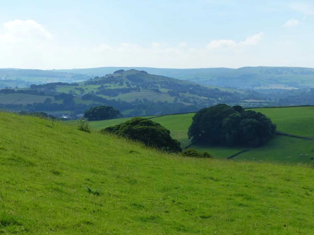
Combs Reservoir — reservoir in Derbyshire, England, UK.

Wikimedia Commons contributors — see linked file page for photographer and licence licence
Plan your visit
- Typical visit
- 1 h–2.5 h
- Nearest railway station
- Chapel-en-le-Frith · 1.8 km
- Free entry
- Dog-friendly
About
Combs Reservoir is a reservoir in the United Kingdom. Records date its origin to 1797. Heritage designation: Site of Special Scientific Interest. Part of Peak Forest Canal. Wikidata describes it as: "reservoir in Derbyshire, England, UK". Coordinates: 53.3134°, -1.9459°.
Photo gallery
Protected designations
- Site of Special Scientific Interest: Combs Reservoir SSSI
Designations sourced from Natural England open data under OGL v3.
From the Wikipedia article
Combs Reservoir is a canal-feeder reservoir in the Peak District National Park, close to Combs village in Derbyshire. The town of Chapel-en-le-Frith lies about 1 kilometre (0.62 mi) east of the reservoir. Combs was built in 1797 as the first reservoir to feed the Peak Forest Canal (which opened in 1800) at Whaley Bridge. The canal was critical for transporting goods to and from the corn mills, cotton factories, collieries, and other local industries, as well as connecting to the Ashton Canal for the nearby limestone quarries. In 1831 the Macclesfield Canal was completed, which was connected to the Peak Forest Canal at Marple. The Toddbrook Reservoir at Whaley Bridge was built as an additional feeder reservoir and the dam at Combs Reservoir was raised between 1834 and 1840, in order to meet the demand for a greater water supply to the extended canal system. By the 1940s use of these canals for transporting industrial goods had ended. The reservoir is now owned by the Canal & River Trust. The Buxton to Manchester railway line runs between Combs Reservoir and Combs village to the south and alongside the western shore. The reservoir is overlooked by Eccles Pike hill from the north and from the south by the Iron Age promontory hillfort Castle Naze, at the northern end of Combs Moss. Castle Naze is a protected Scheduled monument. Combs Reservoir is a designated Site of Special Scientific Interest (SSSI). It is particularly important for its 'ephemeral bryophyte' mosses (such as the rare Physcomitrium sphaericum) and liverworts (Ricca glauca and Fossombronia wondraczekii). The area is a rich habitat for birdlife including the great crested grebe, little ringed plover, snipe and lapwing. Combs Sailing Club has used the reservoir for sailing training and racing since 1950.
Excerpt from Wikipedia under CC BY-SA 4.0. See the source article linked in Sources below.
- Coordinates
- 53.3134, -1.9459
- County
- Derbyshire
- District
- High Peak
- Parish
- Chapel-en-le-Frith
- Postcode
- SK23 7GL
- Parliamentary constituency
- High Peak
- Established
- 1797
- Nearest railway station
- Chapel-en-le-Frith — 1.8 km
- Official site
- web.archive.org
Sources
- wikidata: Q47526963 (CC0)
- wikipedia: Combs Reservoir (CC BY-SA 4.0)
- commons: Combs Reservoir from Whitehills by Dave Dunford.jpg (CC BY-SA 4.0)
Other places nearby
Loading nearby places…
Nearby
Campsites · East Midlands
Combs Valley Campsite
Combs Valley Campsite — a campsite in england east midlands.
 📷 3
📷 3Historic bridges · East Midlands
Bridge on Bank Hall Drive adjacent to Down Lee Farm
Bridge on Bank Hall Drive adjacent to Down Lee Farm — Grade II listed building-listed bridge in england-east-midlands, United Kingdom.
 📷 3
📷 3Mountains & hills · East Midlands
Eccles Pike
Eccles Pike — Named summit at 370 m.
 📷 4
📷 4Chapels · East Midlands
Chapel-en-le-Frith railway station
Chapel-en-le-Frith railway station — a Grade II*-listed chapel in england-east-midlands, United Kingdom.
 📷 3
📷 3Castles · East Midlands
Castle Naze
Castle Naze — a castle in england-east-midlands, United Kingdom.
Vineyards · East Midlands
Promontory fort on Combs Edge
Promontory fort on Combs Edge — a UK vineyard in england east midlands, producing English or Welsh wine from cool-climate grape varieties.
More places in this region
 Flagship📷 5
Reservoirs & lochs · East Midlands
Ladybower Reservoir
Ladybower Reservoir — reservoir in Derbyshire, England.
 📷 3
📷 3Reservoirs & lochs · East Midlands
Toddbrook Reservoir
Toddbrook Reservoir — reservoir in Derbyshire, England, UK.
 📷 3
📷 3Reservoirs & lochs · East Midlands
Agden Reservoir
Agden Reservoir — reservoir in South Yorkshire, England, UK.
 📷 5
📷 5Reservoirs & lochs · East Midlands
Arnfield Reservoir
Arnfield Reservoir — reservoir in Derbyshire, England, UK.
Frequently asked questions
- Where is Combs Reservoir?
- Combs Reservoir is in Derbyshire, the East Midlands, United Kingdom (postcode SK23 7GL), in the parish of Chapel-en-le-Frith.
- When was Combs Reservoir built?
- Built or established in 1797.
- Is Combs Reservoir a listed building?
- Combs Reservoir is officially recognised as Site of Special Scientific Interest listed.
- Is Combs Reservoir a protected site?
- Yes — Combs Reservoir is part of the Combs Reservoir SSSI Site of Special Scientific Interest.
- How do I get to Combs Reservoir?
- The nearest railway station is Chapel-en-le-Frith, about 1.8 km away. Drivers can navigate to postcode SK23 7GL.