
Historic bridges · East Midlands
Bridge on Bank Hall Drive adjacent to Down Lee Farm
In or near Dove Holes.
Bridge on Bank Hall Drive adjacent to Down Lee Farm — Grade II listed building-listed bridge in england-east-midlands, United Kingdom.

Alan Murray-Rust — CC BY-SA 2.0 via Wikimedia Commons licence

Plan your visit
- Typical visit
- 15 min–30 min
- Nearest railway station
- Chapel-en-le-Frith · 0.3 km
- Free entry
- Dog-friendly
Getting there & planning your visit
The Bridge on Bank Hall Drive adjacent to Down Lee Farm is located in the High Peak area of Derbyshire, with the nearest railway station being Chapel-en-le-Frith, just 0.3 km away. Entry to the bridge is free. The postcode for navigation is SK23 9UJ.
About
Bridge on Bank Hall Drive adjacent to Down Lee Farm is a Grade II listed building-listed bridge in england-east-midlands, United Kingdom, registered on the National Heritage List for England (NHLE entry 1396455). Listed status protects buildings and structures of special architectural or historic interest. See the linked Wikipedia article for further details.
Photo gallery
Heritage listing
Details CHAPEL EN LE FRITH 178/0/10009 BANK HALL DRIVE 11-FEB-11 Bridge on Bank Hall Drive adjacent to Down Lee Farm II Bridge of 1830 by John Frith MATERIALS: Constructed of coursed Ashlar grit stone blocks. EXTERIOR: The bridge comprises a low arch with a flat string course, mounted by low parapet walls. The parapets stand to a height of approximately 0.75m above the road surface, with low square pilasters at each end, decorated with an embossed eight-pointed star set within a diamond. The parapets are capped with a curved, decorative coping. HISTORY: The bridge was built in 1830 by John Frith and, central to the eastern parapet wall, carries a date stone which reads 'JF1830'and is embellished with folate and fluted decoration. The bridge is situated on the drive to Bank Hall, once the seat of the Frith family. The current Bank Hall was rebuilt in the 1870s and is listed at Grade II, as are the gates and gate piers. John Frith was the last in the direct line of the Friths, and the brother of Squire Frith. Squire Frith was a Justice of the Peace, Deputy Lieutenant for the county, High Sheriff of Derbyshire in 1781, and colonel of the Bowden Chapel volunteers, formed in response to Napoleonic invasion threats. REASONS FOR DESIGNATION The bridge adjacent to Down Lee Farm on Bank Hall Drive, Chapel en le Frith is listed at Grade II for the following principal reasons: * Architectural Interest: For its simple, but carefully executed, embossed decorative detail and date stone. * Historic Interest: For its association with John Frith, a prominent figure locally, and part of an influential family nationally. * Group Value: For its association with Bank Hall (listed Grade II), the related gates, gate piers and screen (also listed Grade II), as well as other listed bridges in t
From the Historic England List Entry under OGL v3.
Place summary
The Bridge on Bank Hall Drive, adjacent to Down Lee Farm, is a Grade II listed bridge located in Chapel-en-le-Frith, Derbyshire, in the East Midlands. This designation highlights its architectural and historical significance within the region.
AI-generated from the structured facts on this page (operator, designation, listing, era). Not a substitute for visiting.
- Coordinates
- 53.3136, -1.9226
- County
- Derbyshire
- District
- High Peak
- Parish
- Chapel-en-le-Frith
- Postcode
- SK23 9UJ
- Parliamentary constituency
- High Peak
- Established
- 1830
- Nearest railway station
- Chapel-en-le-Frith — 0.3 km
Sources
- wikidata: Q26675242 (CC0)
Other places nearby

Chapel-en-le-Frith railway station
Chapels · 0.3 km

Chapel-en-le-Frith
Museums · 1.0 km

Combs Valley Campsite
Campsites · 1.0 km

The Playhouse
Theatres · 1.1 km

Castle Naze
Castles · 1.2 km

Promontory fort on Combs Edge
Vineyards · 1.2 km

Chapel en le Frith
Villages · 1.3 km

Combs Reservoir
Reservoirs & lochs · 1.6 km

Chapel Milton Viaduct
Historic bridges · 2.2 km
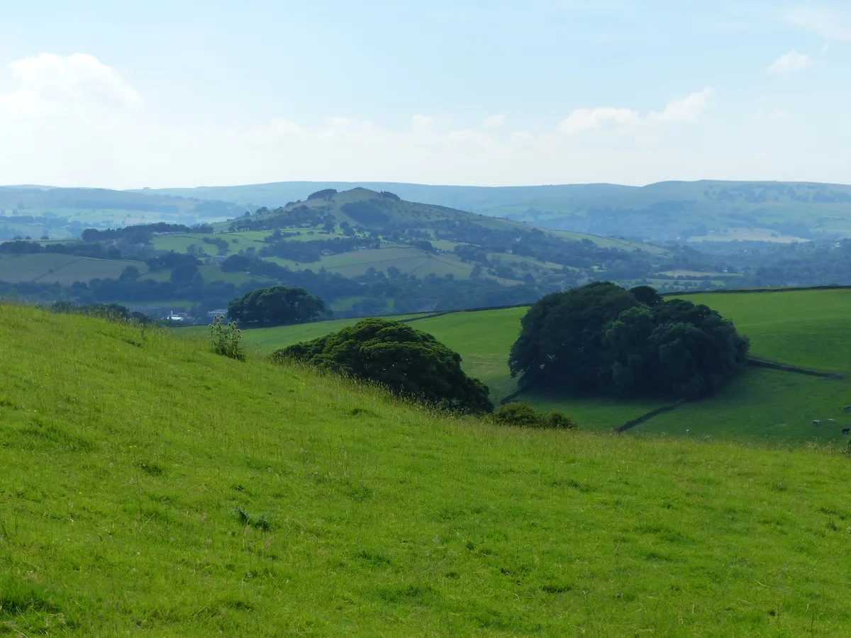
Eccles Pike
Mountains & hills · 2.3 km

Chinley Independent Chapel
Chapels · 2.4 km

Chinley Camping
Campsites · 2.6 km
Nearby
📷 4Chapels · East Midlands
Chapel-en-le-Frith railway station
Chapel-en-le-Frith railway station — a Grade II-listed chapel in england-east-midlands, United Kingdom.
📷 5Museums · East Midlands
Chapel-en-le-Frith
Chapel-en-le-Frith () is a town and civil parish, in the Borough of High Peak, Derbyshire, England. It has been dubbed the "Capital of the Peak", in reference to the Peak District, historically the hi
📷 5Campsites · East Midlands
Combs Valley Campsite
Combs Valley Campsite — a campsite in england east midlands.
📷 3📷 3📷 5Vineyards · East Midlands
Promontory fort on Combs Edge
Promontory fort on Combs Edge — a UK vineyard in england east midlands, producing English or Welsh wine from cool-climate grape varieties.
Where to eat & stay near Bridge on Bank Hall Drive adjacent to Down Lee Farm
Places to stay
📷 5Campsites · East Midlands
Combs Valley Campsite
Combs Valley Campsite — a campsite in england east midlands.
📷 5 📷 5
📷 5Campsites · East Midlands
chapel view campsite
chapel view campsite — a campsite in england east midlands.
 📷 5
📷 5Campsites · East Midlands
Cold Springs Farm Campsite
Cold Springs Farm Campsite — a campsite in england east midlands.
 📷 5
📷 5Caravan parks · East Midlands
Ringstones Caravan Park
Ringstones Caravan Park — a caravan park in england east midlands.
 📷 5
📷 5Hotels · East Midlands
Old Hall Hotel
Old Hall Hotel — a hotel in england east midlands.
Places to eat & drink
 📷 5
📷 5Historic pubs · East Midlands
The Hare And Hounds Hotel
The Hare And Hounds Hotel in England Yorkshire, United Kingdom.
 📷 5
📷 5 📷 5
📷 5Historic pubs · North West England
Disley Friends Meeting House
Disley Friends Meeting House in England North West, United Kingdom.
 📷 4
📷 4Historic pubs · Yorkshire & the Humber
Rams Head Hotel
Rams Head Hotel — Historic pub — listed building or notable heritage status.
 📷 5
📷 5Historic pubs · East Midlands
Cat and Fiddle Inn
Cat and Fiddle Inn in England South East, United Kingdom.
 📷 5
📷 5Historic pubs · East Midlands
The Old Nags Head
The Old Nags Head in England Yorkshire, United Kingdom.
More bridges in this region
 📷 5
📷 5Historic bridges · East Midlands
Mill Race Bridge To Market Deeping Mill
Mill Race Bridge To Market Deeping Mill — Grade II listed building-listed bridge in england-london, United Kingdom.
 📷 5
📷 5Historic bridges · East Midlands
Bridge Over West Glen River
Bridge Over West Glen River — Grade II listed building-listed bridge in england-london, United Kingdom.
 📷 5
📷 5Historic bridges · East Midlands
Bridge And Sluices
Bridge And Sluices — Grade II listed building-listed bridge in england-london, United Kingdom.
 📷 5
📷 5Historic bridges · East Midlands
Bridge Over River Gwash
Bridge Over River Gwash — Grade II listed building-listed bridge in england-london, United Kingdom.
Frequently asked questions
- Where is Bridge on Bank Hall Drive adjacent to Down Lee Farm?
- Bridge on Bank Hall Drive adjacent to Down Lee Farm is in Derbyshire, the East Midlands, United Kingdom (postcode SK23 9UJ), in the parish of Chapel-en-le-Frith.
- What is Bridge on Bank Hall Drive adjacent to Down Lee Farm?
- Bridge on Bank Hall Drive adjacent to Down Lee Farm — Grade II listed building-listed bridge in england-east-midlands, United Kingdom.
- How do I get to Bridge on Bank Hall Drive adjacent to Down Lee Farm?
- The nearest railway station is Chapel-en-le-Frith, about 0.3 km away. The nearest town is Dove Holes. Drivers can use postcode SK23 9UJ.
- When was Bridge on Bank Hall Drive adjacent to Down Lee Farm built?
- Built or established in 1830.
- Is Bridge on Bank Hall Drive adjacent to Down Lee Farm a listed building?
- Bridge on Bank Hall Drive adjacent to Down Lee Farm is officially recognised as Grade II listed building listed.
- Is Bridge on Bank Hall Drive adjacent to Down Lee Farm free to visit?
- Yes, Bridge on Bank Hall Drive adjacent to Down Lee Farm is free to enter.
- How do I get to Bridge on Bank Hall Drive adjacent to Down Lee Farm?
- The nearest railway station is Chapel-en-le-Frith, about 0.3 km away. Drivers can navigate to postcode SK23 9UJ.