
National landscapes (AONB) · North East England
Cauldron Snout
Cauldron Snout is a cascade on the upper reaches of the River Tees in Northern England, immediately below the dam of the Cow Green Reservoir. It is well upstream of the High Force waterfall, and is on

Colin Park — CC BY-SA 2.0 via Wikimedia Commons licence

Plan your visit
- Typical visit
- 3 h–6 h
- Free entry
- Dog-friendly
About
Cauldron Snout is a cascade on the upper reaches of the River Tees in Northern England, immediately below the dam of the Cow Green Reservoir. It is well upstream of the High Force waterfall, and is on the boundary between County Durham and Cumbria (historically Westmorland), England. The waterfall lies within the North Pennines Area of Outstanding Natural Beauty (AONB) and European Geopark. It is more a long cataract than a waterfall, and at 200 yards (180 m) long, reckoned to be the longest waterfall in England. It is impressive by the scale of the British landscape, and attracts a lot of visitors, despite the 3-kilometre (1.9 mi) walk from the nearest car park at Cow Green Reservoir. No fee is payable as of 2020. The Pennine Way takes in Cauldron Snout. The falls are caused by the upper Tees passing over dolerite steps of the Whin Sill.
Photo gallery
Protected designations
- Site of Special Scientific Interest: Upper Teesdale SSSI
- Site of Special Scientific Interest: Appleby Fells SSSI
- Site of Special Scientific Interest: River Eden and Tributaries SSSI
- Site of Special Scientific Interest: Moorhouse and Cross Fell SSSI
Designations sourced from Natural England open data under OGL v3.
From the Wikipedia article
Cauldron Snout is a cascade on the upper reaches of the River Tees in Northern England, immediately below the dam of the Cow Green Reservoir. It is well upstream of the High Force waterfall, and is on the boundary between County Durham and Cumbria (historically Westmorland), England. The waterfall lies within the North Pennines Area of Outstanding Natural Beauty (AONB) and European Geopark. It is more a long cataract than a waterfall, and at 200 yards (180 m) long, reckoned to be the longest waterfall in England. It is impressive by the scale of the British landscape, and attracts a lot of visitors, despite the 3-kilometre (1.9 mi) walk from the nearest car park at Cow Green Reservoir. No fee is payable as of 2020. The Pennine Way takes in Cauldron Snout. The falls are caused by the upper Tees passing over dolerite steps of the Whin Sill.
Excerpt from Wikipedia under CC BY-SA 4.0. See the source article linked in Sources below.
- Coordinates
- 54.6540, -2.2898
- District
- Westmorland and Furness
- Parish
- Dufton
- Postcode
- DL12 0JA
- Parliamentary constituency
- Westmorland and Lonsdale
Sources
- wikipedia: Cauldron Snout (CC BY-SA 4.0)
Other places nearby

Cauldron Snout
Waterfalls · 0.2 km

Cauldron Snout (Waterfall)
Viewpoints · 0.2 km

Caldron Snout
Waterfalls · 0.6 km
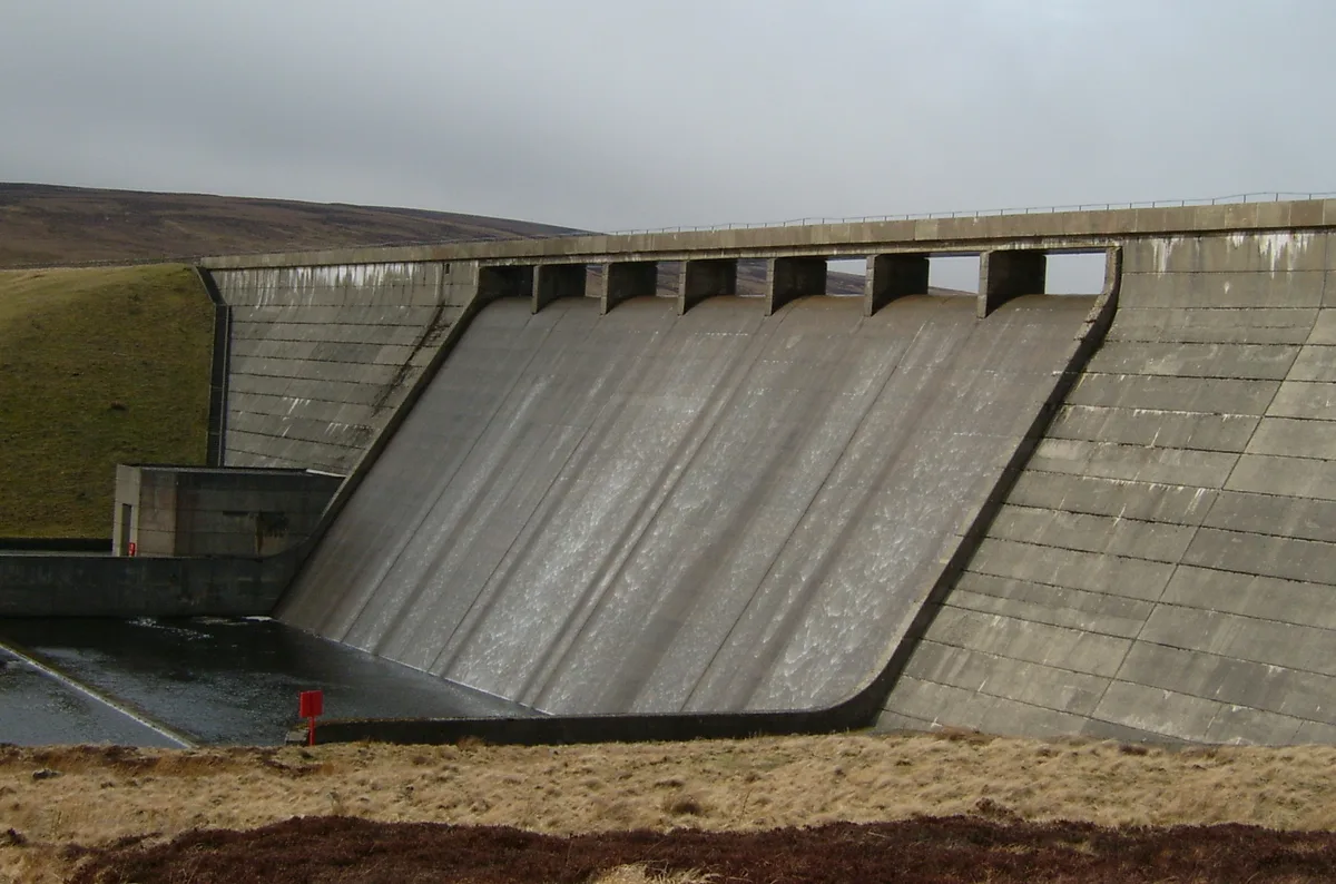
Cow Green Reservoir
Reservoirs & lochs · 2.0 km

Maizebeck Force
Waterfalls · 2.0 km

Moor House National Nature Reserve
Forests & woodlands · 2.4 km

Thistly Hill
Mountains & hills · 2.8 km

Touting Hill
Mountains & hills · 2.9 km

Burnt mound east of Widdy Bank Farm
Archaeological sites · 3.0 km

Burnt mound east of Widdy Bank Farm
Archaeological sites · 3.0 km

Harwood
National landscapes (AONB) · 3.6 km
Upper Teesdale
Wildlife reserves · 3.6 km
Nearby
📷 5📷 3Viewpoints · North East England
Cauldron Snout (Waterfall)
Cauldron Snout (Waterfall) is a viewpoint in the United Kingdom.
📷 5📷 5Reservoirs & lochs · North East England
Cow Green Reservoir
Cow Green Reservoir — reservoir in Cumbria and County Durham, England, UK.
📷 5📷 5Forests & woodlands · North East England
Moor House National Nature Reserve
Moor House National Nature Reserve is a forest or woodland in the United Kingdom.
Where to eat & stay near Cauldron Snout
Places to stay
Hostels · North East England
Langdon Beck Youth Hostel
Langdon Beck Youth Hostel — a hostel in england north east. Brand: Youth Hostels Association.
 📷 5
📷 5Hostels · North East England
Langdon Beck Youth Hostel
Langdon Beck Youth Hostel — a hostel in scotland lowlands.
 📷 5
📷 5Campsites · North East England
Low Way Farm Camping Site
Low Way Farm Camping Site — a campsite in scotland lowlands.
 📷 5
📷 5Caravan parks · North East England
Gate House Cottage Caravan Site
Gate House Cottage Caravan Site — a caravan park in scotland lowlands.
 📷 5
📷 5Caravan parks · North East England
Country Style Holiday Home Park
Country Style Holiday Home Park — a caravan park in scotland lowlands.
 📷 5
📷 5Campsites · North East England
Pennine Lodge
Pennine Lodge — a campsite in scotland lowlands.
Places to eat & drink
 📷 5
📷 5Historic pubs · North East England
1, Scattergate
1, Scattergate in England North East, United Kingdom.
 📷 7
📷 7Cafés · North West England
The White Hare Cafe
The White Hare Cafe — a café in england north west.
 📷 5
📷 5 📷 3
📷 3More national landscapes in this region
 📷 5
📷 5National landscapes (AONB) · North East England
Slaggyford
Slaggyford in England North East, United Kingdom.
 📷 3
📷 3National landscapes (AONB) · North East England
Appleby Fells
Appleby Fells in England North East, United Kingdom.
📷 4National landscapes (AONB) · North East England
Harwood
Harwood in England North East, United Kingdom.
 📷 4
📷 4National landscapes (AONB) · North East England
Halton Lea Gate
Halton Lea Gate in England North East, United Kingdom.
Frequently asked questions
- Where is Cauldron Snout?
- Cauldron Snout is in North-East England, United Kingdom (postcode DL12 0JA), in the parish of Dufton.
- What is Cauldron Snout?
- Cauldron Snout is a cascade on the upper reaches of the River Tees in Northern England, immediately below the dam of the Cow Green Reservoir. It is well upstream of the High Force waterfall, and is on
- How do I get to Cauldron Snout?
- Drivers can use postcode DL12 0JA.
- Is Cauldron Snout a protected site?
- Yes — Cauldron Snout is part of the Upper Teesdale SSSI Site of Special Scientific Interest and the Appleby Fells SSSI Site of Special Scientific Interest.
- Is Cauldron Snout free to visit?
- Yes, Cauldron Snout is free to enter.
- How do I get to Cauldron Snout?
- Drivers can navigate to postcode DL12 0JA. It sits within the Westmorland and Lonsdale parliamentary constituency.