
Wildlife reserves · North East England
Upper Teesdale
Upper Teesdale in England North East, United Kingdom.

Oliver Dixon — CC BY-SA 2.0 via Wikimedia Commons licence

Plan your visit
- Typical visit
- 2 h–4 h
- Best time of year
- Autumn & winter (migration & wildfowl)
- Free entry
- Dog-friendly
About
Upper Teesdale is a place of interest in England North East, United Kingdom — drawn from open-data sources for visitor reference. See the linked Wikipedia article for the full description.
Photo gallery
Official information
Upper Teesdale is a Site of Special Scientific Interest (SSSI) located in County Durham, known for its diverse natural habitats and wildlife. Visitors can explore the area's rich ecological features and enjoy the scenic landscapes of the North Pennines.
Protected designations
- Site of Special Scientific Interest: Upper Teesdale SSSI
- National Nature Reserve: MOOR HOUSE-UPPER TEESDALE
- Area of Outstanding Natural Beauty: North Pennines
Designations sourced from Natural England open data under OGL v3.
From the Wikipedia article
Upper Teesdale is a Site of Special Scientific Interest (SSSI) in the west County Durham, England. It encompasses an extensive upland area that includes the headwaters of the River Tees and the surrounding catchment area upstream of the village of Langdon Beck. The site has a diverse mix of habitats, mainly dry heath, with wet heath and blanket mire in areas that are poorly drained. The Upper Teesdale SSSI is one of the most important botanical sites in Britain; the flora is exceptionally rich in species that are nationally rare, including some that are relicts of the arctic-alpine environment of the last glacial period. The area supports internationally important populations of some wading birds and is home to several rare invertebrates. Within the SSSI are several locations that are of national importance geologically, including one of only two known outcrops of 'sugar' limestone in Britain. The southern part of the SSSI largely coincides with the eastern portion of the Moor House-Upper Teesdale National Nature Reserve, which has been designated a 'Biosphere Reserve' by UNESCO. The entire area falls within the North Pennines Area of Outstanding Natural Beauty. Much of Upper Teesdale SSSI was formerly designated as Upper Teesdale and Appleby Fells SSSI. Following a substantial revision in 1990, most of the site was divided between two new (but adjoining) SSSIs, Upper Teesdale in Durham and Appleby Fells in Cumbria. A small part was amalgamated with Moor House National Nature Reserve to form a third SSSI, Moorhouse and Cross Fell, which is contiguous with the other two. At the same time, two further SSSIs, Mill Beck Wood and Moking Hurth Cave, were incorporated into Upper Teesdale SSSI and ceased to exist as separate entities. Part of the land within Upper Teesdale SSSI is owned by the Ministry of Defence as it includes part of the Warcop Training Area.
Excerpt from Wikipedia under CC BY-SA 4.0. See the source article linked in Sources below.
- Coordinates
- 54.6833, -2.2667
- District
- County Durham
- Parish
- Forest and Frith
- Postcode
- DL12 0HX
- Parliamentary constituency
- Bishop Auckland
- Established
- 1951
- Official site
- designatedsites.naturalengland.org.uk
Sources
- wikidata: Q16248570 (CC0)
- wikipedia: Upper Teesdale (CC BY-SA 4.0)
Other places nearby
Harwood
National landscapes (AONB) · 0.0 km

Forest and Frith
Forests & woodlands · 0.9 km

Touting Hill
Mountains & hills · 1.8 km

Three Pikes
Mountains & hills · 2.4 km

Rough Hill
Mountains & hills · 2.6 km

Burnt mound east of Widdy Bank Farm
Archaeological sites · 2.7 km

Burnt mound east of Widdy Bank Farm
Archaeological sites · 2.7 km
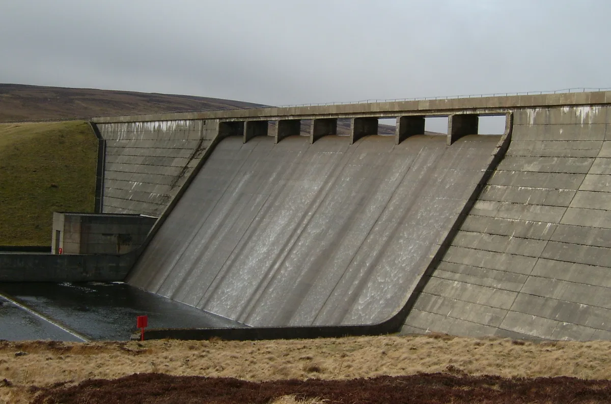
Cow Green Reservoir
Reservoirs & lochs · 3.2 km

Hawk Side Shop
Historic houses · 3.2 km

mine building
Archaeological sites · 3.2 km

Langdon Beck Youth Hostel
Hostels · 3.5 km

Cauldron Snout
National landscapes (AONB) · 3.6 km
Nearby
📷 4National landscapes (AONB) · North East England
Harwood
Harwood in England North East, United Kingdom.
📷 4Forests & woodlands · North East England
Forest and Frith
Forest and Frith in England North East, United Kingdom.
📷 5Mountains & hills · North East England
Touting Hill
Touting Hill — mountain in scotland lowlands. Elevation: 585.5 m.
📷 3Mountains & hills · North East England
Three Pikes
Three Pikes — a mountain in scotland-lowlands, United Kingdom, 650 m.
📷 5Mountains & hills · North East England
Rough Hill
Rough Hill — mountain in scotland lowlands. Elevation: 519 m.
📷 3Archaeological sites · North East England
Burnt mound east of Widdy Bank Farm
Burnt mound east of Widdy Bank Farm — a archaeological in scotland-lowlands, United Kingdom.
Where to eat & stay near Upper Teesdale
Places to stay
📷 5Hostels · North East England
Langdon Beck Youth Hostel
Langdon Beck Youth Hostel — a hostel in scotland lowlands.
 📷 5
📷 5Caravan parks · North East England
Gate House Cottage Caravan Site
Gate House Cottage Caravan Site — a caravan park in scotland lowlands.
 📷 5
📷 5Campsites · North East England
Pennine Lodge
Pennine Lodge — a campsite in scotland lowlands.
 📷 5
📷 5Caravan parks · North East England
Country Style Holiday Home Park
Country Style Holiday Home Park — a caravan park in scotland lowlands.
 📷 5
📷 5Caravan parks · North East England
Westgate Caravan Park and Camping Site
Westgate Caravan Park and Camping Site — a caravan park in scotland lowlands.
 📷 5
📷 5Caravan parks · North East England
Swinhopeburn Caravan Site
Swinhopeburn Caravan Site — a caravan park in scotland lowlands.
Places to eat & drink
 📷 5
📷 5Historic pubs · North East England
1, Scattergate
1, Scattergate in England North East, United Kingdom.
 📷 5
📷 5Historic pubs · North East England
The Lord Crewe Arms Hotel
The Lord Crewe Arms Hotel in Scotland Lowlands, United Kingdom.
 📷 5
📷 5Cafés · North East England
The White Monk Tearoom
The White Monk Tearoom — a café in scotland lowlands.
 📷 7
📷 7Cafés · North West England
The White Hare Cafe
The White Hare Cafe — a café in england north west.
More places in this region
 📷 3
📷 3Wildlife reserves · North East England
Augill Pasture
Augill Pasture — nature reserve in Cumbria, England.
 📷 4
📷 4Wildlife reserves · North East England
Ash Fell Edge
Ash Fell Edge in England North East, United Kingdom.
 📷 4
📷 4Wildlife reserves · North East England
Sunbiggin Tarn
Sunbiggin Tarn in England North East, United Kingdom.
 📷 3
📷 3Wildlife reserves · North East England
Aules Hill Meadows
Aules Hill Meadows in England North East, United Kingdom.
Frequently asked questions
- Where is Upper Teesdale?
- Upper Teesdale is in North-East England, United Kingdom (postcode DL12 0HX), in the parish of Forest and Frith.
- What is Upper Teesdale?
- Upper Teesdale in England North East, United Kingdom.
- How do I get to Upper Teesdale?
- Drivers can use postcode DL12 0HX.
- When was Upper Teesdale built?
- Built or established in 1951.
- Is Upper Teesdale a protected site?
- Yes — Upper Teesdale is part of the Upper Teesdale SSSI Site of Special Scientific Interest and the MOOR HOUSE-UPPER TEESDALE National Nature Reserve.
- Is Upper Teesdale free to visit?
- Yes, Upper Teesdale is free to enter.
- How do I get to Upper Teesdale?
- Drivers can navigate to postcode DL12 0HX. It sits within the Bishop Auckland parliamentary constituency.
- Are dogs allowed at Upper Teesdale?
- Most wildlife reserves allow dogs on lead only, with restrictions during ground-nesting bird season (March-July). Check signage at the reserve.