National landscapes (AONB) · North East England
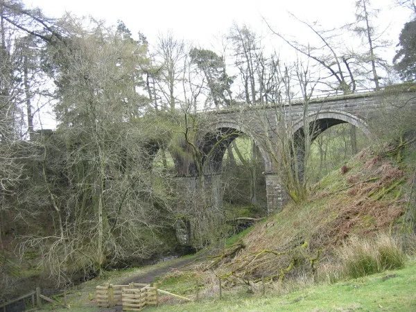
Slaggyford
In or near Coanwood.
Slaggyford in England North East, United Kingdom.

James T M Towill — CC BY-SA 2.0 via Wikimedia Commons licence
Plan your visit
- Typical visit
- 3 h–6 h
- Nearest railway station
- Slaggyford · 0.1 km
- Free entry
- Dog-friendly
- Wheelchair accessible
Getting there & planning your visit
You can reach Slaggyford by train, with the nearest railway station located just 0.1 km away. Entry is free, and the area is wheelchair accessible. The postcode for sat-nav is CA8 7NH.
About
Slaggyford is a place of interest in England North East, United Kingdom — drawn from open-data sources for visitor reference. See the linked Wikipedia article for the full description.
Photo gallery
Protected designations
- Site of Special Scientific Interest: River Eden and Tributaries SSSI
- Area of Outstanding Natural Beauty: North Pennines
Designations sourced from Natural England open data under OGL v3.
From the Wikipedia article
Slaggyford is a village in the civil parish of Knaresdale with Kirkhaugh, in Northumberland, England about 5 miles (8 km) north of Alston, Cumbria. It is set in the South Tyne valley (often called the Tyne Gap). Hadrian's Wall lies to the north of the Tyne Gap. The South Tyne Valley falls within the North Pennines Area of Outstanding Natural Beauty (AONB), the second largest of the 40 AONBs in England and Wales. Slaggyford takes its name from the Old English for ‘muddy, dirty ford’, which may originate from quickly moving river water stirring up the river bed at the bottom of a short steep hill, as the river drops from 1,000 feet (305 m) to 700 feet (213 m) from Alston to Slaggyford. The Pennine Way runs through the village on its way northwards from Alston to Greenhead. The Maiden Way Roman road passes through Slaggyford, with the A689 road following the line of the Roman road for a few hundred yards on the way south out of the village.
Excerpt from Wikipedia under CC BY-SA 4.0. See the source article linked in Sources below.
- Coordinates
- 54.8660, -2.5080
- District
- Northumberland
- Parish
- Knaresdale with Kirkhaugh
- Postcode
- CA8 7NH
- Parliamentary constituency
- Hexham
- Nearest railway station
- Slaggyford — 0.1 km
Sources
- wikidata: Q7538498 (CC0)
- wikipedia: Slaggyford (CC BY-SA 4.0)
Featured in these 2 guides
Other places nearby

Slaggyford railway station
Heritage railway stations · 0.1 km

Knarsdale
Villages · 0.5 km

Fell View Lake House Caravan Park
Caravan parks · 0.6 km

Aules Hill Meadows
Wildlife reserves · 0.7 km

Knarsdale
Other places · 1.0 km

Whitfield Moor, Plenmeller and Asholme Commons
Castles · 1.1 km
Knaresdale with Kirkhaugh
Natural landmarks · 1.3 km

Bridge Over The Knar Burn 200 Metres East Of Knar Farmhouse
Historic bridges · 1.4 km

Kitten Tom
Mountains & hills · 1.6 km
Knar
Natural landmarks · 1.6 km
South Tynedale Railway
Heritage railways · 1.8 km

Knarsdale War Memorial
Memorials & monuments · 1.8 km
Nearby
📷 4Heritage railway stations · North East England
Slaggyford railway station
Slaggyford railway station in England North East, United Kingdom.
📷 5📷 5Caravan parks · North East England
Fell View Lake House Caravan Park
Fell View Lake House Caravan Park — a caravan park in scotland lowlands.
📷 3Wildlife reserves · North East England
Aules Hill Meadows
Aules Hill Meadows in England North East, United Kingdom.
📷 5Other places · North East England
Knarsdale
Knarsdale in England North East, United Kingdom.
📷 3Castles · North East England
Whitfield Moor, Plenmeller and Asholme Commons
Whitfield Moor, Plenmeller and Asholme Commons in England North East, United Kingdom.
Where to eat & stay near Slaggyford
Places to stay
📷 5Caravan parks · North East England
Fell View Lake House Caravan Park
Fell View Lake House Caravan Park — a caravan park in scotland lowlands.
 📷 5
📷 5Caravan parks · North East England
Yont The Cleugh
Yont The Cleugh — a caravan park in scotland lowlands.
 📷 7
📷 7B&Bs · North East England
Lowbyer Manor Country House
Lowbyer Manor Country House — a bed-and-breakfast in scotland lowlands.
 📷 5
📷 5 📷 5
📷 5 📷 5
📷 5Places to eat & drink
 📷 4
📷 4Historic pubs · North West England
Hallbankgate
Hallbankgate in England North East, United Kingdom.
 📷 5
📷 5 📷 5
📷 5Historic pubs · North West England
Graham Arms (West Of Gelt Bridge)
Graham Arms (West Of Gelt Bridge) in Scotland Lowlands, United Kingdom.
 📷 4
📷 4 📷 7
📷 7Historic pubs · North East England
Anchor Hotel
Anchor Hotel in Scotland Lowlands, United Kingdom.
 📷 3
📷 3More national landscapes in this region
 📷 3
📷 3National landscapes (AONB) · North East England
Appleby Fells
Appleby Fells in England North East, United Kingdom.
 📷 4
📷 4National landscapes (AONB) · North East England
Harwood
Harwood in England North East, United Kingdom.
 📷 4
📷 4National landscapes (AONB) · North East England
Halton Lea Gate
Halton Lea Gate in England North East, United Kingdom.
 📷 4
📷 4National landscapes (AONB) · North East England
High Cup Gill
High Cup Gill in England North East, United Kingdom.
Frequently asked questions
- Where is Slaggyford?
- Slaggyford is in North-East England, United Kingdom (postcode CA8 7NH), in the parish of Knaresdale with Kirkhaugh.
- What is Slaggyford?
- Slaggyford in England North East, United Kingdom.
- How do I get to Slaggyford?
- The nearest railway station is Slaggyford, about 0.1 km away. Drivers can use postcode CA8 7NH.
- Is Slaggyford a protected site?
- Yes — Slaggyford is part of the River Eden and Tributaries SSSI Site of Special Scientific Interest and the North Pennines National Landscape (AONB).
- Is Slaggyford free to visit?
- Yes, Slaggyford is free to enter.
- How do I get to Slaggyford?
- The nearest railway station is Slaggyford, about 0.1 km away. Drivers can navigate to postcode CA8 7NH.