
Mountains & hills · North East England
Cateran Hole
In or near Chillingham.
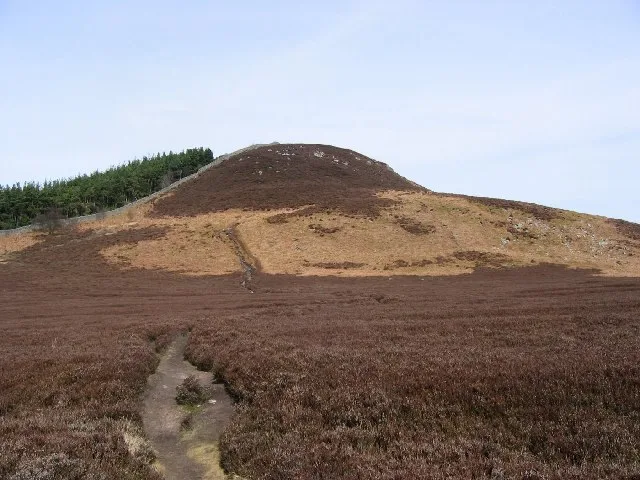
Cateran Hole — Cave in Northumberland, England.

Wikimedia Commons contributors — see linked file page for photographer and licence licence

Plan your visit
- Typical visit
- 3 h–8 h
- Best time of year
- Late spring – early autumn (May–Oct)
- Nearest railway station
- Chathill · 9.1 km
- Free entry
- Dog-friendly
Getting there & planning your visit
Cateran Hole is located in central Scotland, with the nearest railway station being Chathill, approximately 9.1 km away. Entry is free.
About
Cateran Hole is a named summit in the United Kingdom. Wikidata describes it as: "Cave in Northumberland, England". Coordinates: 55.5036°, -1.8381°.
Photo gallery
Protected designations
- Site of Special Scientific Interest: Bewick and Beanley Moors SSSI
- Site of Special Scientific Interest: Northumberland Shore SSSI
- Area of Outstanding Natural Beauty: Northumberland Coast
Designations sourced from Natural England open data under OGL v3.
From the Wikipedia article
Cateran Hole is a circa 35m length cave set in the Gritstone of Cateran Hill in Northumberland. It lies about 4 miles due north of Eglingham, and can be reached by lining up the tall mast behind the farm with the left-hand end of the wood to the side of the Quarry House farm (to the north of the cave), then walking on this bearing. A shallow crater with cut steps leads down into an easy rift passage which ultimately chokes. After the initial steepness of the steps, the passage is roomy with a slight downward tilt, running between two large planes of Gritstone which close in above. After about 30m a block, protruding downwards from the ceiling, reduces the route to a crawl into a small chamber which is choked by large blocks ahead. This crawl is sandy and often completely dry, although in very wet weather it occasionally sumps. The main fault, however, continues, and it is likely that this cave could be extended by concerted digging (a dangerous activity), although it is difficult to see why this would be done in Gritstone, where there is unlikely to be found any significant lateral development. Cateran Hole is reputed to have been a smugglers' hiding place, although locals claim that it once linked nearby Chillingham Castle with Hepburn. The latter seems unlikely as it tends in the direction of neither, while the carved stone steps favour the former.
Excerpt from Wikipedia under CC BY-SA 4.0. See the source article linked in Sources below.
- Coordinates
- 55.5036, -1.8381
- District
- Northumberland
- Parish
- Bewick
- Postcode
- NE67 5JA
- Parliamentary constituency
- North Northumberland
- Nearest railway station
- Chathill — 9.1 km
Sources
- wikidata: Q5051893 (CC0)
- wikipedia: Cateran Hole (CC BY-SA 4.0)
- commons: Cateran Hole Interior.JPG (CC BY-SA 4.0)
Other places nearby

Cateran Hill
Mountains & hills · 0.1 km

Cateran Hole
Caves · 0.4 km

Bewick and Beanley Moors
Wildlife reserves · 1.1 km

Shepherd
Memorials & monuments · 1.2 km

Castle Hill
Mountains & hills · 1.2 km

Foumart Knowe
Mountains & hills · 1.9 km

Bridge Circa 200 Yards West Of Botany
Historic bridges · 2.0 km

Bewick Hill Moor camp, Old Bewick
Vineyards · 2.1 km

Hangwell Law
Mountains & hills · 2.4 km

Tick Law
Mountains & hills · 2.8 km

Willie Law
Mountains & hills · 2.9 km
Ros Hill
Natural landmarks · 3.0 km
Nearby
📷 5Mountains & hills · North East England
Cateran Hill
Cateran Hill — mountain in scotland central. Elevation: 267 m.
📷 3📷 4Wildlife reserves · North East England
Bewick and Beanley Moors
Bewick and Beanley Moors in England North East, United Kingdom.
📷 5Memorials & monuments · North East England
Shepherd
Shepherd — a memorial in scotland-lowlands, United Kingdom.
📷 5Mountains & hills · North East England
Castle Hill
Castle Hill — mountain in scotland lowlands. Elevation: 242 m.
📷 5Mountains & hills · North East England
Foumart Knowe
Foumart Knowe — mountain in scotland central. Elevation: 211 m.
Where to eat & stay near Cateran Hole
Places to stay
 📷 5
📷 5Caravan parks · North East England
Adderstone Caravan Park
Adderstone Caravan Park — a caravan park in scotland central.
 📷 5
📷 5Campsites · North East England
Powburn Scout Adventure Centre
Powburn Scout Adventure Centre — a campsite in scotland lowlands.
 📷 5
📷 5Caravan parks · North East England
Orchard Caravan Park
Orchard Caravan Park — a caravan park in scotland central.
 📷 5
📷 5Caravan parks · North East England
River Breamish - Caravan Club site
River Breamish - Caravan Club site — a caravan park in scotland lowlands.
 📷 5
📷 5Campsites · North East England
Tewart Arms Cottage Camping & Caravan Site
Tewart Arms Cottage Camping & Caravan Site — a campsite in scotland central.
 📷 5
📷 5Caravan parks · North East England
South Meadows Caravan Park
South Meadows Caravan Park — a caravan park in scotland central.
Places to eat & drink
 📷 7
📷 7Historic pubs · North East England
Plough Inn With Outbuilding To North
Plough Inn With Outbuilding To North in Scotland Lowlands, United Kingdom.
 📷 7
📷 7Historic pubs · North East England
Bridge Of Aln Hotel
Bridge Of Aln Hotel in Scotland Lowlands, United Kingdom.
 📷 7
📷 7 📷 7
📷 7Historic pubs · North East England
Black Swan Public House
Black Swan Public House in Scotland Lowlands, United Kingdom.
 📷 7
📷 7 📷 5
📷 5More mountains in this region
 📷 5
📷 5Mountains & hills · North East England
Danby High Moor
Danby High Moor — a hill or mountain in england yorkshire.
 📷 5
📷 5Mountains & hills · North East England
Arndale Hill
Arndale Hill — mountain in england yorkshire. Elevation: 515.7 m.
 📷 5
📷 5Mountains & hills · North East England
Peat Hill
Peat Hill — mountain in england yorkshire. Elevation: 396 m.
 📷 5
📷 5Mountains & hills · North East England
Cocker Hill
Cocker Hill — mountain in england yorkshire. Elevation: 470 m.
Frequently asked questions
- Where is Cateran Hole?
- Cateran Hole is in North-East England, United Kingdom (postcode NE67 5JA), in the parish of Bewick.
- What is Cateran Hole?
- Cateran Hole — Cave in Northumberland, England.
- How do I get to Cateran Hole?
- The nearest railway station is Chathill, about 9.1 km away. The nearest town is Chillingham. Drivers can use postcode NE67 5JA.
- Is Cateran Hole a protected site?
- Yes — Cateran Hole is part of the Bewick and Beanley Moors SSSI Site of Special Scientific Interest and the Northumberland Shore SSSI Site of Special Scientific Interest.
- Is Cateran Hole free to visit?
- Yes, Cateran Hole is free to enter.
- How do I get to Cateran Hole?
- Drivers can navigate to postcode NE67 5JA. It sits within the North Northumberland parliamentary constituency.