
Wildlife reserves · North East England
Bewick and Beanley Moors
In or near Chillingham.
Bewick and Beanley Moors in England North East, United Kingdom.

Dave Dunford — CC BY-SA 2.0 via Wikimedia Commons licence

Plan your visit
- Typical visit
- 2 h–4 h
- Best time of year
- Autumn & winter (migration & wildfowl)
- Free entry
- Dog-friendly
About
Bewick and Beanley Moors is a place of interest in England North East, United Kingdom — drawn from open-data sources for visitor reference. See the linked Wikipedia article for the full description.
Photo gallery
Protected designations
- Site of Special Scientific Interest: Bewick and Beanley Moors SSSI
- Site of Special Scientific Interest: Northumberland Shore SSSI
- Area of Outstanding Natural Beauty: Northumberland Coast
Designations sourced from Natural England open data under OGL v3.
From the Wikipedia article
Bewick and Beanley Moors is the name given to a Site of Special Scientific Interest (SSSI) in north Northumberland, in the north-east of England. The moors are asserted to be of national importance by Natural England for the extent, quality and diversity of upland types including heaths, fens, wet grassland, flushes, mires and blanket bogs, together creating an extensive mosaic habitat supporting an exceptional community of amphibians. The moors are important, too, for their relict juniper woodland and scrub. Designated in 2010, Bewick and Beanley Moors incorporates within its boundaries two now denotified SSSIs, Hannah's Hill, Harehope (first notified in 1968) and Quarryhouse Moor Ponds (first notified in 1986).
Excerpt from Wikipedia under CC BY-SA 4.0. See the source article linked in Sources below.
- Coordinates
- 55.4982, -1.8536
Sources
- wikidata: Q27990679 (CC0)
- wikipedia: Bewick and Beanley Moors (CC BY-SA 4.0)
Other places nearby

Castle Hill
Mountains & hills · 0.3 km

Bewick Hill Moor camp, Old Bewick
Vineyards · 0.9 km
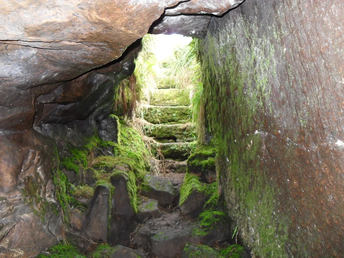
Cateran Hole
Mountains & hills · 1.1 km

Cateran Hill
Mountains & hills · 1.2 km

Cateran Hole
Caves · 1.3 km

Shepherd
Memorials & monuments · 1.5 km

Tick Law
Mountains & hills · 1.7 km

Harehope Hill
Mountains & hills · 2.1 km

Bewick Hill
Mountains & hills · 2.1 km

Bridge Circa 200 Yards West Of Botany
Historic bridges · 2.1 km

Forts
Archaeological sites · 2.2 km
Bewick Hill camp
Vineyards · 2.2 km
Nearby
📷 5Mountains & hills · North East England
Castle Hill
Castle Hill — mountain in scotland lowlands. Elevation: 242 m.
📷 5Vineyards · North East England
Bewick Hill Moor camp, Old Bewick
Bewick Hill Moor camp, Old Bewick — a UK vineyard in scotland lowlands, producing English or Welsh wine from cool-climate grape varieties.
📷 4Mountains & hills · North East England
Cateran Hole
Cateran Hole — Cave in Northumberland, England.
📷 5Mountains & hills · North East England
Cateran Hill
Cateran Hill — mountain in scotland central. Elevation: 267 m.
📷 3📷 5Memorials & monuments · North East England
Shepherd
Shepherd — a memorial in scotland-lowlands, United Kingdom.
Where to eat & stay near Bewick and Beanley Moors
Places to stay
 📷 5
📷 5Campsites · North East England
Powburn Scout Adventure Centre
Powburn Scout Adventure Centre — a campsite in scotland lowlands.
 📷 5
📷 5Caravan parks · North East England
River Breamish - Caravan Club site
River Breamish - Caravan Club site — a caravan park in scotland lowlands.
 📷 5
📷 5Caravan parks · North East England
Adderstone Caravan Park
Adderstone Caravan Park — a caravan park in scotland central.
 📷 5
📷 5Caravan parks · North East England
Orchard Caravan Park
Orchard Caravan Park — a caravan park in scotland central.
 📷 5
📷 5Caravan parks · North East England
South Meadows Caravan Park
South Meadows Caravan Park — a caravan park in scotland central.
 📷 5
📷 5Campsites · North East England
Tewart Arms Cottage Camping & Caravan Site
Tewart Arms Cottage Camping & Caravan Site — a campsite in scotland central.
Places to eat & drink
 📷 7
📷 7Historic pubs · North East England
Plough Inn With Outbuilding To North
Plough Inn With Outbuilding To North in Scotland Lowlands, United Kingdom.
 📷 7
📷 7Historic pubs · North East England
Bridge Of Aln Hotel
Bridge Of Aln Hotel in Scotland Lowlands, United Kingdom.
 📷 7
📷 7 📷 7
📷 7Historic pubs · North East England
Black Swan Public House
Black Swan Public House in Scotland Lowlands, United Kingdom.
 📷 7
📷 7 📷 5
📷 5More places in this region
 📷 3
📷 3Wildlife reserves · North East England
Augill Pasture
Augill Pasture — nature reserve in Cumbria, England.
 📷 4
📷 4Wildlife reserves · North East England
Ash Fell Edge
Ash Fell Edge in England North East, United Kingdom.
 📷 4
📷 4Wildlife reserves · North East England
Sunbiggin Tarn
Sunbiggin Tarn in England North East, United Kingdom.
 📷 3
📷 3Wildlife reserves · North East England
Aules Hill Meadows
Aules Hill Meadows in England North East, United Kingdom.
Frequently asked questions
- Where is Bewick and Beanley Moors?
- Bewick and Beanley Moors is in North-East England, United Kingdom.
- What is Bewick and Beanley Moors?
- Bewick and Beanley Moors in England North East, United Kingdom.
- How do I get to Bewick and Beanley Moors?
- The nearest town is Chillingham. Its coordinates are 55.4982°, -1.8536°.
- Is Bewick and Beanley Moors a protected site?
- Yes — Bewick and Beanley Moors is part of the Bewick and Beanley Moors SSSI Site of Special Scientific Interest and the Northumberland Shore SSSI Site of Special Scientific Interest.
- Is Bewick and Beanley Moors free to visit?
- Yes, Bewick and Beanley Moors is free to enter.
- Are dogs allowed at Bewick and Beanley Moors?
- Most wildlife reserves allow dogs on lead only, with restrictions during ground-nesting bird season (March-July). Check signage at the reserve.