
Historic bridges · North East England
Bridge Circa 200 Yards West Of Botany
In or near Chillingham.
Bridge Circa 200 Yards West Of Botany — Grade II listed building-listed bridge in scotland-central, United Kingdom.

DS Pugh — CC BY-SA 2.0 via Wikimedia Commons licence

Plan your visit
- Typical visit
- 15 min–30 min
- Nearest railway station
- Chathill · 9.8 km
- Free entry
- Dog-friendly
Getting there & planning your visit
The nearest railway station is Chathill, located 9.8 km away. Entry to the bridge is free.
About
Bridge Circa 200 Yards West Of Botany is a Grade II listed building-listed bridge in scotland-central, United Kingdom, registered on the National Heritage List for England (NHLE entry 1042385). Listed status protects buildings and structures of special architectural or historic interest. See the linked Wikipedia article for further details.
Photo gallery
Heritage listing
Details NU02 SE CHILLINGHAM BOTANY 8/38 Bridge. c.200 yards West of Botany II Bridge. C19. Dressed stone. Ashlar tunnel vault. Small round-arched structure with plain parapet. Invert, lined with dressed stone, forms a steep chute, the sides of which are also dressed stone and splay out below tile bridge. Listing NGR: NU0903324832 Legacy The contents of this record have been generated from a legacy data system. Legacy System number: 237505 Legacy System: LBS
From the Historic England List Entry under OGL v3.
Protected designations
- Site of Special Scientific Interest: Bewick and Beanley Moors SSSI
- Site of Special Scientific Interest: Northumberland Shore SSSI
- Area of Outstanding Natural Beauty: Northumberland Coast
Designations sourced from Natural England open data under OGL v3.
Place summary
Bridge Circa 200 Yards West Of Botany is a Grade II listed bridge located in central Scotland. Its designation reflects architectural or historical significance, contributing to the region's heritage.
AI-generated from the structured facts on this page (operator, designation, listing, era). Not a substitute for visiting.
- Coordinates
- 55.5172, -1.8585
- District
- Northumberland
- Parish
- Bewick
- Postcode
- NE67 5JA
- Parliamentary constituency
- North Northumberland
- Nearest railway station
- Chathill — 9.8 km
Sources
- wikidata: Q26294147 (CC0)
Other places nearby
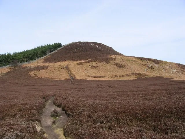
Ros Hill
Natural landmarks · 1.0 km

Univallate hillfort, 560m south west of Shepherd's Cairn
Vineyards · 1.0 km

Ros Castle fort
Castles · 1.0 km
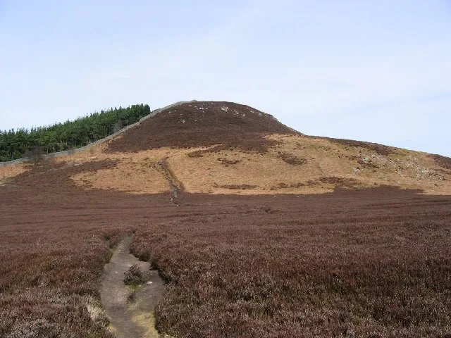
Ros Castle
Mountains & hills · 1.1 km

Willie Law
Mountains & hills · 1.4 km

Hepburn Crags
Mountains & hills · 1.4 km

Promontory fort, 551m east of Hepburn Cottage
Vineyards · 1.6 km

Cateran Hole
Caves · 1.7 km

Cyst and Capstone
Follies · 1.8 km

Chillingham cattle
Castles · 1.8 km

Cateran Hill
Mountains & hills · 1.9 km

Hepburn Bastle
Historic houses · 1.9 km
Nearby
📷 3📷 5Vineyards · North East England
Univallate hillfort, 560m south west of Shepherd's Cairn
Univallate hillfort, 560m south west of Shepherd's Cairn — a UK vineyard in scotland central, producing English or Welsh wine from cool-climate grape varieties.
📷 3Castles · North East England
Ros Castle fort
Ros Castle fort — a castle in scotland-central, United Kingdom.
📷 3📷 5Mountains & hills · North East England
Willie Law
Willie Law — mountain in scotland central. Elevation: 248 m.
📷 5Mountains & hills · North East England
Hepburn Crags
Hepburn Crags — mountain in scotland central. Elevation: 277 m.
Where to eat & stay near Bridge Circa 200 Yards West Of Botany
Places to stay
 📷 5
📷 5Caravan parks · North East England
Adderstone Caravan Park
Adderstone Caravan Park — a caravan park in scotland central.
 📷 5
📷 5Campsites · North East England
Powburn Scout Adventure Centre
Powburn Scout Adventure Centre — a campsite in scotland lowlands.
 📷 5
📷 5Caravan parks · North East England
Orchard Caravan Park
Orchard Caravan Park — a caravan park in scotland central.
 📷 5
📷 5Caravan parks · North East England
South Meadows Caravan Park
South Meadows Caravan Park — a caravan park in scotland central.
 📷 5
📷 5Caravan parks · North East England
River Breamish - Caravan Club site
River Breamish - Caravan Club site — a caravan park in scotland lowlands.
 📷 5
📷 5Hotels · North East England
The Blue Bell Hotel
The Blue Bell Hotel — a hotel in scotland central.
Places to eat & drink
 📷 7
📷 7Historic pubs · North East England
Plough Inn With Outbuilding To North
Plough Inn With Outbuilding To North in Scotland Lowlands, United Kingdom.
 📷 7
📷 7 📷 7
📷 7Historic pubs · North East England
Bridge Of Aln Hotel
Bridge Of Aln Hotel in Scotland Lowlands, United Kingdom.
 📷 7
📷 7Historic pubs · North East England
Black Swan Public House
Black Swan Public House in Scotland Lowlands, United Kingdom.
 📷 7
📷 7 📷 5
📷 5More bridges in this region
 📷 3
📷 3Historic bridges · North East England
Bridge About 30 Metres South Of The Manor House
Bridge About 30 Metres South Of The Manor House — Grade II listed building-listed bridge in england-yorkshire, United Kingdom.
 📷 3
📷 3Historic bridges · North East England
Old Bridge Over Nor Beck, On East Side Of Road
Old Bridge Over Nor Beck, On East Side Of Road — Grade II listed building-listed bridge in england-yorkshire, United Kingdom.
 📷 3
📷 3Historic bridges · North East England
Barnard Castle Bridge
Barnard Castle Bridge is a historic bridge in the United Kingdom.
 📷 3
📷 3Historic bridges · North East England
Blandswath Bridge
Blandswath Bridge is a historic bridge in the United Kingdom.
Frequently asked questions
- Where is Bridge Circa 200 Yards West Of Botany?
- Bridge Circa 200 Yards West Of Botany is in North-East England, United Kingdom (postcode NE67 5JA), in the parish of Bewick.
- What is Bridge Circa 200 Yards West Of Botany?
- Bridge Circa 200 Yards West Of Botany — Grade II listed building-listed bridge in scotland-central, United Kingdom.
- How do I get to Bridge Circa 200 Yards West Of Botany?
- The nearest railway station is Chathill, about 9.8 km away. The nearest town is Chillingham. Drivers can use postcode NE67 5JA.
- Is Bridge Circa 200 Yards West Of Botany a listed building?
- Bridge Circa 200 Yards West Of Botany is officially recognised as Grade II listed building listed.
- Is Bridge Circa 200 Yards West Of Botany a protected site?
- Yes — Bridge Circa 200 Yards West Of Botany is part of the Bewick and Beanley Moors SSSI Site of Special Scientific Interest and the Northumberland Shore SSSI Site of Special Scientific Interest.
- Is Bridge Circa 200 Yards West Of Botany free to visit?
- Yes, Bridge Circa 200 Yards West Of Botany is free to enter.
- How do I get to Bridge Circa 200 Yards West Of Botany?
- Drivers can navigate to postcode NE67 5JA. It sits within the North Northumberland parliamentary constituency.