
Mountains & hills · East Midlands
Carl Wark
In or near Hathersage.
Carl Wark — Named summit at 370 m.

Wikimedia Commons contributors — see linked file page for photographer and licence licence

Plan your visit
- Typical visit
- 3 h–8 h
- Best time of year
- Late spring – early autumn (May–Oct)
- Nearest railway station
- Hathersage · 2.7 km
- Free entry
- Dog-friendly
Getting there & planning your visit
To visit Carl Wark, the nearest railway station is Hathersage, located 2.7 km away. Entry is free.
About
Carl Wark is a named summit in the United Kingdom. Wikidata describes it as: "Named summit at 370 m.". Coordinates: 53.3292°, -1.6119°.
Photo gallery
Protected designations
- Site of Special Scientific Interest: Eastern Peak District Moors SSSI
Designations sourced from Natural England open data under OGL v3.
From the Wikipedia article
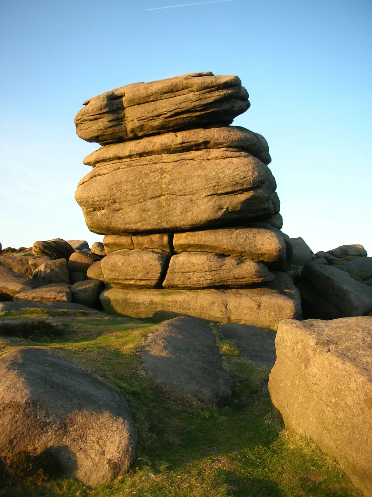
Carl Wark (sometimes Carl's Wark) is a rocky promontory on Hathersage Moor in the Peak District National Park, just inside the boundary of Sheffield, England. The promontory is faced by vertical cliffs on all but one side, which is protected by a prehistoric embankment. The cliffs and embankment form an enclosure that has been interpreted as an Iron Age hill fort, though the date of construction and purpose of the fortifications remains unknown. The site is a scheduled monument.
Excerpt from Wikipedia under CC BY-SA 4.0. See the source article linked in Sources below.
Background
History
The date and purpose of the construction of the rampart at Carl Wark are uncertain. It has been described as being "unlike any other [structure] found in Northern England." It is widely postulated to be a hill fort of Iron Age origin, perhaps dating from the 8th to the 5th centuries BC, though a similar enclosure at Gardom's Edge has been dated to the late Bronze Age, between 1300 and 900 BC. There is no evidence of settlement within the enclosure so it is unlikely that the site was used for a continuously occupied fort; it may have been used as a place of refuge for a population living in the surrounding area or it may have had some ceremonial purpose. In 1861 historian John Gardner…
Architecture
The promontory is approximately 230 m long and 60 m wide, oriented south-east to north-west. It gently slopes down to the west; at the peak of the promontory an area of 0.7 ha—180 m long, 60 m wide—is enclosed by natural cliffs enhanced with man-made fortifications. The eastern and north-eastern sides of this enclosure are faced with vertical cliffs of up to 10 m in height. The southern edge of the enclosure consists of large earth-fast boulders that have been reinforced with millstone grit blocks, forming a wall 2 – high. A rampart across the western end of the promontory completes the enclosure. The rampart is 40 m long and 8 m wide at its base, rising to a height of 3 m. It is…
Sourced from Wikipedia under CC BY-SA 4.0.
- Coordinates
- 53.3292, -1.6119
- District
- Sheffield
- Parish
- Sheffield, unparished area
- Postcode
- S11 7TW
- Parliamentary constituency
- Sheffield Hallam
- Nearest railway station
- Hathersage — 2.7 km
Sources
- osm: n255173948 (ODbL)
- wikipedia: Carl Wark (CC BY-SA 4.0)
- commons: Carl Wark 061009.jpg (CC BY-SA 4.0)
Other places nearby

Carl Wark slight univallate hillfort
Vineyards · 0.0 km

Packhorse Bridge
Historic bridges · 0.4 km
Higger Tor
Mountains & hills · 0.6 km

The Liver
Climbing & bouldering crags · 0.6 km

The Kidney
Climbing & bouldering crags · 0.6 km
The Fat Cobra
Climbing & bouldering crags · 0.7 km
Pock Block
Climbing & bouldering crags · 0.7 km
The Rabbit
Climbing & bouldering crags · 0.7 km

Higgar Tor
Climbing & bouldering crags · 0.7 km
The Dog
Climbing & bouldering crags · 0.7 km
The Brick
Climbing & bouldering crags · 0.7 km
The Sheep
Climbing & bouldering crags · 0.7 km
Nearby
📷 5Vineyards · East Midlands
Carl Wark slight univallate hillfort
Carl Wark slight univallate hillfort — a UK vineyard in england east midlands, producing English or Welsh wine from cool-climate grape varieties.
📷 4Historic bridges · East Midlands
Packhorse Bridge
Packhorse Bridge is a historic bridge in the United Kingdom.
📷 3📷 5Climbing & bouldering crags · East Midlands
The Liver
The Liver — a climbing crag in england east midlands.
📷 5Climbing & bouldering crags · East Midlands
The Kidney
The Kidney — a climbing crag in england east midlands.
📷 5Climbing & bouldering crags · East Midlands
The Fat Cobra
The Fat Cobra — a climbing crag in england east midlands.
Where to eat & stay near Carl Wark
Places to stay
 📷 5
📷 5Campsites · East Midlands
North Lees Campsite
North Lees Campsite — a campsite in england east midlands.
 📷 5
📷 5Hostels · East Midlands
YHA Hathersage
YHA Hathersage — a hostel in england east midlands. Brand: Youth Hostels Association.
 📷 5
📷 5Hostels · East Midlands
The Maynard
The Maynard — a hostel in england east midlands.
 📷 5
📷 5Hostels · East Midlands
Thorpe Farm Bunkhouses
Thorpe Farm Bunkhouses — a hostel in england east midlands.
📷 5 📷 5
📷 5Places to eat & drink
 📷 7
📷 7Historic pubs · Yorkshire & the Humber
The Fox House
The Fox House in England Yorkshire, United Kingdom.
 📷 5
📷 5Historic pubs · Yorkshire & the Humber
Norfolk Arms Public House
Norfolk Arms Public House in England Yorkshire, United Kingdom.
 📷 5
📷 5Historic pubs · East Midlands
The Chequers Inn and attached outbuildings
The Chequers Inn and attached outbuildings in England East Midlands, United Kingdom.
 📷 5
📷 5Historic pubs · Yorkshire & the Humber
Union Hotel and adjoining boundary wall
Union Hotel and adjoining boundary wall in England Yorkshire, United Kingdom.
 📷 5
📷 5Historic pubs · East Midlands
The Eyre Arms Public House
The Eyre Arms Public House in England East Midlands, United Kingdom.
 📷 7
📷 7Historic pubs · East Midlands
The Three Stags' Heads
The Three Stags' Heads in England South East, United Kingdom.
More mountains in this region
 📷 5
📷 5Mountains & hills · East Midlands
Errwood Hall
The ruin of Errwood Hall is a popular tourist destination in the scenic Upper Goyt Valley within the Peak District of England.
 📷 3
📷 3 📷 5
📷 5 📷 3
📷 3Mountains & hills · East Midlands
Black Edge - Summit
Black Edge - Summit — Named summit at 506.7 m.
Frequently asked questions
- Where is Carl Wark?
- Carl Wark is in the East Midlands, United Kingdom (postcode S11 7TW), in the parish of Sheffield, unparished area.
- What is Carl Wark?
- Carl Wark — Named summit at 370 m.
- How do I get to Carl Wark?
- The nearest railway station is Hathersage, about 2.7 km away. The nearest town is Hathersage. Drivers can use postcode S11 7TW.
- Is Carl Wark a protected site?
- Yes — Carl Wark is part of the Eastern Peak District Moors SSSI Site of Special Scientific Interest.
- Is Carl Wark free to visit?
- Yes, Carl Wark is free to enter.
- How do I get to Carl Wark?
- The nearest railway station is Hathersage, about 2.7 km away. Drivers can navigate to postcode S11 7TW.