
Towns & cities · Northern Ireland
Camlough
Camlough — village in County Armagh, Northern Ireland, UK.

Wikimedia Commons contributors — see linked file page for photographer and licence licence

Plan your visit
- Typical visit
- 3 h–6 h
- Nearest railway station
- Newry · 3.3 km
- Free entry
- Family-friendly
- Dog-friendly
About
Camlough is a town, city, village or settlement in the United Kingdom. Recent population estimates put it at around 1,074 people. Address: BT35. Wikidata describes it as: "village in County Armagh, Northern Ireland, UK". Coordinates: 54.1805°, -6.4109°.
Photo gallery
See it from the streetimagery from 2020
Imagery © Mapillary contributors, CC BY-SA 4.0
From the Wikipedia article
Camlough ( KAM-lokh; from Irish Camloch, meaning 'crooked lake') is a village west of Newry in County Armagh, Northern Ireland. The village is named after a lake, known as the Cam Lough. South of the village is Camlough Mountain (or Slieve Girkin), part of the Ring of Gullion which is an Area of Outstanding Natural Beauty. Camlough had a population of 1,074 at the 2011 census.
Excerpt from Wikipedia under CC BY-SA 4.0. See the source article linked in Sources below.
Background
History
Evidence of pre-Christian settlement in and around the village includes several dolmens (portal tombs) on Camlough Mountain. The Hag's Chair in Lislea and the Ballykeel Dolmen also indicate settlement in the area during the Neolithic period. Camlough was an ecclesiastical district in the Barony of Upper Orior and was anciently part of the O'Hanlon's country. At the time of the Plantation of Ulster, 1000 acres of 12 townlands were granted to Henry McShane O'Neill and the village was developed during this period. Camlough village is in the townland of Cross, referring not to a stone monument but to the village crossroads in the north of the townland. In 1620 Camlough Mountain was known as…
Description
Camlough is situated in South Armagh, which was the most militarised region in Western Europe during the Troubles. The region was a stronghold of support for the Provisional IRA, earning it the nickname 'Bandit Country' (see Provisional IRA South Armagh Brigade). On 19 May 1981, five British soldiers were killed in an Irish Republican Army (IRA) landmine attack on the Chancellors Road 3 miles from Camlough. The soldiers had been travelling in a Saracen armoured personnel carrier when the bomb exploded. This attack was during the 1981 Irish hunger strike in Maze (HM Prison), and 3 miles from the home of one of the hunger strikers, Raymond McCreesh.
Sourced from Wikipedia under CC BY-SA 4.0.
- Coordinates
- 54.1805, -6.4109
- District
- Newry, Mourne and Down
- Postcode
- BT35
- Parliamentary constituency
- Newry and Armagh
- Population
- 1,074
- Nearest railway station
- Newry — 3.3 km
Sources
- wikidata: Q1249329 (CC0)
- wikipedia: Camlough (CC BY-SA 4.0)
- commons: Cam Lough - geograph.org.uk - 267458.jpg (CC BY-SA 4.0)
Other places nearby

In-Flux
Public art & sculpture · 0.6 km

St. Paul's High School, Bessbrook
Historic churches · 1.4 km

Mount Caulfield
Castles · 1.6 km
The Flax Flower
Public art & sculpture · 1.8 km

Rathore School Star
Public art & sculpture · 1.8 km

Camlough Mountain
Mountains & hills · 1.9 km
Camlough Mountain
Mountains & hills · 2.0 km
Bessbrook
Natural landmarks · 2.0 km
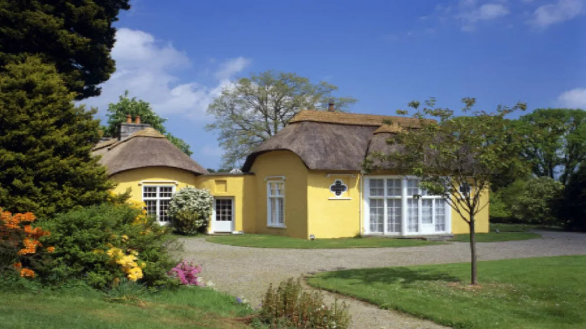
Derrymore House
Historic houses · 2.3 km

Corrinshego
Towns & cities · 2.3 km

Millvale
Natural landmarks · 2.7 km

Keggall Picnic Area
Natural landmarks · 2.8 km
Camlough is a town in Northern Ireland with a population of 1,074. Our guide lists several nearby attractions within reach.
At a glance
- Population
- 1,074
- Constituency
- Newry and Armagh
- Top categories near here
Things to see in Camlough
6 attractions within 12 km.
📷 3Historic churches · Northern Ireland
St. Paul's High School, Bessbrook
St. Paul's High School, Bessbrook in Northern Ireland, United Kingdom.
 📷 3
📷 3Archaeological sites · Northern Ireland
Drumilly Fort
Drumilly Fort — an archaeological site in Northern Ireland, United Kingdom.
📷 3Natural landmarks · Northern Ireland
Keggall Picnic Area
Keggall Picnic Area — a place in Northern Ireland, United Kingdom.
📷 3Castles · Northern Ireland
Mount Caulfield
Mount Caulfield — a castle in Northern Ireland, United Kingdom.
📷 3Public art & sculpture · Northern Ireland
The Flax Flower
The Flax Flower — a public art in Northern Ireland, United Kingdom.
📷 3Public art & sculpture · Northern Ireland
In-Flux
In-Flux — a public art in Northern Ireland, United Kingdom.
Nearby
📷 3Public art & sculpture · Northern Ireland
In-Flux
In-Flux — a public art in Northern Ireland, United Kingdom.
📷 3Historic churches · Northern Ireland
St. Paul's High School, Bessbrook
St. Paul's High School, Bessbrook in Northern Ireland, United Kingdom.
📷 3Castles · Northern Ireland
Mount Caulfield
Mount Caulfield — a castle in Northern Ireland, United Kingdom.
📷 3Public art & sculpture · Northern Ireland
The Flax Flower
The Flax Flower — a public art in Northern Ireland, United Kingdom.
📷 3Public art & sculpture · Northern Ireland
Rathore School Star
Rathore School Star — a public art in Northern Ireland, United Kingdom.
📷 5Mountains & hills · Northern Ireland
Camlough Mountain
Camlough Mountain — a hill or mountain in northern ireland.
Where to eat & stay near Camlough
Places to stay
 📷 5
📷 5Caravan parks · Northern Ireland
Slieve Gullion Getaways
Slieve Gullion Getaways — a caravan park in northern ireland.
 📷 5
📷 5 📷 5
📷 5 📷 5
📷 5Hostels · Northern Ireland
Kilbroney Youth Centre C.O.I
Kilbroney Youth Centre C.O.I — a hostel in northern ireland.
 📷 5
📷 5Caravan parks · Northern Ireland
Touring in the Trees - Kilbroney
Touring in the Trees - Kilbroney — a caravan park in northern ireland.
 📷 5
📷 5Caravan parks · Northern Ireland
Kilbroney Caravan Park
Kilbroney Caravan Park — a caravan park in northern ireland.
More towns in this region
 Flagship📷 5
Towns & cities · Northern Ireland
Bangor
Bangor — city in Northern Ireland, United Kingdom.
 Flagship📷 5
Towns & cities · Northern Ireland
Belfast
Belfast — capital city of Northern Ireland.
 Flagship📷 3
 Flagship📷 5
Towns & cities · Northern Ireland
Lisburn
Lisburn — city in Northern Ireland.
Frequently asked questions
- Where is Camlough?
- Camlough is in Northern Ireland, United Kingdom (postcode BT35).
- What is Camlough?
- Camlough — village in County Armagh, Northern Ireland, UK.
- How do I get to Camlough?
- The nearest railway station is Newry, about 3.3 km away. Drivers can use postcode BT35.
- Is Camlough free to visit?
- Yes, Camlough is free to enter.
- How do I get to Camlough?
- The nearest railway station is Newry, about 3.3 km away. Drivers can navigate to postcode BT35.