
Natural landmarks · Northern Ireland
Bessbrook
Also known as: An Sruthán
In or near Mullaghglass.
Bessbrook in Northern Ireland, United Kingdom.

Eric Jones — CC BY-SA 2.0 via Wikimedia Commons licence

Plan your visit
- Typical visit
- 1 h–2 h
- Nearest railway station
- Newry · 2.2 km
- Free entry
- Dog-friendly
Getting there & planning your visit
To visit Bessbrook, the nearest railway station is Newry, located 2.2 km away. The postcode for sat-nav is BT35 7DE, and entry to the site is free.
About
Bessbrook is a place of interest in Northern Ireland, United Kingdom — drawn from open-data sources for visitor reference. See the linked Wikipedia article for the full description.
Photo gallery
From the Wikipedia article
Bessbrook is a village in County Armagh, Northern Ireland. It lies about three miles (5 km) northwest of Newry and near the Newry bypass on the main A1 Belfast-Dublin road and Belfast-Dublin railway line. Today the village of Bessbrook straddles the three townlands of Maghernahely, Clogharevan and Maytown. Bessbrook is near Newry railway station. It had a population of 2,892 at the 2021 census. The model village of Bessbrook, County Armagh is a visible memorial to the commercial endeavours of the Richardson family over a number of generations. During the late 20th century some of the worst violence of "the Troubles" took place near the village and it became a military zone with a large garrison. The small village became the busiest (military) heliport in Europe.
Excerpt from Wikipedia under CC BY-SA 4.0. See the source article linked in Sources below.
Background
History
Bessbrook is named from Elizabeth or Bess Nicholson, wife of Joseph Nicholson whose family had carried on a linen business in the district from 1806 until 1845. The 'brook' is a stream which runs through the outskirts of the village. Bessbrook was founded by John Grubb Richardson in 1845 as a 'model village' along with the Richardson Spinning industry, with spacious streets and squares surrounding a large linen mill owned by the Quaker Richardson family. In the 18th and 19th centuries the linen industry was a significant contributor to the wealth of Quaker families in Ulster. The founder of Bessbrook, John G. Richardson, was a Quaker and was likely aware of other quakers such as the…
Description
Bessbrook saw much of the worst violence in the Troubles. The linen mill was converted by the British Army into a major military base. A helicopter landing area was established to supply other military outposts in the area since road-borne movements of troops and supplies were vulnerable to landmine attack. At one stage the little village was reportedly the busiest helicopter airport in Europe. Nine of the ten Protestants murdered by the Provisional Irish Republican Army in the Kingsmill massacre were from Bessbrook. The end of the Troubles, following the signing of the Good Friday Agreement in 1998, has led to some recovery for the village. Traffic restrictions have been relaxed and the…
Sourced from Wikipedia under CC BY-SA 4.0.
- Coordinates
- 54.1959, -6.3943
- District
- Newry, Mourne and Down
- Postcode
- BT35 7DE
- Parliamentary constituency
- Newry and Armagh
- Nearest railway station
- Newry — 2.2 km
Sources
Other places nearby
The Flax Flower
Public art & sculpture · 0.3 km
Mount Caulfield
Castles · 0.5 km

St. Paul's High School, Bessbrook
Historic churches · 1.2 km

Millvale
Natural landmarks · 1.3 km
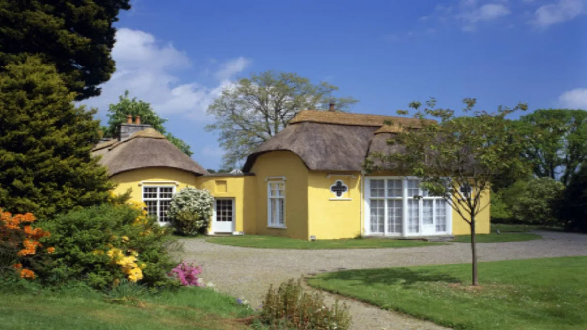
Derrymore House
Historic houses · 1.5 km

Mullaghglass
Towns & cities · 2.0 km

Camlough
Towns & cities · 2.0 km

Newry railway station
Natural landmarks · 2.2 km
.jpg?width=1200)
MacNeill's Egyptian Arch
Historic bridges · 2.4 km

In-Flux
Public art & sculpture · 2.6 km

Corrinshego
Towns & cities · 2.9 km

Newry Fault
Natural landmarks · 3.2 km
Nearby
📷 3Public art & sculpture · Northern Ireland
The Flax Flower
The Flax Flower — a public art in northern-ireland, United Kingdom.
📷 3Castles · Northern Ireland
Mount Caulfield
Mount Caulfield — a castle in northern-ireland, United Kingdom.
📷 3Historic churches · Northern Ireland
St. Paul's High School, Bessbrook
St. Paul's High School, Bessbrook in Northern Ireland, United Kingdom.
📷 3📷 3Historic houses · Northern Ireland
Derrymore House
Derrymore House — National Trust property.
📷 3Towns & cities · Northern Ireland
Mullaghglass
Mullaghglass — village in County Armagh, Northern Ireland, UK.
Where to eat & stay near Bessbrook
Places to stay
 📷 5
📷 5Caravan parks · Northern Ireland
Slieve Gullion Getaways
Slieve Gullion Getaways — a caravan park in northern ireland.
 📷 5
📷 5 📷 5
📷 5 📷 4
📷 4Caravan parks · Northern Ireland
Clare Glen Caravan Park
Clare Glen Caravan Park — a caravan park in northern ireland.
 📷 5
📷 5Hostels · Northern Ireland
Kilbroney Youth Centre C.O.I
Kilbroney Youth Centre C.O.I — a hostel in northern ireland.
 📷 5
📷 5Caravan parks · Northern Ireland
Touring in the Trees - Kilbroney
Touring in the Trees - Kilbroney — a caravan park in northern ireland.
More natural landmarks in this region
 Flagship📷 4
Natural landmarks · Northern Ireland
Lough Erne
Lough Erne — lake in County Fermanagh, Northern Ireland, UK.
 Flagship📷 4
Natural landmarks · Northern Ireland
Lough Neagh
Lough Neagh — large lake in Northern Ireland.
 📷 3
📷 3Natural landmarks · Northern Ireland
Ballysaggart Lough
Ballysaggart Lough — lake in the United Kingdom.
 📷 5
📷 5Natural landmarks · Northern Ireland
Belmore Mountain
Belmore Mountain — mountain in the United Kingdom.
Frequently asked questions
- Where is Bessbrook?
- Bessbrook is in Northern Ireland, United Kingdom (postcode BT35 7DE).
- What is Bessbrook?
- Bessbrook in Northern Ireland, United Kingdom.
- How do I get to Bessbrook?
- The nearest railway station is Newry, about 2.2 km away. Drivers can use postcode BT35 7DE.
- Is Bessbrook free to visit?
- Yes, Bessbrook is free to enter.
- How do I get to Bessbrook?
- The nearest railway station is Newry, about 2.2 km away. Drivers can navigate to postcode BT35 7DE.