Natural landmarks · North West England
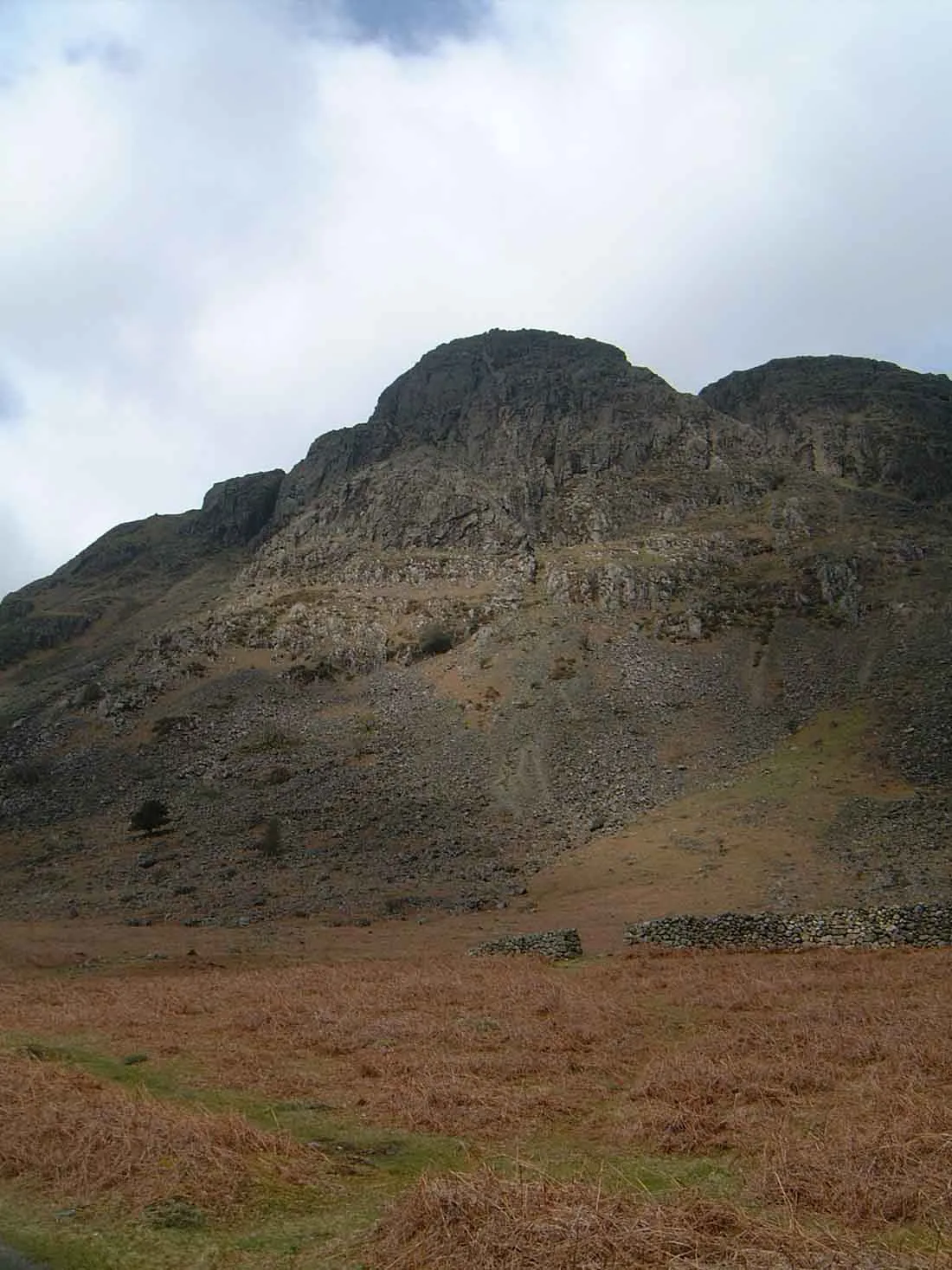
Buckbarrow
In or near Boot.
Buckbarrow — mountain in United Kingdom.

Wikimedia Commons contributors — see linked file page for photographer and licence licence
Plan your visit
- Typical visit
- 1 h–2 h
- Nearest railway station
- Fisherground Halt · 5.9 km
- Free entry
- Dog-friendly
Getting there & planning your visit
To visit Buckbarrow, the nearest railway station is Fisherground Halt, which is 5.9 km away. The postcode for Buckbarrow is CA20 1EU. Entry to the site is free.
About
Buckbarrow is a named natural landmark in the United Kingdom. Wikidata describes it as: "mountain in United Kingdom". Coordinates: 54.4420°, -3.3351°.
Photo gallery
From the Wikipedia article
Buckbarrow is a small fell in the English Lake District overlooking the western end of Wastwater. It is featured in Alfred Wainwright’s Pictorial Guide to the Lakeland Fells and is given a height of 1,410 ft approximately; however, the Ordnance Survey and other guidebooks now give an altitude of 423 m (1,388 ft). The fell’s name means ‘The hill of the buck or goat’. It is derived either from the Old English word bucc meaning buck or the Old Norse word bokki meaning a male goat.
Excerpt from Wikipedia under CC BY-SA 4.0. See the source article linked in Sources below.
- Coordinates
- 54.4420, -3.3351
- District
- Cumberland
- Parish
- Wasdale
- Postcode
- CA20 1EU
- Parliamentary constituency
- Whitehaven and Workington
- Nearest railway station
- Fisherground Halt — 5.9 km
Sources
- wikidata: Q4982997 (CC0)
- wikipedia: Buckbarrow (CC BY-SA 4.0)
- commons: The cliffs of Buckbarrow.jpg (CC BY-SA 4.0)
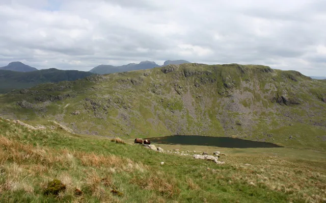
Other places nearby
Buckbarrow
Mountains & hills · 0.1 km

Glade How
Mountains & hills · 0.4 km

Joss Naylor Cairn
Memorials & monuments · 0.7 km

High Birkhow
Mountains & hills · 1.8 km
High Birkhow
Mountains & hills · 1.8 km

YHA Wasdale Hall
Hostels · 1.8 km
Middle Fell
Mountains & hills · 2.0 km

Church Stile Farm And Holiday Park
Campsites · 2.0 km
Seatallan
Natural landmarks · 2.4 km

Seatallan
Mountains & hills · 2.5 km

Wast Water
Lakes · 2.6 km

Bamse's Wood
Wildlife reserves · 2.7 km
Nearby
📷 3📷 5Mountains & hills · North West England
Glade How
Glade How — mountain in england north west. Elevation: 440 m.
📷 3Memorials & monuments · North West England
Joss Naylor Cairn
Joss Naylor Cairn is a memorial in the United Kingdom.
📷 5Mountains & hills · North West England
High Birkhow
High Birkhow — mountain in england north west. Elevation: 125 m.
📷 5Mountains & hills · North West England
High Birkhow
High Birkhow — a hill or mountain in england north west.
📷 5Hostels · North West England
YHA Wasdale Hall
YHA Wasdale Hall — a hostel in england north west.
Where to eat & stay near Buckbarrow
Places to stay
📷 5Hostels · North West England
YHA Wasdale Hall
YHA Wasdale Hall — a hostel in england north west.
📷 5Campsites · North West England
Church Stile Farm And Holiday Park
Church Stile Farm And Holiday Park — a campsite in england north west.
 📷 5
📷 5Campsites · North West England
The old Post Office Campsite
The old Post Office Campsite — a campsite in england north west.
 📷 5
📷 5Campsites · North West England
Wasdale Campsite
Wasdale Campsite — a campsite in england north west.
 📷 5
📷 5Campsites · North West England
Wasdale Head Campsite
Wasdale Head Campsite — a campsite in england north west.
 📷 5
📷 5Campsites · North West England
The Barn Campsite
The Barn Campsite — a campsite in england north west.
Places to eat & drink
 📷 7
📷 7Cafés · North West England
Grange Bridge Cottage
Grange Bridge Cottage — a café in england north east.
 📷 5
📷 5Historic pubs · North West England
Blacksmiths Arms
Blacksmiths Arms in England North West, United Kingdom.
 📷 7
📷 7Historic pubs · North West England
Church House Public House
Church House Public House in England North West, United Kingdom.
 📷 5
📷 5Historic pubs · North West England
Fox and Grapes
Fox and Grapes in England North West, United Kingdom.
 📷 7
📷 7Historic pubs · North West England
The Travellers Rest
The Travellers Rest in England North West, United Kingdom.
 📷 5
📷 5Restaurants · North West England
The Terrace Coffee House and Restaurant
The Terrace Coffee House and Restaurant — a restaurant in england north west. Cuisine: sandwich;lunch.
More natural landmarks in this region
 📷 3
📷 3Natural landmarks · North West England
Statue of Oliver Cromwell
Statue of Oliver Cromwell — Public artwork (statue).
 📷 3
📷 3Natural landmarks · North West England
Dagfields Craft Centre
Dagfields Craft Centre — a other in england-west-midlands, United Kingdom.
 📷 3
📷 3Natural landmarks · North West England
Weaver Valley Cruises
Weaver Valley Cruises — a other in england-west-midlands, United Kingdom.
 📷 3
📷 3Natural landmarks · North West England
Golden Gates
Golden Gates — a other in england-west-midlands, United Kingdom.
Frequently asked questions
- Where is Buckbarrow?
- Buckbarrow is in North-West England, United Kingdom (postcode CA20 1EU), in the parish of Wasdale.
- What is Buckbarrow?
- Buckbarrow — mountain in United Kingdom.
- How do I get to Buckbarrow?
- The nearest railway station is Fisherground Halt, about 5.9 km away. Drivers can use postcode CA20 1EU.
- Is Buckbarrow free to visit?
- Yes, Buckbarrow is free to enter.
- How do I get to Buckbarrow?
- The nearest railway station is Fisherground Halt, about 5.9 km away. Drivers can navigate to postcode CA20 1EU.