
Historic bridges · South East England
Bridge 50 Metres North Of The House
In or near Selborne.
Bridge 50 Metres North Of The House — Grade II listed building-listed bridge in england-south-east, United Kingdom.

Shazz — CC BY-SA 2.0 via Wikimedia Commons licence

Plan your visit
- Typical visit
- 15 min–30 min
- Nearest railway station
- Medstead and Four Marks · 4.0 km
- Free entry
- Dog-friendly
Getting there & planning your visit
The nearest railway station is Medstead and Four Marks, located 4 km away. Entry to Bridge 50 Metres North Of The House is free.
About
Bridge 50 Metres North Of The House is a Grade II listed building-listed bridge in england-south-east, United Kingdom, registered on the National Heritage List for England (NHLE entry 1157369). Listed status protects buildings and structures of special architectural or historic interest. See the linked Wikipedia article for further details.
Photo gallery
Heritage listing
Details SU 63 SE 4/5 EAST TISTED ROTHERFIELD PARK Bridge 50 metres north of the House II Bridge, carrying the driveway to the House. Early C19. A Gothic arch across a steep ravine, which the driveway to the house crosses on its winding approach, being an integral part of the landscape treatment, of the total scheme for the mansion. Brick walls in Flemish bond, pointed arch with a deep splay and outer hoodmould, flanked by circular recesses and then by buttresses, beyond which the retaining wall curves outward to end in plain piers. Stucco parapet, with Gothic pierced work and plain band. Legacy The contents of this record have been generated from a legacy data system. Legacy System number: 142971 Legacy System: LBS
From the Historic England List Entry under OGL v3.
Place summary
Bridge 50 Metres North Of The House is a Grade II listed bridge located in South-East England. Its designation reflects architectural or historical significance, although specific details about its construction or design are not provided.
AI-generated from the structured facts on this page (operator, designation, listing, era). Not a substitute for visiting.
- Coordinates
- 51.0867, -1.0085
- County
- Hampshire
- District
- East Hampshire
- Parish
- East Tisted
- Postcode
- GU34 3QE
- Parliamentary constituency
- East Hampshire
- Nearest railway station
- Medstead and Four Marks — 4 km
Sources
- wikidata: Q26451150 (CC0)
Other places nearby

Rotherfield Park
Manor houses · 0.1 km

East Tisted
Villages · 0.6 km
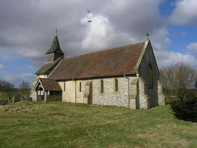
Church of St Peter ad Vincula, Colemore
Historic churches · 1.9 km

Rear Admiral Dennis Royle Farquharson Cambell
Memorials & monuments · 2.1 km

Four Marks
Mountains & hills · 2.5 km

Lower Farringdon
Villages · 2.8 km

Newton Valence War Memorial
Memorials & monuments · 2.8 km

St Swithun's Way
Military museums · 3.3 km

Upper Farringdon
Villages · 3.3 km

Goleigh Hill
Mountains & hills · 3.5 km

Mid-Hants Railway (Watercress Line)
Heritage railways · 3.6 km

Four Marks
Villages · 3.7 km
Nearby
📷 5Manor houses · South East England
Rotherfield Park
Rotherfield Park — a manor in england-south-east, United Kingdom.
📷 5📷 5Historic churches · South East England
Church of St Peter ad Vincula, Colemore
Church of St Peter ad Vincula, Colemore — church in Colemore, Hampshire, England, UK.
📷 5Memorials & monuments · South East England
Rear Admiral Dennis Royle Farquharson Cambell
Rear Admiral Dennis Royle Farquharson Cambell — a memorial in england-south-east, United Kingdom.
📷 5Mountains & hills · South East England
Four Marks
Four Marks — a hill or mountain in england south east.
📷 5Where to eat & stay near Bridge 50 Metres North Of The House
Places to stay
 📷 5
📷 5 📷 5
📷 5 📷 5
📷 5Campsites · South East England
Watercress Lodges and Campsite
Watercress Lodges and Campsite — a campsite in england south east.
 📷 5
📷 5 📷 7
📷 7 📷 7
📷 7Hotels · South East England
Alton House Hotel
Alton House Hotel — a hotel in england south east.
Places to eat & drink
 📷 7
📷 7Historic pubs · South East England
The Selborne Arms
The Selborne Arms in England South East, United Kingdom.
 📷 5
📷 5 📷 6
📷 6 📷 5
📷 5Historic pubs · South East England
The 'Eight Bells' Public House
The 'Eight Bells' Public House in England South East, United Kingdom.
 📷 6
📷 6Historic pubs · South East England
Three Horseshoes Public House
Three Horseshoes Public House in England South East, United Kingdom.
 📷 5
📷 5Historic pubs · South East England
The Harrow
The Harrow in England South East, United Kingdom.
More bridges in this region
 📷 5
📷 5Historic bridges · South East England
Briary Hill Bridge east
Briary Hill Bridge east is a historic bridge in the United Kingdom.
 📷 5
📷 5Historic bridges · South East England
Briary Hill Bridge west
Briary Hill Bridge west is a historic bridge in the United Kingdom.
 📷 5
📷 5Historic bridges · South East England
Bridge 157 VIR (Bath Hard Road)
Bridge 157 VIR (Bath Hard Road) is a historic bridge in the United Kingdom.
 📷 5
📷 5Historic bridges · South East England
Dorking Arch Bridge
Dorking Arch Bridge is a historic bridge in the United Kingdom.
Frequently asked questions
- Where is Bridge 50 Metres North Of The House?
- Bridge 50 Metres North Of The House is in Hampshire, South-East England, United Kingdom (postcode GU34 3QE), in the parish of East Tisted.
- What is Bridge 50 Metres North Of The House?
- Bridge 50 Metres North Of The House — Grade II listed building-listed bridge in england-south-east, United Kingdom.
- How do I get to Bridge 50 Metres North Of The House?
- The nearest railway station is Medstead and Four Marks, about 4.0 km away. Drivers can use postcode GU34 3QE.
- Is Bridge 50 Metres North Of The House a listed building?
- Bridge 50 Metres North Of The House is officially recognised as Grade II listed building listed.
- Is Bridge 50 Metres North Of The House free to visit?
- Yes, Bridge 50 Metres North Of The House is free to enter.
- How do I get to Bridge 50 Metres North Of The House?
- The nearest railway station is Medstead and Four Marks, about 4.0 km away. Drivers can navigate to postcode GU34 3QE.