
Villages · South East England
Lower Farringdon
In or near Selborne.
Lower Farringdon — a village in england south east.

Colin Smith — CC BY-SA 2.0 via Wikimedia Commons licence

Plan your visit
- Typical visit
- 1 h–2 h
- Nearest railway station
- Medstead and Four Marks · 3.6 km
About
A British village — settlements of this size traditionally cluster a green, parish church, pub and post office around historic land routes.
Photo gallery
See it from the streetimagery from 2024
Imagery © Mapillary contributors, CC BY-SA 4.0
Place summary
Lower Farringdon is a village located in South-East England. This rural settlement offers a glimpse into traditional English village life, characterised by its surrounding countryside. Visitors can expect a quiet atmosphere, with local amenities that reflect the community's character. The village is part of the larger Farringdon area, which has historical significance and picturesque landscapes.
AI-generated from the structured facts on this page (operator, designation, listing, era). Not a substitute for visiting.
- Coordinates
- 51.1103, -0.9940
- County
- Hampshire
- District
- East Hampshire
- Parish
- Farringdon
- Postcode
- GU34 3DR
- Parliamentary constituency
- East Hampshire
- Nearest railway station
- Medstead and Four Marks — 3.6 km
Sources
- manual: geonames-2643524 (CC BY 4.0)
Other places nearby

Upper Farringdon
Villages · 1.0 km

The Manor House
Historic houses · 2.1 km

Four Marks
Mountains & hills · 2.3 km

Chawton
National parks · 2.5 km

Jane Austen's House Museum
Museums · 2.6 km

Bridge 50 Metres North Of The House
Historic bridges · 2.8 km

East Tisted
Villages · 2.8 km

Rotherfield Park
Manor houses · 2.9 km

Newton Valence War Memorial
Memorials & monuments · 3.0 km

Red Hill
Mountains & hills · 3.4 km

Red Hill
Mountains & hills · 3.5 km
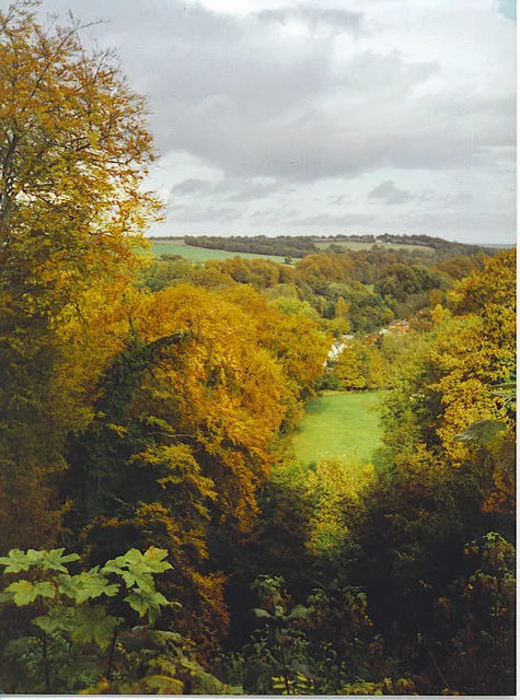
Selborne Hill
Mountains & hills · 3.5 km
Nearby
📷 5📷 5Historic houses · South East England
The Manor House
The Manor House — house in Chawton, East Hampshire, England, UK.
📷 5Mountains & hills · South East England
Four Marks
Four Marks — a hill or mountain in england south east.
📷 5National parks · South East England
Chawton
Chawton is a village and civil parish in the East Hampshire district of Hampshire, England. The village lies within the South Downs National Park and is famous as the home of Jane Austen for the last
📷 5Museums · South East England
Jane Austen's House Museum
Jane Austen's House Museum — a museum in england-south-east, United Kingdom.
📷 5Historic bridges · South East England
Bridge 50 Metres North Of The House
Bridge 50 Metres North Of The House — Grade II listed building-listed bridge in england-south-east, United Kingdom.
Where to eat & stay near Lower Farringdon
Places to stay
 📷 5
📷 5 📷 7
📷 7 📷 7
📷 7Hotels · South East England
Alton House Hotel
Alton House Hotel — a hotel in england south east.
 📷 5
📷 5 📷 5
📷 5Campsites · South East England
Watercress Lodges and Campsite
Watercress Lodges and Campsite — a campsite in england south east.
 📷 5
📷 5Places to eat & drink
 📷 7
📷 7Historic pubs · South East England
The Selborne Arms
The Selborne Arms in England South East, United Kingdom.
 📷 5
📷 5 📷 6
📷 6 📷 5
📷 5Historic pubs · South East England
The 'Eight Bells' Public House
The 'Eight Bells' Public House in England South East, United Kingdom.
 📷 5
📷 5Historic pubs · South East England
Hen And Chicken Public House
Hen And Chicken Public House in England South East, United Kingdom.
 📷 6
📷 6Historic pubs · South East England
Three Horseshoes Public House
Three Horseshoes Public House in England South East, United Kingdom.
More places in this region
 📷 5
📷 5 📷 5
📷 5 📷 5
📷 5 📷 5
📷 5Frequently asked questions
- Where is Lower Farringdon?
- Lower Farringdon is in Hampshire, South-East England, United Kingdom (postcode GU34 3DR), in the parish of Farringdon.
- What is Lower Farringdon?
- Lower Farringdon — a village in england south east.
- How do I get to Lower Farringdon?
- The nearest railway station is Medstead and Four Marks, about 3.6 km away. Drivers can use postcode GU34 3DR.
- How do I get to Lower Farringdon?
- The nearest railway station is Medstead and Four Marks, about 3.6 km away. Drivers can navigate to postcode GU34 3DR.