
Historic churches · South East England
Church of St Peter ad Vincula, Colemore
In or near Selborne.
Church of St Peter ad Vincula, Colemore — church in Colemore, Hampshire, England, UK.

Wikimedia Commons contributors — see linked file page for photographer and licence licence

Plan your visit
- Typical visit
- 30 min–1 h
- Nearest railway station
- Medstead and Four Marks · 5.9 km
- Free entry
Getting there & planning your visit
The Church of St Peter ad Vincula is located in Colemore, Hampshire, with the postcode GU34 3RX. The nearest railway station is Medstead and Four Marks, which is 5.9 km away. Entry to the church is free.
About
Church of St Peter ad Vincula, Colemore is a historic church in the United Kingdom. Built in the Norman architecture style. Heritage designation: Grade II* listed building. Wikidata describes it as: "church in Colemore, Hampshire, England, UK". Coordinates: 51.0719°, -0.9937°.
Photo gallery
Heritage listing
The Church of St Peter ad Vincula is a redundant Anglican church in the village of Colemore, Hampshire, England. It is recorded in the National Heritage List for England as a designated Grade II* listed building, and is under the care of the Churches Conservation Trust. Colemore is located some 6 miles (10 km) south of Alton to the east of the A32 road.
From the Historic England List Entry under OGL v3.
From the Wikipedia article
The Church of St Peter ad Vincula is a redundant Anglican church in the village of Colemore, Hampshire, England. It is recorded in the National Heritage List for England as a designated Grade II* listed building, and is under the care of the Churches Conservation Trust. Colemore is located some 6 miles (10 km) south of Alton to the east of the A32 road.
Excerpt from Wikipedia under CC BY-SA 4.0. See the source article linked in Sources below.
Background
History
Colemore is mentioned in the Domesday Book of 1086, and a church has been on the site since the 10th century. The present church dates from the 12th century. However, by 1308 its fabric was "in a ruinous" condition" and the bishop ordered that repairs should be undertaken. By the end of the century the church was under the control of Waverley Abbey in Surrey. By 1463 it was again in a ruinous condition, and again the bishop had to intervene; the church was put in good order again by July 1464. But its condition had deteriorated again by 1612; a new roof was built and a bellcote added. At this time the church had a cruciform plan, but in 1669 the parishioners considered that the interior was…
Architecture
The transept arch is Norman. Between the nave and chancel is a 16th-century wooden screen. In the east wall of the transept is a piscina and a squint, and in the south wall are the remains of a rood staircase. There is another piscina in the south wall of the chancel. In the north wall of the chancel is a recess that originally contained an Easter Sepulchre. The floor of the chancel contains ledger stones commemorating former rectors of the parish, and from its ceiling hang two chandeliers. The font dates from the 12th century. It is made from Purbeck marble and consists of a square bowl supported by a central drum and columns at the corners. The drum is carved on two sides with arcades, on…
Sourced from Wikipedia under CC BY-SA 4.0.
- Coordinates
- 51.0719, -0.9937
- County
- Hampshire
- District
- East Hampshire
- Parish
- Colemore and Priors Dean
- Postcode
- GU34 3RX
- Parliamentary constituency
- East Hampshire
- Nearest railway station
- Medstead and Four Marks — 5.9 km
- Official site
- www.visitchurches.org.uk
Sources
- wikidata: Q5117706 (CC0)
- wikipedia: Church of St Peter ad Vincula, Colemore (CC BY-SA 4.0)
- commons: Colemore, Hampshire, Church of St Peter ad Vincula - geograph.org.uk - 135628.jpg (CC BY-SA 4.0)
Other places nearby

Rear Admiral Dennis Royle Farquharson Cambell
Memorials & monuments · 0.2 km

East Tisted
Villages · 1.5 km

Rotherfield Park
Manor houses · 1.9 km

Bridge 50 Metres North Of The House
Historic bridges · 1.9 km

Goleigh Hill
Mountains & hills · 2.1 km

Priors Dean Church
Historic churches · 2.5 km

Newton Valence War Memorial
Memorials & monuments · 2.6 km
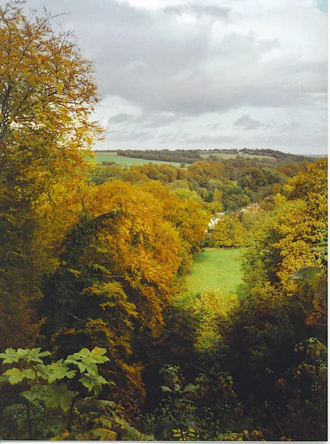
Selborne Hill
Mountains & hills · 3.5 km

Warren Corner
Mountains & hills · 3.6 km

Wheatham Hill
Mountains & hills · 4.0 km

Hawkley
Villages · 4.3 km

Lower Farringdon
Villages · 4.3 km
Nearby
📷 5Memorials & monuments · South East England
Rear Admiral Dennis Royle Farquharson Cambell
Rear Admiral Dennis Royle Farquharson Cambell — a memorial in england-south-east, United Kingdom.
📷 5📷 5Manor houses · South East England
Rotherfield Park
Rotherfield Park — a manor in england-south-east, United Kingdom.
📷 5Historic bridges · South East England
Bridge 50 Metres North Of The House
Bridge 50 Metres North Of The House — Grade II listed building-listed bridge in england-south-east, United Kingdom.
📷 5Mountains & hills · South East England
Goleigh Hill
Goleigh Hill — a hill or mountain in england south east.
📷 5Historic churches · South East England
Priors Dean Church
Priors Dean Church — Grade II* listed building-listed church in england-south-east, United Kingdom.
Where to eat & stay near Church of St Peter ad Vincula, Colemore
Places to stay
 📷 5
📷 5 📷 5
📷 5Campsites · South East England
Watercress Lodges and Campsite
Watercress Lodges and Campsite — a campsite in england south east.
 📷 5
📷 5 📷 5
📷 5 📷 7
📷 7 📷 7
📷 7Hotels · South East England
Alton House Hotel
Alton House Hotel — a hotel in england south east.
Places to eat & drink
 📷 7
📷 7Historic pubs · South East England
The Selborne Arms
The Selborne Arms in England South East, United Kingdom.
 📷 5
📷 5Historic pubs · South East England
The Harrow
The Harrow in England South East, United Kingdom.
 📷 5
📷 5 📷 7
📷 7Historic pubs · South East England
The Good Intent
The Good Intent in England South East, United Kingdom.
 📷 7
📷 7Historic pubs · South East England
The Market Inn
The Market Inn in England South East, United Kingdom.
 📷 5
📷 5Historic pubs · South East England
The Red Lion Hotel
The Red Lion Hotel in England South East, United Kingdom.
More places in this region
 📷 5
📷 5Historic churches · South East England
All Saints Church, Frindsbury
All Saints Church, Frindsbury — church in Medway, UK.
 📷 5
📷 5Historic churches · South East England
All Saints Church, Maidstone
All Saints Church, Maidstone — parish church associated with the Archbishop's Palace, Maidstone, Kent, England, UK.
 📷 5
📷 5Historic churches · South East England
All Saints Church, West Farleigh
All Saints Church, West Farleigh — Grade I listed church in West Farleigh, Maidstone, Kent, England, UK.
 📷 5
📷 5Historic churches · South East England
All Souls' Church, Sutton Green
All Souls' Church, Sutton Green — church in Guildford, England.
Frequently asked questions
- Where is Church of St Peter ad Vincula, Colemore?
- Church of St Peter ad Vincula, Colemore is in Hampshire, South-East England, United Kingdom (postcode GU34 3RX), in the parish of Colemore and Priors Dean.
- What is Church of St Peter ad Vincula, Colemore?
- Church of St Peter ad Vincula, Colemore — church in Colemore, Hampshire, England, UK.
- How do I get to Church of St Peter ad Vincula, Colemore?
- The nearest railway station is Medstead and Four Marks, about 5.9 km away. The nearest town is Selborne. Drivers can use postcode GU34 3RX.
- Is Church of St Peter ad Vincula, Colemore a listed building?
- Church of St Peter ad Vincula, Colemore is officially recognised as Grade II* listed building listed.
- Is Church of St Peter ad Vincula, Colemore free to visit?
- Yes, Church of St Peter ad Vincula, Colemore is free to enter.
- How do I get to Church of St Peter ad Vincula, Colemore?
- The nearest railway station is Medstead and Four Marks, about 5.9 km away. Drivers can navigate to postcode GU34 3RX.