Hill forts · South East England
Bokerley Dyke
Bokerley Dyke — Romano-British defensive dyke.

Wikimedia Commons contributors — see linked file page for photographer and licence licence
Plan your visit
- Typical visit
- 1 h–2 h
- Free entry
- Dog-friendly
About
Bokerley Dyke is a hill fort in the United Kingdom. Wikidata describes it as: "Romano-British defensive dyke". Coordinates: 50.9722°, -1.9416°.
Photo gallery
Protected designations
- Site of Special Scientific Interest: River Avon System SSSI
- Site of Special Scientific Interest: Martin and Tidpit Downs SSSI
- National Nature Reserve: MARTIN DOWN
- Area of Outstanding Natural Beauty: Cranborne Chase & West Wiltshire Downs
Designations sourced from Natural England open data under OGL v3.
From the Wikipedia article
Bokerley Dyke, Bokerly Dyke, Bokerley Ditch, is a linear earthwork 5.75 kilometres (3.6 mi) long on Cranborne Chase in Dorset, partially running along the county's border with Hampshire between Woodyates and Martin. It is part of a Scheduled Monument together with Grim's Ditch and other associated earthworks. Bokerley Dyke was excavated by Augustus Pitt Rivers between 1888 and 1891 and by Philip Rahtz in advance of road widening in 1958. Bokerley Dyke may have originated in the Bronze Age or Early Iron Age and formed a political and cultural boundary. It was cut through by a Roman Road (Ackling Dyke running between Old Sarum and Badbury Rings) in the 1st century. In the 4th century it was remodelled and brought back into use, and excavations show that the Roman road was blocked. A coin of Valens dates this activity to shortly after 364 AD. It may have been built in 367-8 AD when Roman sources report that Britain was attacked by Picts, Scots and Saxons in a supposed Great Conspiracy. The Roman road was later reopened, but the dyke may have continued in use after the cessation of the Roman rule and still forms part of a boundary between the counties of Dorset and Hampshire. Bokerley Dyke runs through Martin and Tidpit Downs, which is a Site of Special Scientific Interest, and it is continuous with Grim's Ditch.
Excerpt from Wikipedia under CC BY-SA 4.0. See the source article linked in Sources below.
- Coordinates
- 50.9722, -1.9416
- District
- Dorset
- Parish
- Sixpenny Handley and Pentridge
- Postcode
- SP5 5RQ
- Parliamentary constituency
- North Dorset
Sources
- wikidata: Q891218 (CC0)
- wikipedia: Bokerley Dyke (CC BY-SA 4.0)
- commons: Bokerley Dyke, Martin Down - geograph.org.uk - 674000.jpg (CC BY-SA 4.0)
Other places nearby
Loading nearby places…
Nearby
 📷 5
📷 5Archaeological sites · South East England
Martin Down Camp
Martin Down Camp — a archaeological in england-south-east, United Kingdom.
 📷 5
📷 5Towns & cities · South East England
Pentridge
Pentridge — village in Dorset, England, UK.
Vineyards · South East England
Penbury Knoll camp on Pentridge Hill
Penbury Knoll camp on Pentridge Hill — a UK vineyard in england south east, producing English or Welsh wine from cool-climate grape varieties.
 📷 5
📷 5Forests & woodlands · South East England
Chickengrove Bottom SSSI
Chickengrove Bottom SSSI is a forest or woodland in the United Kingdom.
 📷 5
📷 5Manor houses · South East England
West Woodyates Manor
West Woodyates Manor — a manor in england-south-east, United Kingdom.
 📷 4
📷 4Burial mounds & barrows · South East England
Oakley Down Barrow Cemetery
Oakley Down Barrow Cemetery — a burial mound in england-south-east, United Kingdom.
More places in this region
 Flagship📷 10
Hill forts · South East England
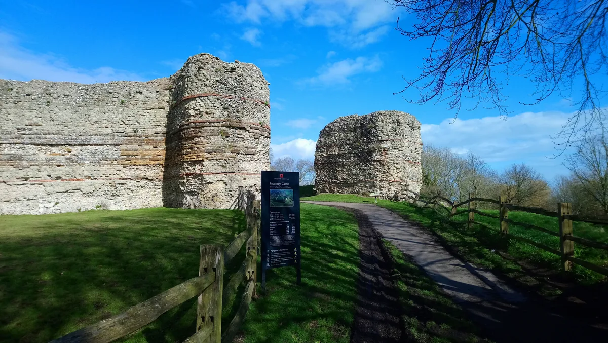
Castrum Anderitum
Castrum Anderitum — 3rd century Roman fort in the province of Britannia.
 Flagship📷 10
Hill forts · South East England
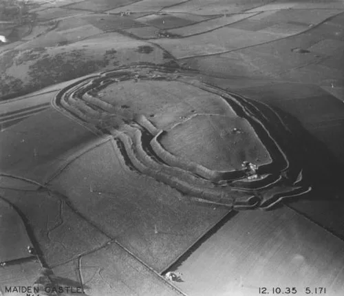
Maiden Castle
Maiden Castle — Iron Age hill fort in Dorset, England, UK.
 Flagship📷 10
Hill forts · South East England
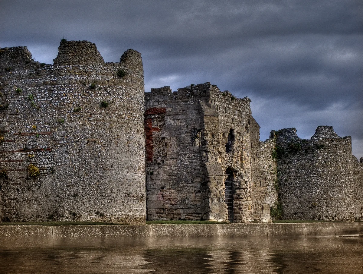
Portus Adurni
Portus Adurni is a hill fort in the United Kingdom.
 Flagship📷 10
Hill forts · South East England
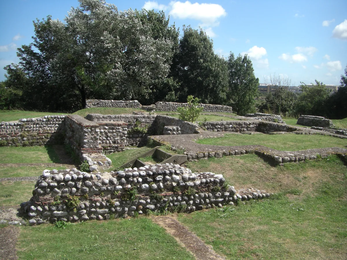
Richborough Roman Fort
Richborough Roman Fort — Roman fort at Richborough, Ash, United Kingdom.
Frequently asked questions
- Where is Bokerley Dyke?
- Bokerley Dyke is in South-East England, United Kingdom (postcode SP5 5RQ), in the parish of Sixpenny Handley and Pentridge.
- Is Bokerley Dyke a protected site?
- Yes — Bokerley Dyke is part of the River Avon System SSSI Site of Special Scientific Interest and the Martin and Tidpit Downs SSSI Site of Special Scientific Interest.
- Is Bokerley Dyke free to visit?
- Yes, Bokerley Dyke is free to enter.
- How do I get to Bokerley Dyke?
- Drivers can navigate to postcode SP5 5RQ. It sits within the North Dorset parliamentary constituency.