Forests & woodlands · South East England
Chickengrove Bottom SSSI
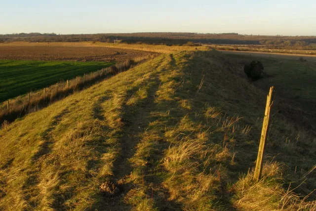
Chickengrove Bottom SSSI is a forest or woodland in the United Kingdom.

Wikimedia Commons licence
Plan your visit
- Typical visit
- 1 h–3 h
- Free entry
- Family-friendly
- Dog-friendly
About
Chickengrove Bottom SSSI is a named forest, woodland or nature reserve in the United Kingdom. Coordinates: 50.9940°, -1.9439°. This entry is part of The Great Britain Guide, a free, ad-free, open-data tourist directory.
Photo gallery
Protected designations
- Site of Special Scientific Interest: Chickengrove Bottom SSSI
- Site of Special Scientific Interest: River Avon System SSSI
- Area of Outstanding Natural Beauty: Cranborne Chase & West Wiltshire Downs
Designations sourced from Natural England open data under OGL v3.
From the Wikipedia article
Chickengrove Bottom (grid reference SU040216) is a 9.8 hectare biological Site of Special Scientific Interest to the south east of the village of Bowerchalke in Wiltshire, notified in 1975.
Excerpt from Wikipedia under CC BY-SA 4.0. See the source article linked in Sources below.
- Coordinates
- 50.9940, -1.9439
- District
- Wiltshire
- Parish
- Broad Chalke
- Postcode
- SP5 5LU
- Parliamentary constituency
- Salisbury
Sources
- osm: w1053444044 (ODbL)
- wikipedia: Chickengrove Bottom (CC BY-SA 4.0)
Other places nearby
Loading nearby places…
Nearby
 📷 5
📷 5Archaeological sites · South East England
Martin Down Camp
Martin Down Camp — a archaeological in england-south-east, United Kingdom.
 📷 5
📷 5Archaeological sites · South East England
Marleycombe Barrows
Marleycombe Barrows — a archaeological in england-south-east, United Kingdom.
 📷 5
📷 5Hill forts · South East England
Bokerley Dyke
Bokerley Dyke — Romano-British defensive dyke.
 📷 5
📷 5Forests & woodlands · South East England
Bowerchalke Downs SSSI
Bowerchalke Downs SSSI is a forest or woodland in the United Kingdom.
 📷 5
📷 5Memorials & monuments · South East England
William Golding
William Golding — a memorial in england-south-east, United Kingdom.
 📷 5
📷 5Manor houses · South East England
West Woodyates Manor
West Woodyates Manor — a manor in england-south-east, United Kingdom.
More forests in this region
 📷 5
📷 5Forests & woodlands · South East England
Alice Holt Forest
Alice Holt Forest is a forest or woodland in the United Kingdom.
.jpg?width=1200) 📷 5
📷 5Forests & woodlands · South East England
Alverstone Mead Nature Reserve
Alverstone Mead Nature Reserve is a forest or woodland in the United Kingdom.
 📷 5
📷 5Forests & woodlands · South East England
Ambarrow Court
Ambarrow Court is a forest or woodland in the United Kingdom.
 📷 5
📷 5Forests & woodlands · South East England
Ancells Farm Nature Reserve
Ancells Farm Nature Reserve is a forest or woodland in the United Kingdom.
Frequently asked questions
- Where is Chickengrove Bottom SSSI?
- Chickengrove Bottom SSSI is in South-East England, United Kingdom (postcode SP5 5LU), in the parish of Broad Chalke.
- Is Chickengrove Bottom SSSI a protected site?
- Yes — Chickengrove Bottom SSSI is part of the Chickengrove Bottom SSSI Site of Special Scientific Interest and the River Avon System SSSI Site of Special Scientific Interest.
- Is Chickengrove Bottom SSSI free to visit?
- Yes, Chickengrove Bottom SSSI is free to enter.
- How do I get to Chickengrove Bottom SSSI?
- Drivers can navigate to postcode SP5 5LU. It sits within the Salisbury parliamentary constituency.