Mountains & hills · Northern Ireland
Binevenagh
Also known as: Binn Fhoibhne
In or near Bellarena.
Binevenagh — Named summit at 385 m.

Wikimedia Commons contributors — see linked file page for photographer and licence licence
Plan your visit
- Typical visit
- 3 h–8 h
- Best time of year
- Late spring – early autumn (May–Oct)
- Nearest railway station
- Bellarena · 2.6 km
- Free entry
- Dog-friendly
Getting there & planning your visit
To visit Binevenagh, the nearest railway station is Bellarena, located 2.6 km away. Admission is free.
About
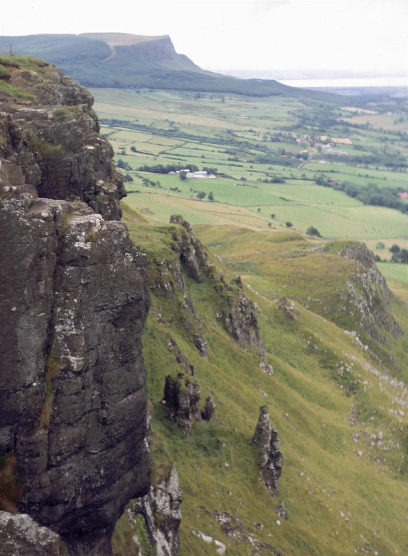
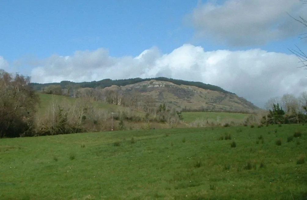
Binevenagh is a named summit in the United Kingdom. Also known as: Binn Fhoibhne. Wikidata describes it as: "Named summit at 385 m.". Coordinates: 55.1142°, -6.9164°.
Photo gallery
From the Wikipedia article
Binevenagh (from Irish Binn Fhoibhne, meaning 'Foibhne's peak') is a large, steep-sided hill in County Londonderry, Northern Ireland. It is part of the Keenaght Hills, which mark the western edge of the Antrim Plateau, formed around 60 million years ago by molten lava. Binevenagh and its cliffs overlook the Magilligan peninsula and dominate the skyline over the villages of Bellarena, Downhill, Castlerock and Benone beach. The area has been classified as both an Area of Special Scientific Interest and as an Area of Outstanding Natural Beauty (AONB). The total area of the AONB is 138 km2. The Bishop's Road, named after the Bishop of Derry, extends across the plateau. Notable features include a cliff top viewing area giving good views over Lough Foyle and across Inishowen in County Donegal.
Excerpt from Wikipedia under CC BY-SA 4.0. See the source article linked in Sources below.
- Coordinates
- 55.1142, -6.9164
- Address
- County Londonderry, Northern Ireland
- Nearest railway station
- Bellarena — 2.6 km
Sources
- osm: n332373430 (ODbL)
- wikipedia: Binevenagh (CC BY-SA 4.0)
- commons: Castle-rock-derry.jpg (CC BY-SA 4.0)
Other places nearby
Binevenagh
Natural landmarks · 0.5 km

Binevenagh View
Viewpoints · 0.8 km

Limavady transmitting station
Natural landmarks · 2.0 km

Bellarena railway station
Natural landmarks · 2.6 km

Harkin's Hill
Mountains & hills · 2.8 km

Bellarena House
Castles · 2.8 km

Bellarena
Towns & cities · 3.3 km

Ballyscullion
Towns & cities · 3.3 km

Crindle
Villages · 4.1 km

Magilligan GAC
Natural landmarks · 4.1 km

Magilligan railway station
Natural landmarks · 4.5 km

Shanvey
Towns & cities · 4.6 km
Nearby
📷 3📷 3Viewpoints · Northern Ireland
Binevenagh View
Binevenagh View is a viewpoint in the United Kingdom.
📷 2Natural landmarks · Northern Ireland
Limavady transmitting station
Limavady transmitting station in Northern Ireland, United Kingdom.
📷 4Natural landmarks · Northern Ireland
Bellarena railway station
Bellarena railway station in Northern Ireland, United Kingdom.
📷 5Mountains & hills · Northern Ireland
Harkin's Hill
Harkin's Hill — mountain in northern ireland. Elevation: 353 m.
📷 5Castles · Northern Ireland
Bellarena House
Bellarena House — a castle in northern-ireland, United Kingdom.
Where to eat & stay near Binevenagh
Places to stay
 📷 5
📷 5Caravan parks · Northern Ireland
Deighans Caravan Park
Deighans Caravan Park — a caravan park in northern ireland.
 📷 5
📷 5Caravan parks · Northern Ireland
Golden Sands
Golden Sands — a caravan park in northern ireland.
📷 5Caravan parks · Northern Ireland
Benone Caravan Park
Benone Caravan Park — a caravan park in northern ireland.
📷 5Caravan parks · Northern Ireland
Tivole Caravan Park
Tivole Caravan Park — a caravan park in northern ireland.
📷 5Caravan parks · Northern Ireland
Benone Tourist Complex
Benone Tourist Complex — a caravan park in northern ireland.
📷 5More mountains in this region
 📷 5
📷 5Mountains & hills · Northern Ireland
Belfast Lough
Belfast Lough — intertidal inlet in Northern Ireland.
 📷 5
📷 5 📷 4
📷 4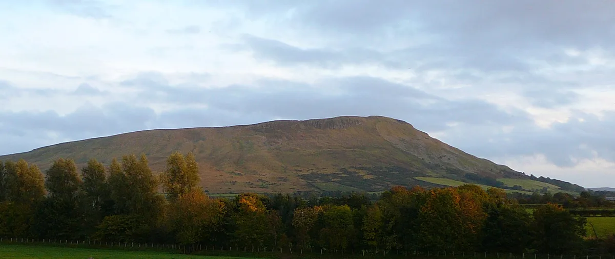 📷 3
📷 3Mountains & hills · Northern Ireland
Benbradagh
Benbradagh — Named summit at 465 m.
Frequently asked questions
- Where is Binevenagh?
- Binevenagh is in Northern Ireland, United Kingdom.
- What is Binevenagh?
- Binevenagh — Named summit at 385 m.
- How do I get to Binevenagh?
- The nearest railway station is Bellarena, about 2.6 km away. Its coordinates are 55.1142°, -6.9164°.
- Is Binevenagh free to visit?
- Yes, Binevenagh is free to enter.
- How do I get to Binevenagh?
- The nearest railway station is Bellarena, about 2.6 km away.