
Archaeological sites · South Wales
Banc Du Causewayed Enclosure
In or near Spittal.
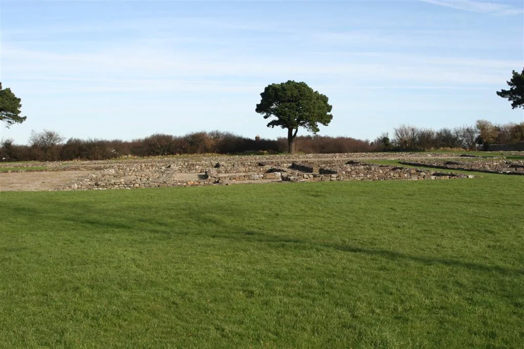
Banc Du Causewayed Enclosure — a archaeological in wales-south, United Kingdom.

David Gearing — CC BY-SA 2.0 via Wikimedia Commons licence

Plan your visit
- Typical visit
- 45 min–1.5 h
- Free entry
- Dog-friendly
About
Banc Du Causewayed Enclosure is a archaeological located in wales-south, United Kingdom. Sourced from OpenStreetMap (ODbL licence); see local listings for visitor information, opening hours and admission details.
Photo gallery
Place summary
Banc Du Causewayed Enclosure is an archaeological site located in South Wales. It features a series of prehistoric earthworks, notable for its causewayed design, which dates back to the Neolithic period. The site provides insight into early agricultural communities and their social structures.
AI-generated from the structured facts on this page (operator, designation, listing, era). Not a substitute for visiting.
- Coordinates
- 51.9406, -4.8226
- District
- Pembrokeshire
- Parish
- Puncheston
- Postcode
- SA66 7RA
- Parliamentary constituency
- Ceredigion Preseli
Sources
- osm: node/8419402604 (ODbL)
Other places nearby

Banc Du Causewayed Enclosure
Archaeological sites · 0.0 km

Deserted Medieval Site at New Inn
Vineyards · 0.5 km

Foel Eryr
Viewpoints · 1.5 km

Foel Eryr
Mountains & hills · 1.5 km
Cerrig Lladron
Mountains & hills · 1.5 km

Rosebush Holiday Park
Caravan parks · 1.8 km

Rosebush quarry
Quarries · 1.8 km

Bellstone quarry
Quarries · 1.8 km

Rosebush
Villages · 1.9 km

Mynydd Morvil
Mountains & hills · 2.1 km
Morvil
Villages · 2.4 km

Mynydd Morvil
Literary houses · 2.8 km
Nearby
📷 5Archaeological sites · South Wales
Banc Du Causewayed Enclosure
Banc Du Causewayed Enclosure — archaeological in wales south.
📷 5Vineyards · South Wales
Deserted Medieval Site at New Inn
Deserted Medieval Site at New Inn — a UK vineyard in wales south, producing English or Welsh wine from cool-climate grape varieties.
📷 3📷 5📷 5📷 5Caravan parks · South Wales
Rosebush Holiday Park
Rosebush Holiday Park — a caravan park in wales south.
Where to eat & stay near Banc Du Causewayed Enclosure
Places to stay
📷 5Caravan parks · South Wales
Rosebush Holiday Park
Rosebush Holiday Park — a caravan park in wales south.
 📷 5
📷 5 📷 5
📷 5Campsites · South Wales
Coed Temple Druid
Coed Temple Druid — a campsite in wales south.
 📷 5
📷 5
 📷 5
📷 5Campsites · South Wales
Bloomfield Farm Caravan and Camping
Bloomfield Farm Caravan and Camping — a campsite in wales south.
Places to eat & drink
 📷 4
📷 4Historic pubs · Mid Wales
Dyffryn Arms
Dyffryn Arms — Historic pub — listed building or notable heritage status.
 📷 4
📷 4Historic pubs · Mid Wales
Crymmych Arms railway station
Crymmych Arms railway station in Wales Mid, United Kingdom.
 📷 7
📷 7 📷 3
📷 3 📷 4
📷 4Historic pubs · Mid Wales
Cardiff Arms
Cardiff Arms — Historic pub — listed building or notable heritage status.
 📷 3
📷 3Historic pubs · Mid Wales
The Pendre Inn
The Pendre Inn — Historic pub — listed building or notable heritage status.
More archaeological sites in this region
 📷 3
📷 3Archaeological sites · South Wales
Coygan Cave
Coygan Cave — cave and archaeological site in the United Kingdom.
 📷 3
📷 3 📷 3
📷 3Archaeological sites · South Wales
Glasfynydd Forest
Glasfynydd Forest — forest on the boundary of Carmarthenshire and Powys, Wales, UK.
 📷 3
📷 3Archaeological sites · South Wales
Gwersyll Rhufeinig Bargoed
Gwersyll Rhufeinig Bargoed — archaeological site in Caerphilly County Borough, Wales, UK.
Frequently asked questions
- Where is Banc Du Causewayed Enclosure?
- Banc Du Causewayed Enclosure is in South Wales, United Kingdom (postcode SA66 7RA), in the parish of Puncheston.
- What is Banc Du Causewayed Enclosure?
- Banc Du Causewayed Enclosure — a archaeological in wales-south, United Kingdom.
- How do I get to Banc Du Causewayed Enclosure?
- Drivers can use postcode SA66 7RA.
- Is Banc Du Causewayed Enclosure free to visit?
- Yes, Banc Du Causewayed Enclosure is free to enter.
- How do I get to Banc Du Causewayed Enclosure?
- Drivers can navigate to postcode SA66 7RA. It sits within the Ceredigion Preseli parliamentary constituency.