
Archaeological sites · South Wales
Glasfynydd Forest
In or near Llandovery.
Glasfynydd Forest — forest on the boundary of Carmarthenshire and Powys, Wales, UK.

Wikimedia Commons licence
Plan your visit
- Typical visit
- 45 min–1.5 h
- Free entry
- Dog-friendly
About
Glasfynydd Forest is an archaeological site in the United Kingdom. Wikidata describes it as: "forest on the boundary of Carmarthenshire and Powys, Wales, UK". Coordinates: 51.9269°, -3.7011°.
Photo gallery
From the Wikipedia article
Glasfynydd Forest is an extensive area of coniferous plantations in the west of the Brecon Beacons National Park in Wales. It straddles the border between the counties of Powys and Carmarthenshire. The forest is divided into three blocks: The northernmost (51°56′42″N 3°43′34″W) encircles the Usk Reservoir near the head of the River Usk. Car parking and picnic facilities exist at the northern end of the Usk Reservoir dam on land owned by Dŵr Cymru Welsh Water and managed on its behalf by the Natural Resources Wales. The southernmost (51°54′29″N 3°39′43″W) is the largest block and occupies the ground south of the Usk valley and to the west of Crai which rises to Moel Feity. The smaller central block (51°55′37″N 3°42′04″W) lies to the south of the minor road between Trecastle and Llanddeusant at Mynydd Wysg. Car parking and picnic facilities are provided by Natural Resources Wales at Pont'ar Wysg on this road.
Excerpt from Wikipedia under CC BY-SA 4.0. See the source article linked in Sources below.
- Coordinates
- 51.9269, -3.7011
- District
- Powys
- Parish
- Llywel
- Postcode
- LD3 8YG
- Parliamentary constituency
- Brecon, Radnor and Cwm Tawe
Sources
- wikidata: Q5566716 (CC0)
- wikipedia: Glasfynydd Forest (CC BY-SA 4.0)
Other places nearby

Foel Darw
Mountains & hills · 1.0 km
Foel Darw
Mountains & hills · 1.0 km

Gwernwyddog Standing Stone
Stone circles · 1.6 km
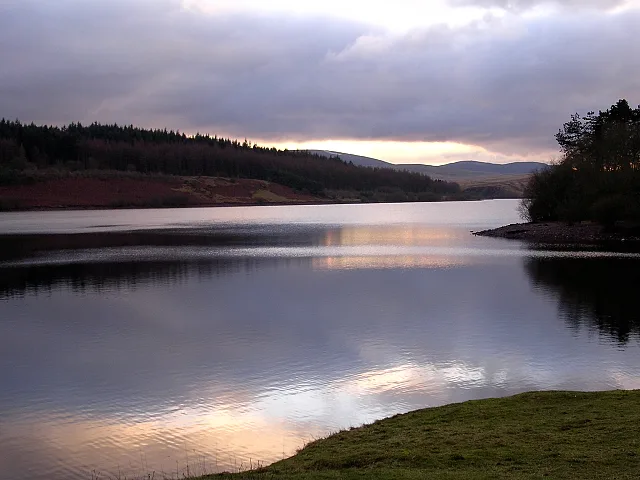
Usk Reservoir
Reservoirs & lochs · 2.1 km

Bryn Elen
Mountains & hills · 2.4 km

Castell Du, Llywel
Literary houses · 2.5 km

Cwmwysg
Historic churches · 2.5 km
Pont Cwmwysg
Historic bridges · 2.7 km

Fedw Fawr
Mountains & hills · 2.8 km

Ynysfaen Camping
Campsites · 2.8 km

Standing Stones
Memorials & monuments · 3.3 km

Bryn Mawr
Mountains & hills · 3.3 km
Nearby
📷 5📷 5📷 3Stone circles · South Wales
Gwernwyddog Standing Stone
Gwernwyddog Standing Stone — a stone circle in wales-south, United Kingdom.
📷 3Reservoirs & lochs · South Wales
Usk Reservoir
Usk Reservoir — reservoir on the boundary of Carmarthenshire and Powys, Wales, UK.
📷 5📷 5Literary houses · South Wales
Castell Du, Llywel
Castell Du, Llywel — a literary house museum in wales south.
Where to eat & stay near Glasfynydd Forest
Places to stay
📷 5 📷 5
📷 5Campsites · South Wales
The Wildman Woods Campsite
The Wildman Woods Campsite — a campsite in wales south.
 📷 7
📷 7 📷 5
📷 5 📷 5
📷 5Caravan parks · South Wales
Black Mountain Caravan and Camping Park
Black Mountain Caravan and Camping Park — a caravan park in wales south.
 📷 5
📷 5Caravan parks · Mid Wales
Erwlon Caravan & Camping Site
Erwlon Caravan & Camping Site — a caravan park in wales south.
Places to eat & drink
 📷 5
📷 5 📷 7
📷 7More archaeological sites in this region
 📷 3
📷 3Archaeological sites · South Wales
Coygan Cave
Coygan Cave — cave and archaeological site in the United Kingdom.
 📷 3
📷 3 📷 3
📷 3Archaeological sites · South Wales
Gwersyll Rhufeinig Bargoed
Gwersyll Rhufeinig Bargoed — archaeological site in Caerphilly County Borough, Wales, UK.
 📷 3
📷 3Archaeological sites · South Wales
Limebreach Wood
Limebreach Wood — woodland in Somerset, England.
Frequently asked questions
- Where is Glasfynydd Forest?
- Glasfynydd Forest is in South Wales, United Kingdom (postcode LD3 8YG), in the parish of Llywel.
- What is Glasfynydd Forest?
- Glasfynydd Forest — forest on the boundary of Carmarthenshire and Powys, Wales, UK.
- How do I get to Glasfynydd Forest?
- Drivers can use postcode LD3 8YG.
- Is Glasfynydd Forest free to visit?
- Yes, Glasfynydd Forest is free to enter.
- How do I get to Glasfynydd Forest?
- Drivers can navigate to postcode LD3 8YG. It sits within the Brecon, Radnor and Cwm Tawe parliamentary constituency.