Archaeological sites · South Wales
Fforest Fach
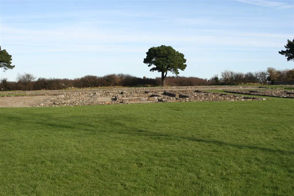
Fforest Fach — Unenclosed area of Powys, Wales.

Wikimedia Commons licence
Plan your visit
- Typical visit
- 45 min–1.5 h
- Free entry
- Dog-friendly
About
Fforest Fach is an archaeological site in the United Kingdom. Wikidata describes it as: "Unenclosed area of Powys, Wales". Coordinates: 51.9289°, -3.5975°.
Photo gallery
From the Wikipedia article
Fforest Fach is a small area of unenclosed land within Brecon Beacons National Park southwest of Sennybridge in the county of Powys, Wales. Translating from Welsh as 'little forest', it is named in opposition to the much larger area of unenclosed land to the south which is known as Fforest Fawr or the 'great forest'. Whilst Fforest Fawr and Fforest Fach have been distinct areas for many centuries, the odd situation now arises where Fforest Fach now finds itself within Fforest Fawr Geopark, the boundaries of which are drawn rather more widely than those of the traditional royal hunting forest.The hill possesses two indistinct summits, the higher of which at 382m is in the south whilst that to the north at 381m is crowned by a trig point. There was formerly a rifle range at the north-western corner of the hill.
Excerpt from Wikipedia under CC BY-SA 4.0. See the source article linked in Sources below.
Background
Visiting
The summit plateau of the hill is open country across which walkers may wander at will. Access is also provided by a couple of bridleways, one of which cuts east–west across the hill between Cwm Treweryn and Cwm Crai.
Sourced from Wikipedia under CC BY-SA 4.0.
- Coordinates
- 51.9289, -3.5975
- District
- Powys
- Parish
- Cray
- Postcode
- LD3 8PY
- Parliamentary constituency
- Brecon, Radnor and Cwm Tawe
Sources
- wikidata: Q5446225 (CC0)
- wikipedia: Fforest Fach (CC BY-SA 4.0)
Other places nearby

Fforest Fach
Mountains & hills · 0.6 km

Pont Nantyrharn
Historic bridges · 1.1 km

Y Gaer
Mountains & hills · 2.0 km

Twyn-y-Gaer
Vineyards · 2.1 km
Twyn y Gaer
Mountains & hills · 2.1 km

Devynock
Villages · 2.2 km

Castell Du
Castles · 2.3 km

Pont Pantysgallog
Historic bridges · 2.4 km

Crai, Powys
Other places · 2.5 km

St Cynog's Church
Historic churches · 2.5 km

Maescar
Historic churches · 2.6 km

Sennybridge
Historic churches · 2.7 km
Nearby
📷 5📷 5Historic bridges · South Wales
Pont Nantyrharn
Pont Nantyrharn — Grade II listed building-listed bridge in wales-south, United Kingdom.
📷 5📷 2Vineyards · South Wales
Twyn-y-Gaer
Twyn-y-Gaer — a UK vineyard in wales south, producing English or Welsh wine from cool-climate grape varieties.
📷 5📷 5Where to eat & stay near Fforest Fach
Places to stay
 📷 7
📷 7 📷 5
📷 5 📷 5
📷 5 📷 5
📷 5Campsites · South Wales
Brecon Beacons Wild Camping
Brecon Beacons Wild Camping — a campsite in wales south.
 📷 5
📷 5Hostels · South Wales
YHA Llwyn-y-celyn (YHA Brecon Beacons)
YHA Llwyn-y-celyn (YHA Brecon Beacons) — a hostel in wales south.
 📷 5
📷 5Caravan parks · Mid Wales
Aberbran Fawr Campsite
Aberbran Fawr Campsite — a caravan park in wales south.
Places to eat & drink
 📷 7
📷 7 📷 5
📷 5 📷 5
📷 5Historic pubs · South Wales
White Hart
White Hart — Historic pub — listed building or notable heritage status.
More archaeological sites in this region
 📷 3
📷 3Archaeological sites · South Wales
Coygan Cave
Coygan Cave — cave and archaeological site in the United Kingdom.
 📷 3
📷 3Archaeological sites · South Wales
Glasfynydd Forest
Glasfynydd Forest — forest on the boundary of Carmarthenshire and Powys, Wales, UK.
 📷 3
📷 3Archaeological sites · South Wales
Gwersyll Rhufeinig Bargoed
Gwersyll Rhufeinig Bargoed — archaeological site in Caerphilly County Borough, Wales, UK.
 📷 3
📷 3Archaeological sites · South Wales
Limebreach Wood
Limebreach Wood — woodland in Somerset, England.
Frequently asked questions
- Where is Fforest Fach?
- Fforest Fach is in South Wales, United Kingdom (postcode LD3 8PY), in the parish of Cray.
- What is Fforest Fach?
- Fforest Fach — Unenclosed area of Powys, Wales.
- How do I get to Fforest Fach?
- Drivers can use postcode LD3 8PY.
- Is Fforest Fach free to visit?
- Yes, Fforest Fach is free to enter.
- How do I get to Fforest Fach?
- Drivers can navigate to postcode LD3 8PY. It sits within the Brecon, Radnor and Cwm Tawe parliamentary constituency.