
Natural landmarks · North East England
Aerial Ashes
In or near Great Broughton.
Aerial Ashes in England North East, United Kingdom.

Mike Rayner — CC BY-SA 2.0 via Wikimedia Commons licence

Plan your visit
- Typical visit
- 1 h–2 h
- Nearest railway station
- Great Ayton · 4.9 km
- Free entry
- Dog-friendly
- Limited wheelchair access
About
Aerial Ashes is a place of interest in England North East, United Kingdom — drawn from open-data sources for visitor reference. See the linked Wikipedia article for the full description.
Photo gallery
See it from the streetimagery from 2018
Imagery © Mapillary contributors, CC BY-SA 4.0
Official information
Aerial Ashes specializes in drone ash scattering ceremonies across the UK, offering families a dignified and meaningful way to honor their loved ones. The service allows ashes to be released over significant locations, providing a serene farewell experience.
Protected designations
- Site of Special Scientific Interest: North York Moors SSSI
Designations sourced from Natural England open data under OGL v3.
From the Wikipedia article
Aerial Ashes is a British multirotor unmanned aerial vehicle company founded in 2019 in Christchurch, Dorset.
Excerpt from Wikipedia under CC BY-SA 4.0. See the source article linked in Sources below.
Background
History
Aerial Ashes was started by Christopher Mace, a helicopter pilot in the Royal Air Force. Mace was asked to scatter the ashes of ex-RAF airmen over the sea, creating meaningful experiences for families. After refining techniques for optimal scattering, he retired and founded Aerial Ashes. The company uses drones with modified load boxes to release cremation ashes at chosen locations, offering a respectful, innovative service. In March 2021, Aerial Ashes was the first and only company in the UK granted an operational safety case by the UKS Civilian Aviation Authority to scatter cremated ashes by drone. In 2022, the company teamed up with A.W.Lymn The Family Funeral Service and gained a much…
Sourced from Wikipedia under CC BY-SA 4.0.
- Coordinates
- 54.4640, -1.1774
- District
- North Yorkshire
- Parish
- Great and Little Broughton
- Postcode
- TS9 5JY
- Parliamentary constituency
- Richmond and Northallerton
- Phone
- 0800 246 5940
- Established
- 2019
- Nearest railway station
- Great Ayton — 4.9 km
- Opening
- Monday – Friday 9 am - 5pm
- Official site
- www.aerialashes.co.uk
Sources
- wikidata: Q130408090 (CC0)
- wikipedia: Aerial Ashes (CC BY-SA 4.0)
Other places nearby

Stokesley Sports Club F.C.
Stadiums · 0.4 km
Stokesley School
Other places · 0.5 km
Stokesley railway station
Heritage railway stations · 0.5 km

Castle Hill
Literary houses · 1.0 km
Stokesley Castle Hill
Castles · 1.0 km
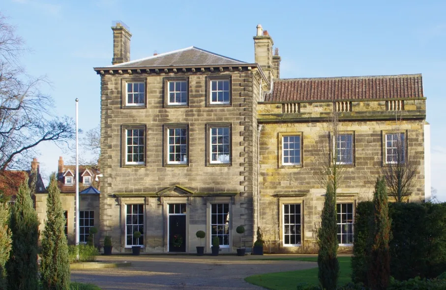
Manor House and Wall Adjoining
Stately homes · 1.1 km

Levenside packhorse bridge
Historic bridges · 1.1 km

The Queen's Head Public House
Historic pubs · 1.2 km

Stokesley
Memorials & monuments · 1.2 km

Stokesley Rural District
Other places · 1.2 km

42 High Street
Historic houses · 1.2 km

Handyside Cottage Handyside House
Historic houses · 1.3 km
Nearby
📷 3Stadiums · North East England
Stokesley Sports Club F.C.
Stokesley Sports Club F.C. in England North East, United Kingdom.
📷 3Other places · North East England
Stokesley School
Stokesley School in England North East, United Kingdom.
📷 4Heritage railway stations · North East England
Stokesley railway station
Stokesley railway station in England North East, United Kingdom.
📷 5Literary houses · Yorkshire & the Humber
Castle Hill
Castle Hill — a literary house museum in england yorkshire.
📷 5Castles · Yorkshire & the Humber
Stokesley Castle Hill
Stokesley Castle Hill — a castle in england yorkshire.
📷 5Stately homes · Yorkshire & the Humber
Manor House and Wall Adjoining
Manor House and Wall Adjoining — house in Stokesley, North Yorkshire, England, UK.
Where to eat & stay near Aerial Ashes
Places to stay
 📷 5
📷 5Caravan parks · Yorkshire & the Humber
Angrove Country Park
Angrove Country Park — a caravan park in england yorkshire.
 📷 5
📷 5Campsites · Yorkshire & the Humber
Southview Farm Campsite
Southview Farm Campsite — a campsite in england yorkshire.
 📷 5
📷 5Campsites · Yorkshire & the Humber
Holiday Lodge Park
Holiday Lodge Park — a campsite in england yorkshire.
 📷 5
📷 5Campsites · Yorkshire & the Humber
Lordstones Country Park
Lordstones Country Park — a campsite in england yorkshire.
 📷 2
📷 2Caravan parks · Yorkshire & the Humber
Goulton Beck Lodges
Goulton Beck Lodges — a caravan park in england yorkshire.
 📷 5
📷 5Campsites · Yorkshire & the Humber
Kildale Camping & Barn
Kildale Camping & Barn — a campsite in england yorkshire.
Places to eat & drink
📷 7Historic pubs · North East England
The Queen's Head Public House
The Queen's Head Public House in England North East, United Kingdom.
 📷 5
📷 5Historic pubs · North East England
The Royal Oak Hotel
The Royal Oak Hotel in England North East, United Kingdom.
 📷 4
📷 4Historic pubs · North East England
The Dudley Arms Public House
The Dudley Arms Public House in England North East, United Kingdom.
 📷 4
📷 4Historic pubs · North East England
The Bay Horse Inn
The Bay Horse Inn in England North East, United Kingdom.
 📷 5
📷 5 📷 5
📷 5Historic pubs · North East England
The Stainton Public House
The Stainton Public House in England North East, United Kingdom.
More natural landmarks in this region
 📷 4
📷 4Natural landmarks · North East England
Cleveland Way
109-mile horseshoe trail around the North York Moors and its sea cliffs.
 📷 3
📷 3Natural landmarks · North East England
The Hand Stone
The Hand Stone — a other in england-yorkshire, United Kingdom.
 📷 3
📷 3Natural landmarks · North East England
The Face Stone
The Face Stone — a other in england-yorkshire, United Kingdom.
 📷 3
📷 3Frequently asked questions
- Where is Aerial Ashes?
- Aerial Ashes is in North-East England, United Kingdom (postcode TS9 5JY), in the parish of Great and Little Broughton.
- What is Aerial Ashes?
- Aerial Ashes in England North East, United Kingdom.
- How do I get to Aerial Ashes?
- The nearest railway station is Great Ayton, about 4.9 km away. Drivers can use postcode TS9 5JY.
- When was Aerial Ashes built?
- Built or established in 2019.
- Who owns Aerial Ashes?
- Aerial Ashes is owned by Matt Young.
- Is Aerial Ashes a protected site?
- Yes — Aerial Ashes is part of the North York Moors SSSI Site of Special Scientific Interest.
- Is Aerial Ashes free to visit?
- Yes, Aerial Ashes is free to enter.
- How do I get to Aerial Ashes?
- The nearest railway station is Great Ayton, about 4.9 km away. Drivers can navigate to postcode TS9 5JY.