
Towns & cities · East of England
Wormingford
Wormingford — village and civil parish in Essex, United Kingdom.

Wikimedia Commons contributors — see linked file page for photographer and licence licence

Plan your visit
- Typical visit
- 3 h–6 h
- Nearest railway station
- Bures · 3.7 km
- Free entry
- Family-friendly
- Dog-friendly
Getting there & planning your visit
Wormingford is located in Essex, with the nearest railway station being Bures, approximately 3.7 km away. Entry to the town is free.
About
Wormingford is a town, city, village or settlement in the United Kingdom. Recent population estimates put it at around 450 people. Address: CO6. Wikidata describes it as: "village and civil parish in Essex, United Kingdom". Coordinates: 51.9581°, 0.8194°.
Photo gallery
Protected designations
- Area of Outstanding Natural Beauty: Dedham Vale
Designations sourced from Natural England open data under OGL v3.
From the Wikipedia article
Wormingford is a village and civil parish in the City of Colchester district of Essex, England. At the 2021 census the parish had a population of 450. The ancient parish of Wormingford on the south bank of the River Stour, 6 miles (9.7 km) north- west of Colchester and 8 miles (13 km) south-east of Sudbury, Suffolk, covered 2,322 acres (929 hectares). The Stour forms the northern boundary, and the eastern, southern, and western ones follow mainly field boundaries, but sometimes cut through fields. Detached fields totalling 15 acres (61,000 m2) in Little Horkesley, were transferred to that parish in 1889. Wormingford has a post office and a public house and restaurant called The Crown. Most of the parish lies on a relatively high plain which drains northwards to the River Stour and southwards to the River Colne. From the Stour the ground rises southwards to reach a height of more than 225 ft (70 m) in the south-west. A band of alluvium runs beside the Stour and there are river terrace deposits south of that, then, as the ground rises, bands of London clay, and sands and gravels. Most of the higher south part of the parish is boulder clay, good farming land, with a small pocket of sands and gravels running south-east from Wood Hall. The main road from Colchester to Bures and Sudbury (B1508) runs from south-east to north-west across the parish. Minor roads connected the parish with Assington (Suffolk) across Wormingford bridge, with Fordham, and with Little Horkesley and Nayland (Suffolk). Other minor roads and tracks and a network of footpaths link the scattered farms and houses. The ford from which the parish takes its name (originally 'Withermund's ford') was probably that in the river Stour by the watermill, at the bottom of Church Road, where there is a sand bank in the middle of the river. A ford further east near Garnons has also been suggested, but seems less likely. The Church Road ford was replaced before 1802 by a bridge, called a horse-bridge in 1812.…
Excerpt from Wikipedia under CC BY-SA 4.0. See the source article linked in Sources below.
- Coordinates
- 51.9581, 0.8194
- County
- Essex
- District
- Colchester
- Parish
- Wormingford
- Postcode
- CO6
- Parliamentary constituency
- Harwich and North Essex
- Population
- 450
- Nearest railway station
- Bures — 3.7 km
Sources
- wikidata: Q770268 (CC0)
- wikipedia: Wormingford (CC BY-SA 4.0)
- commons: St Andrew's Church, Wormingford - geograph.org.uk - 860376.jpg (CC BY-SA 4.0)
Other places nearby

Smallbridge Hall
Historic houses · 1.0 km

Wormingford
Villages · 1.3 km

Rushbanks Campsite
Campsites · 1.5 km
Lodge Hills
Mountains & hills · 1.6 km

Wissington
Villages · 2.0 km

Landscape Lens'
Viewpoints · 2.1 km

Little Horkesley Village Sign
Public art & sculpture · 2.4 km
Little Horkesley War Memorial
Memorials & monuments · 2.4 km
.jpg?width=1200)
Wiston Mill
Mills · 2.5 km

Edmund King & Martyr
Memorials & monuments · 2.7 km

Chapel of St Stephen
Chapels · 2.7 km
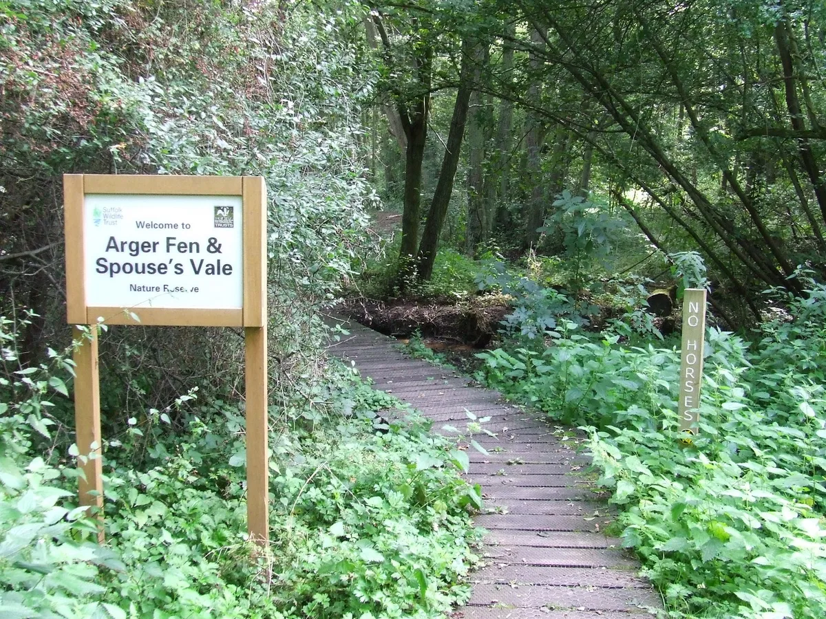
Arger Fen
Wildlife reserves · 3.1 km
Wormingford is a village in Essex, within the East of England region. Visitors can explore Smallbridge Hall, a historic house, and enjoy views from Landscape Lens. The area also offers Little Horkesley War Memorial and Mount Bures, a literary house, for those seeking cultural highlights.
At a glance
- Population
- 450
- Administrative county
- Essex
- Constituency
- Harwich and North Essex
- Top categories near here
Things to see in Wormingford
12 attractions within 12 km. Full guide: things to do in Wormingford →
📷 3Chapels · East of England
Chapel of St Stephen
Chapel of St Stephen — Grade I listed chapel in Babergh, Suffolk, England, UK.
📷 4Viewpoints · East of England
Landscape Lens'
Landscape Lens' is a viewpoint in the United Kingdom.
📷 3Historic houses · East of England
Smallbridge Hall
Smallbridge Hall — house in Bures St. Mary, Suffolk, England, UK.
📷 3Mills · East of England
Wiston Mill
Wiston Mill — mill in Nayland-with-Wissington, Babergh, England, UK.
📷 3Memorials & monuments · East of England
Little Horkesley War Memorial
Little Horkesley War Memorial — Grade II listed building-listed memorial in england-east, United Kingdom.
📷 3Public art & sculpture · East of England
Little Horkesley Village Sign
Little Horkesley Village Sign — a public art in East of England, United Kingdom.
📷 3Memorials & monuments · East of England
Edmund King & Martyr
Edmund King & Martyr — a memorial in East of England, United Kingdom.
📷 5Campsites · East of England
Rushbanks Campsite
Rushbanks Campsite — a campsite in england east.
 📷 5📷 5📷 5📷 5
Mountains & hills · East of England
Lodge Hills
Lodge Hills — mountain in england east. Elevation: 69 m.
Nearby
📷 3Historic houses · East of England
Smallbridge Hall
Smallbridge Hall — house in Bures St. Mary, Suffolk, England, UK.
📷 5📷 5Campsites · East of England
Rushbanks Campsite
Rushbanks Campsite — a campsite in england east.
📷 5Mountains & hills · East of England
Lodge Hills
Lodge Hills — mountain in england east. Elevation: 69 m.
📷 5📷 4Viewpoints · East of England
Landscape Lens'
Landscape Lens' is a viewpoint in the United Kingdom.
Where to eat & stay near Wormingford
Places to stay
📷 5Campsites · East of England
Rushbanks Campsite
Rushbanks Campsite — a campsite in england east.
 📷 5
📷 5Campsites · East of England
Little Ropers Woodland Camping
Little Ropers Woodland Camping — a campsite in england east.
 📷 5
📷 5B&Bs · East of England
Poplar Farmhouse
Poplar Farmhouse — a bed-and-breakfast in england east.
Caravan parks · East of England
Colchester Country Park
Colchester Country Park — a caravan park in england east.
 📷 5
📷 5Campsites · East of England
Colchester Country Park
Colchester Country Park — a campsite in england east.
 📷 5
📷 5Places to eat & drink
 📷 5
📷 5Historic pubs · East of England
The Anchor Public House
The Anchor Public House in England East, United Kingdom.
 📷 5
📷 5 📷 7
📷 7Restaurants · East of England
The Angel Inn
The Angel Inn — a restaurant in england east.
 📷 7
📷 7 📷 5
📷 5 📷 7
📷 7More towns in this region
 Flagship📷 10
 Flagship📷 10
Towns & cities · East of England
Cambridge
Cambridge — city in Cambridgeshire, England.
 Flagship📷 10
Towns & cities · East of England
Chelmsford
Chelmsford — city in Essex, United Kingdom.
 Flagship📷 10
Towns & cities · East of England
Colney Heath
Colney Heath — village and civil parish in St Albans, Hertfordshire, England, UK.
Frequently asked questions
- Where is Wormingford?
- Wormingford is in Essex, East of England, United Kingdom (postcode CO6), in the parish of Wormingford.
- What is Wormingford?
- Wormingford — village and civil parish in Essex, United Kingdom.
- How do I get to Wormingford?
- The nearest railway station is Bures, about 3.7 km away. Drivers can use postcode CO6.
- Is Wormingford a protected site?
- Yes — Wormingford is part of the Dedham Vale National Landscape (AONB).
- Is Wormingford free to visit?
- Yes, Wormingford is free to enter.
- How do I get to Wormingford?
- The nearest railway station is Bures, about 3.7 km away. Drivers can navigate to postcode CO6.